Category Archives: Landscapes

Milford Sound: Fjordlands, New Zealand

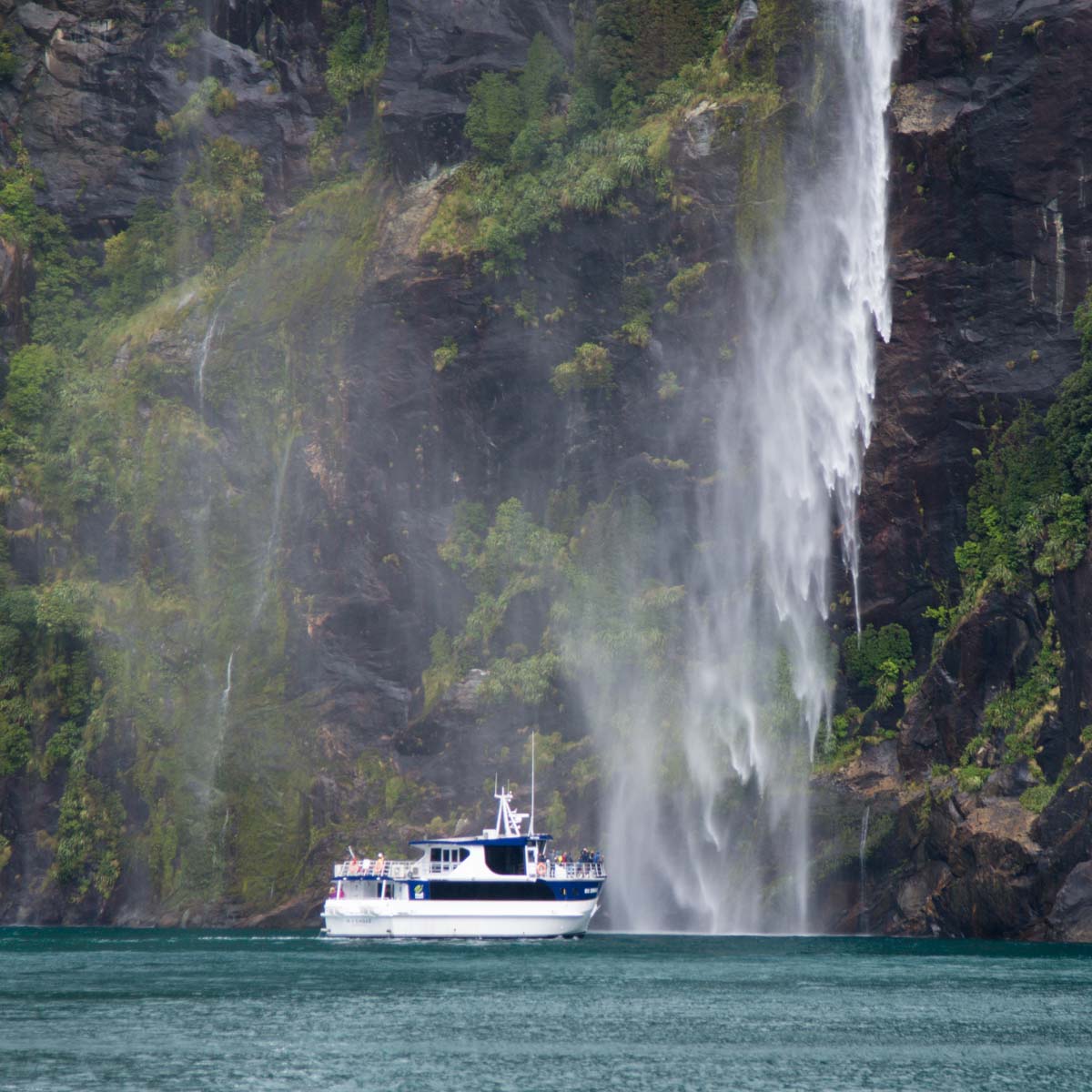
One of New Zealand’s top destinations is a town with a population of just about 150.  There’s one cafe and one ‘lodge’ with mostly dorm-style rooms and a few bathroomless ‘cabins’.  But there’s a whole fleet of boats and ships ready to take you through the valley and out to the Tasman Sea.

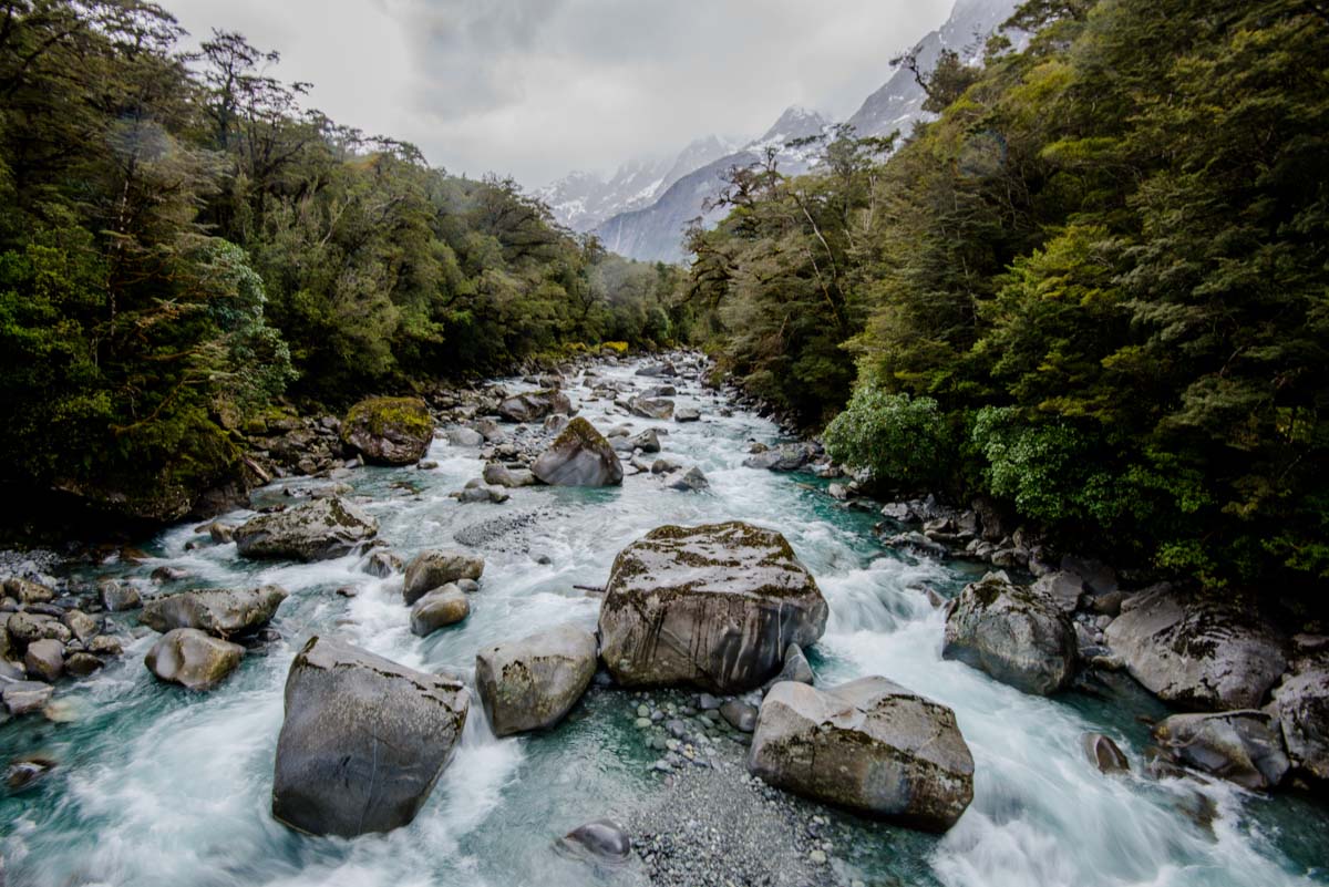
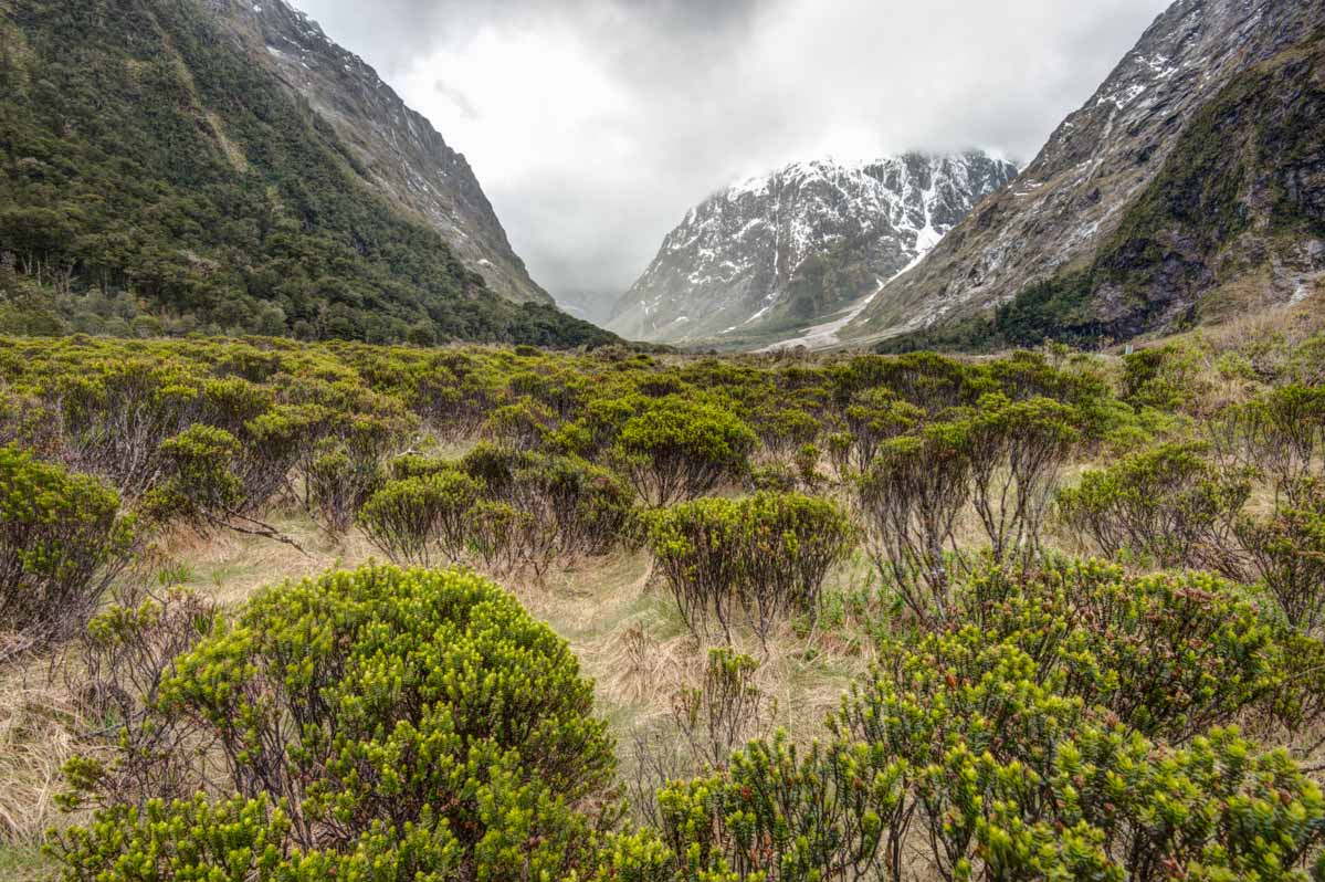
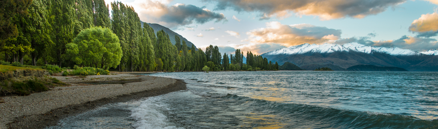
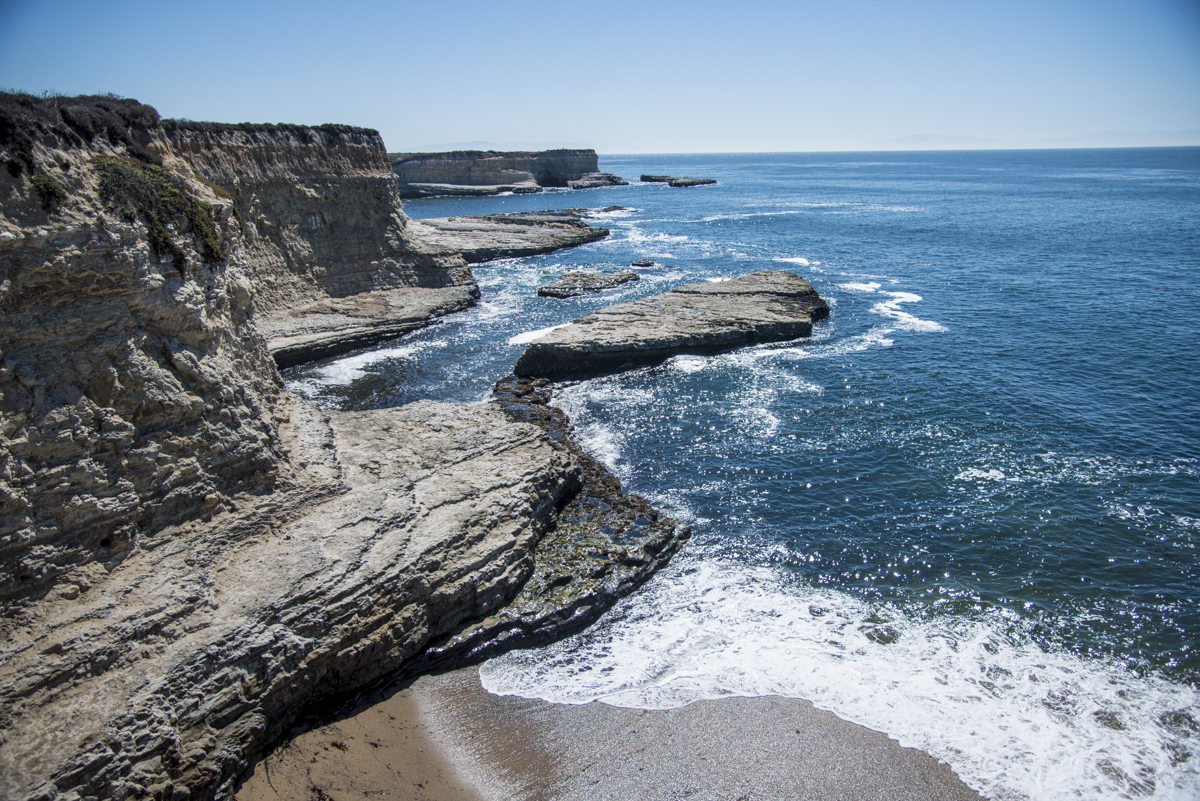
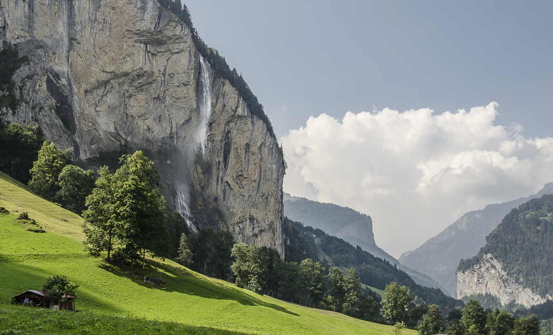
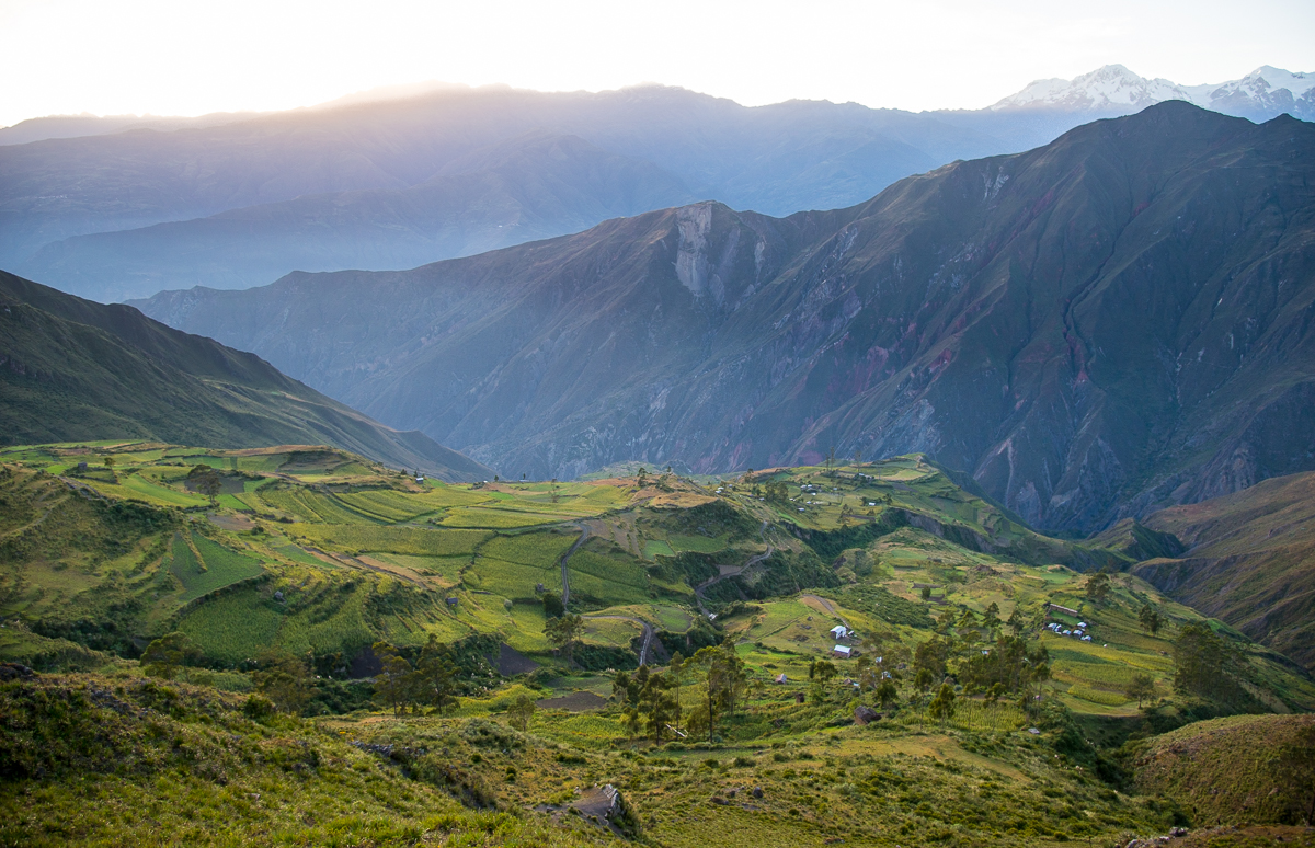
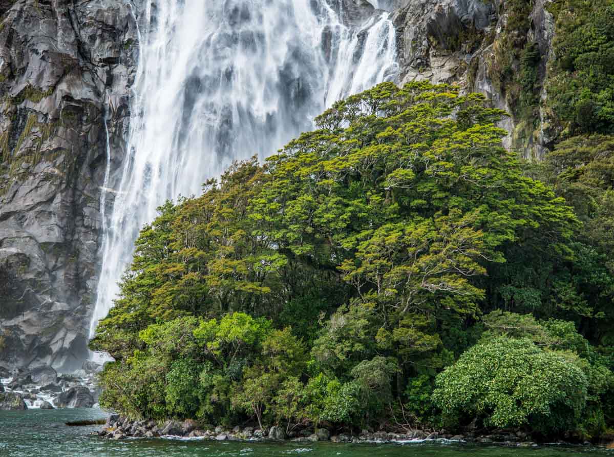
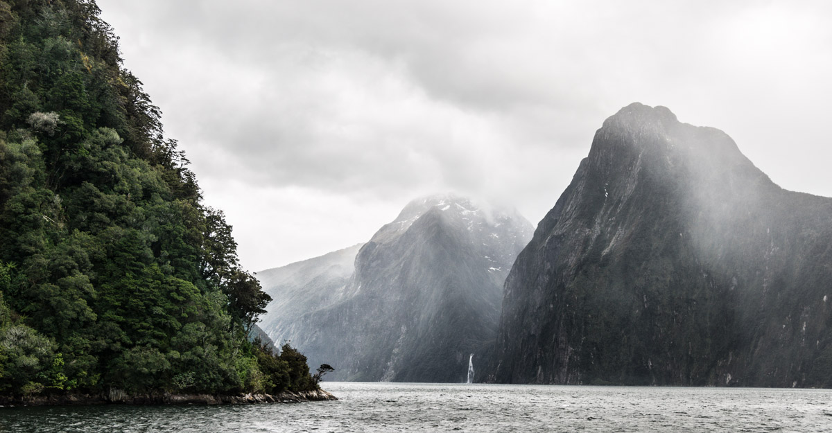
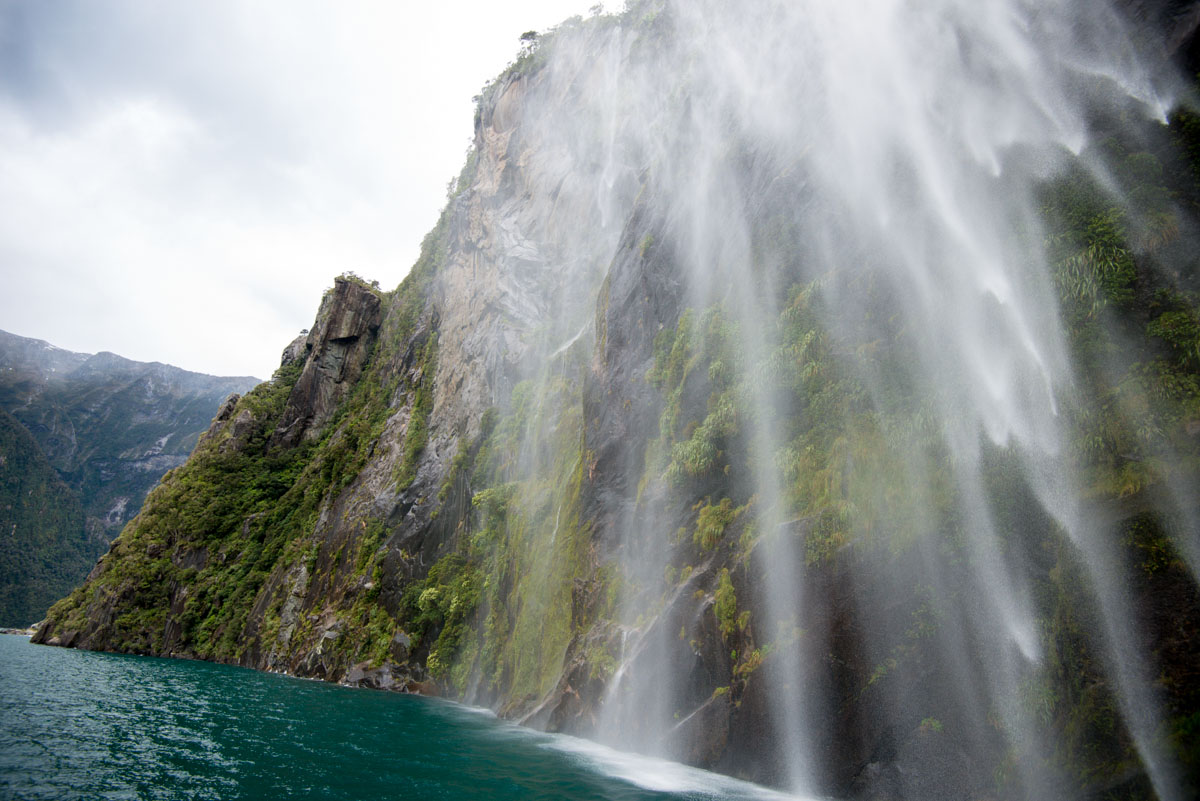
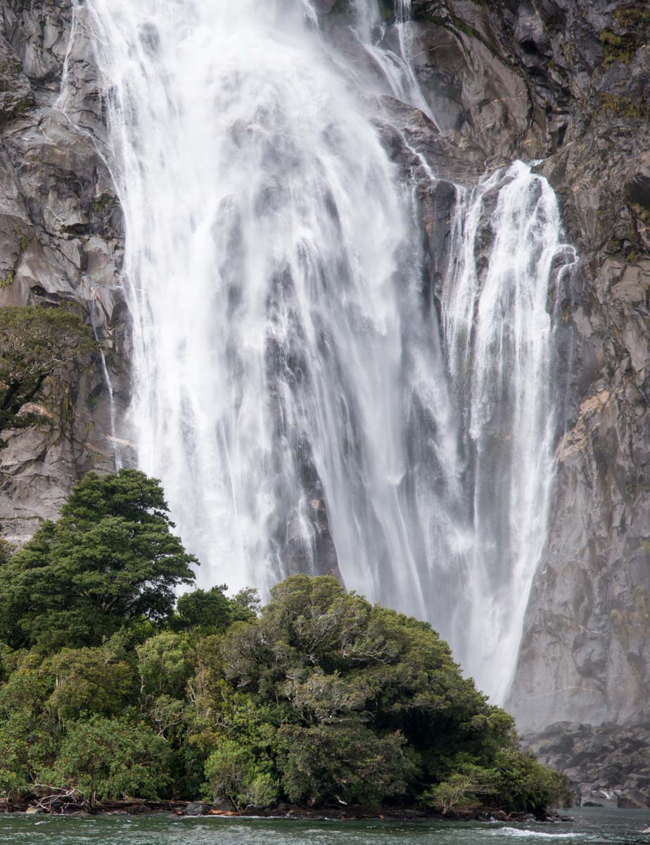
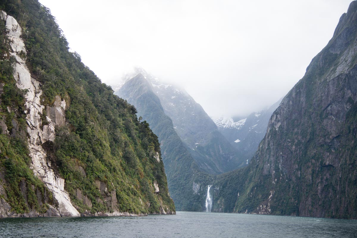
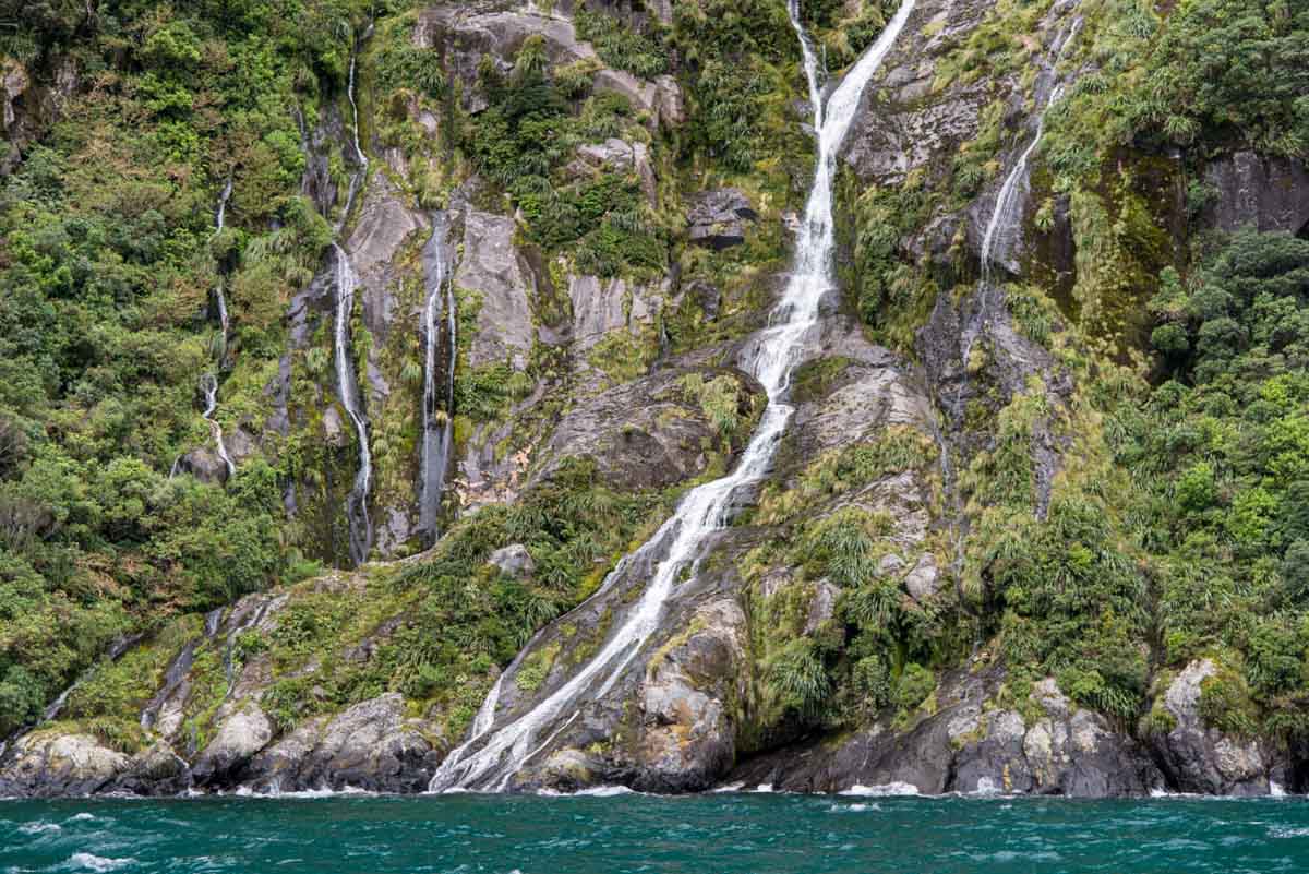
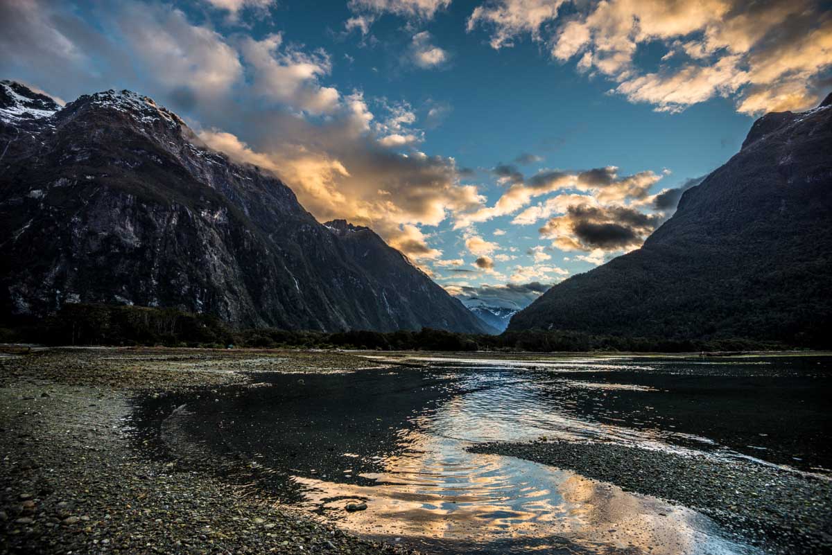
Milford Sound is a “fjord” – a large bay-like inlet, initially carved by a glacier thousands of years ago.  This means it’s U-shaped at the bottom, not V-shaped like canyons that are carved by rivers.  In the rainy spring season, there are waterfalls everywhere – several of which run off cliffs and then disappear into the wind before the water ever hits the ground.


The Sound is part of southwest New Zealand’s Fjordlands National Park, and part of the Te Wahipounamu UNESCO World Heritage Site.  If you’re not already familiar with UNESCO’s list and if you ever get anywhere near the bottom of your personal bucket list, check out the UNESCO sites (1,000 or so natural and cultural wonders around the globe) and you’ll have lots more destination ideas.  Apparently there’s a lot to see in the World.

_JD89644.JPG_JD89661.JPG_JD80236.JPG_JD89696.JPG_JCE4546.JPG_JD89833.JPG_JCE4678.JPG_JCE4674.JPG_JD80179.JPG_JD80192.JPG_JD89951.JPG_JD89732.JPG_JD89931.JPG_JCE4260_1_2.JPG_JCE4393_3_5-Edit.JPG_JCE4443.JPG_JD89581.JPG_JD89714.JPG_JCE3880_1_4.JPG_JD80146.JPG_JCE4823.JPG_JD80345.JPG

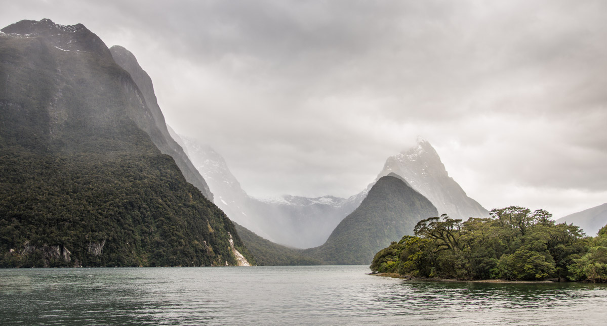
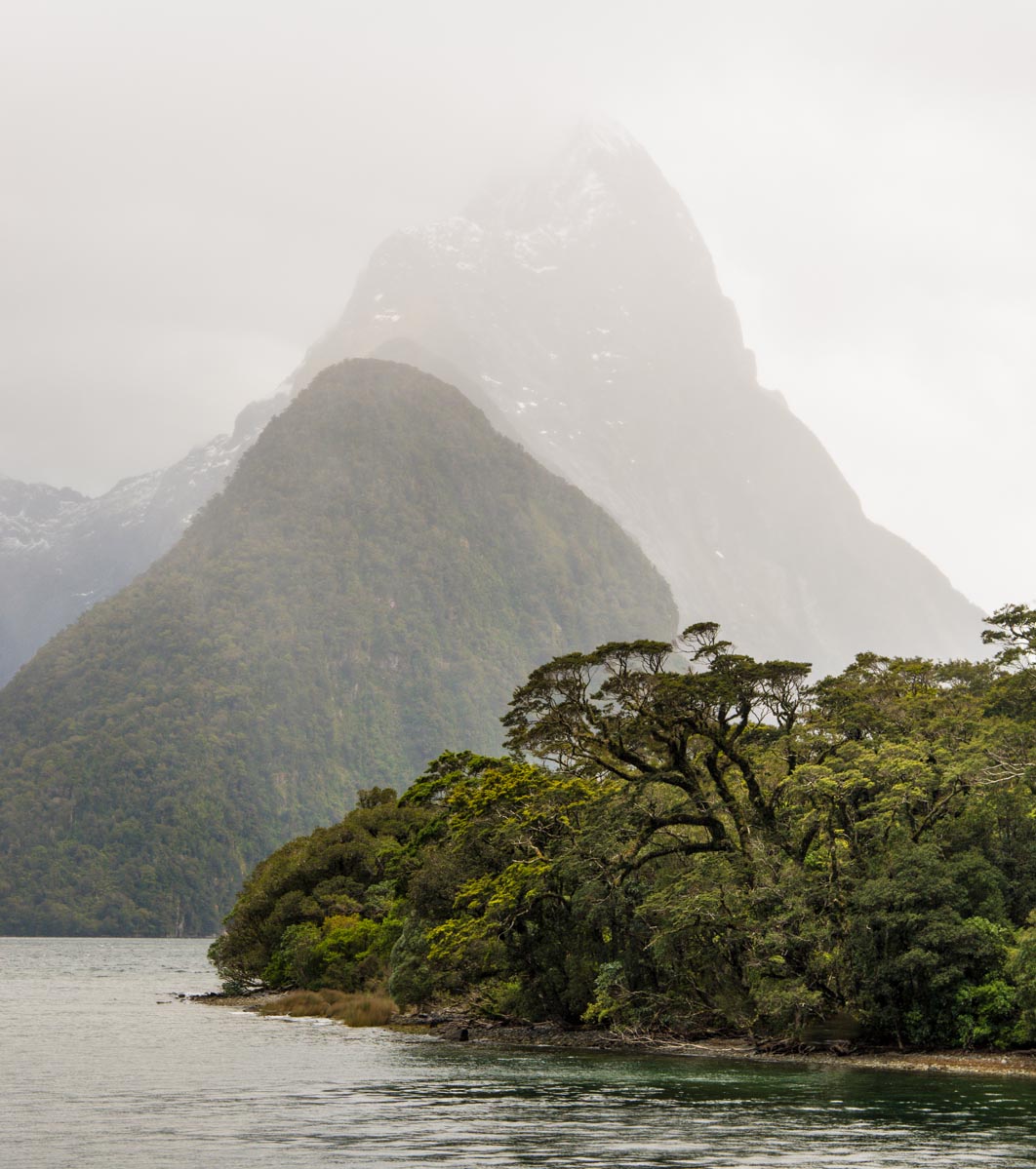
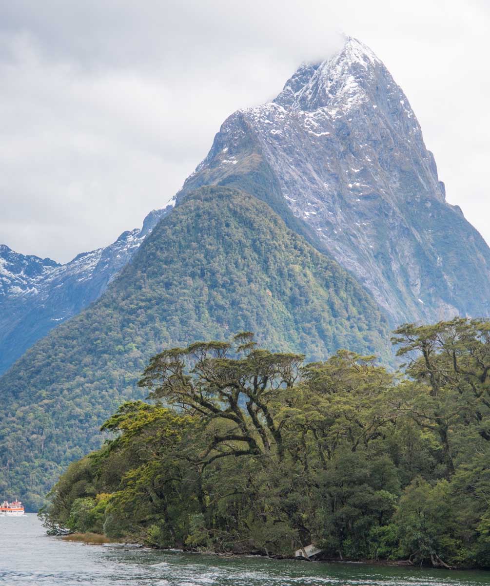
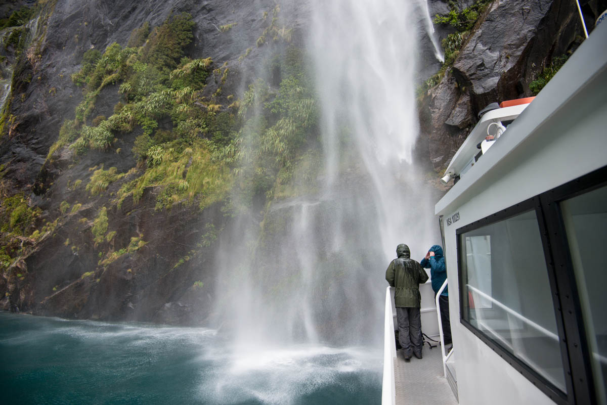
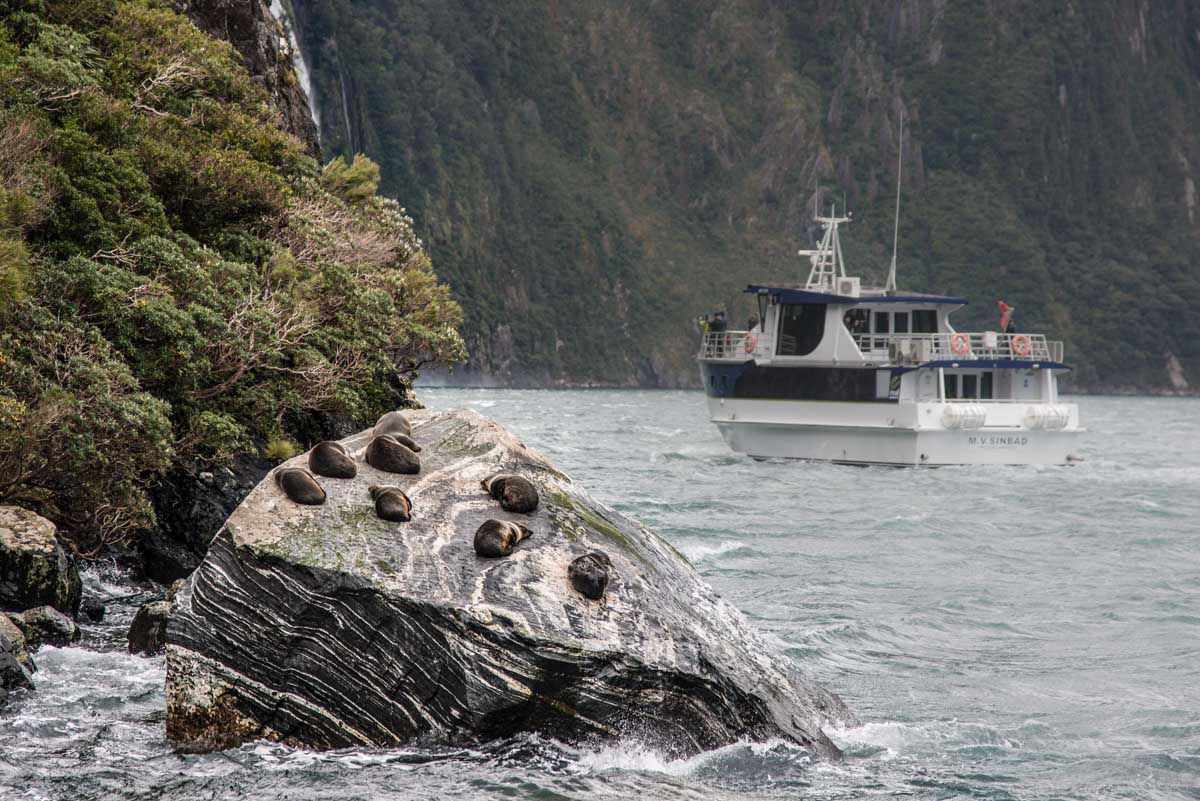
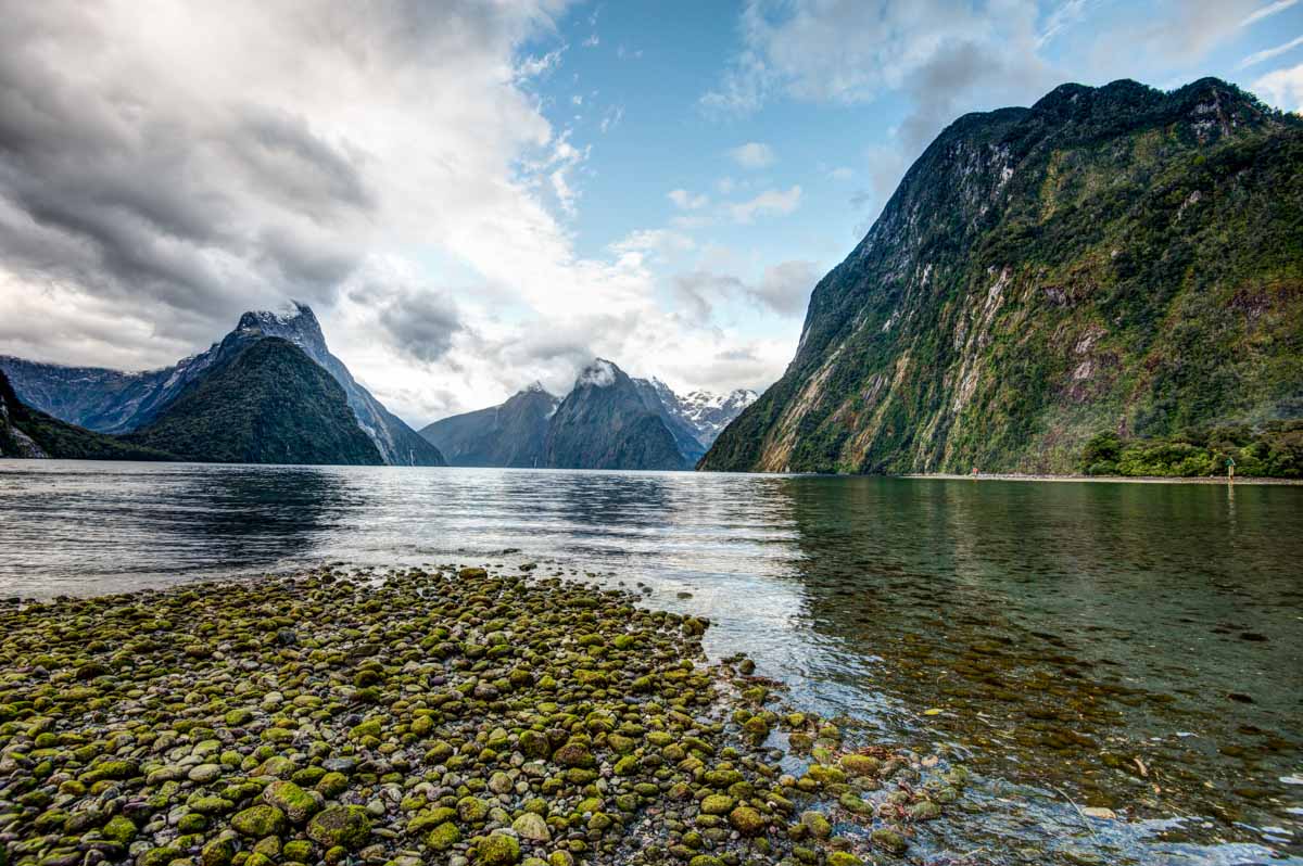
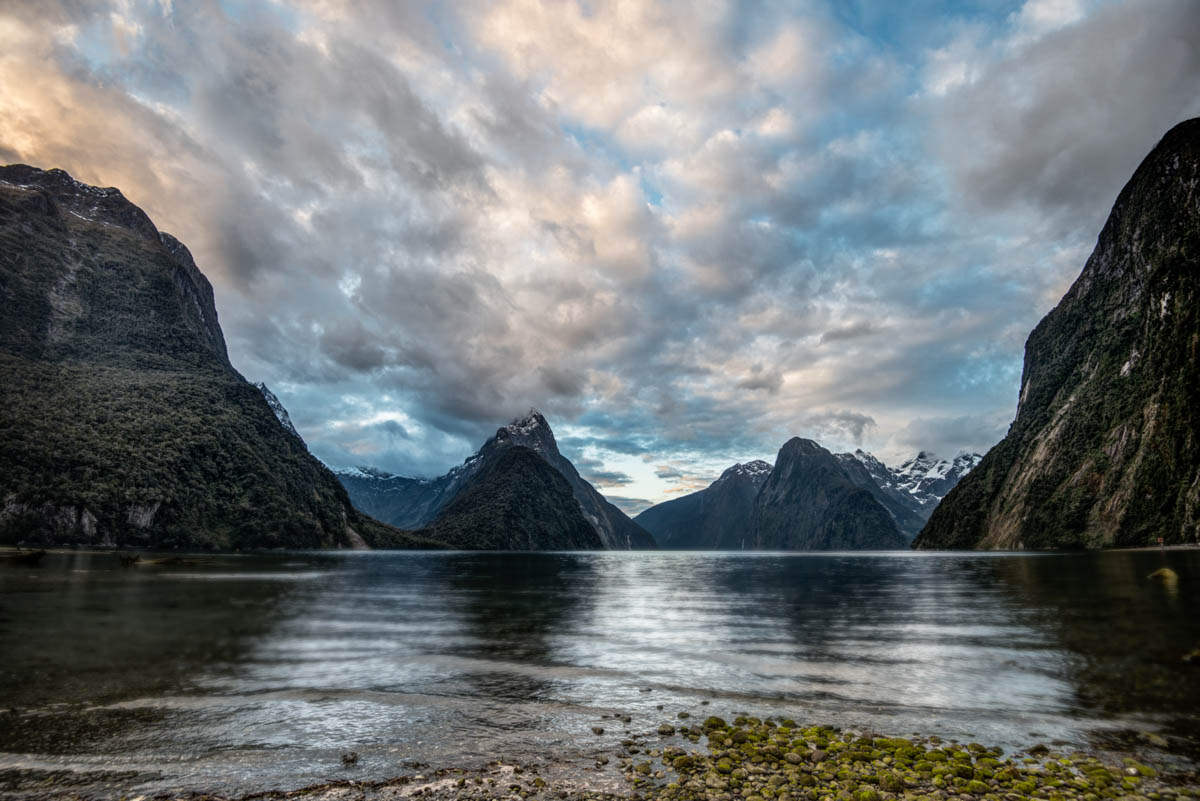
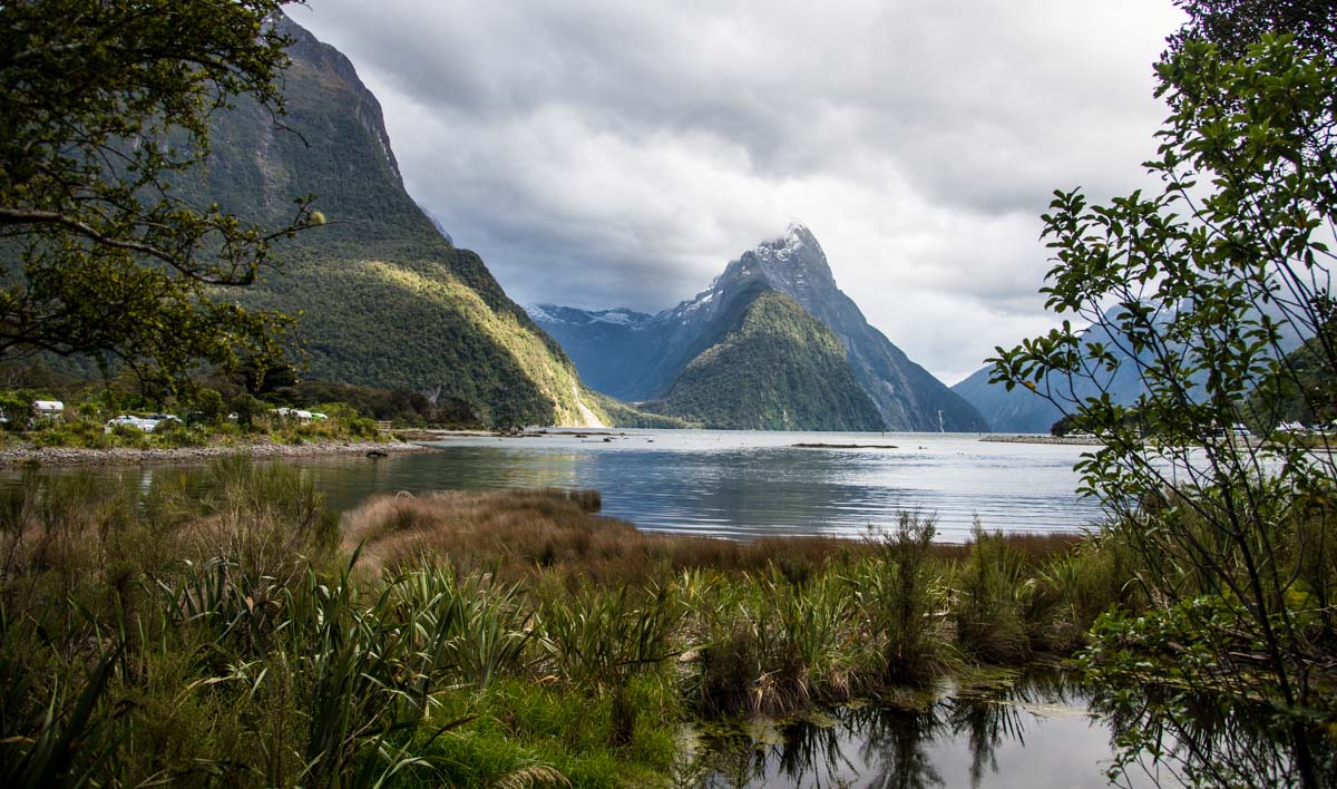
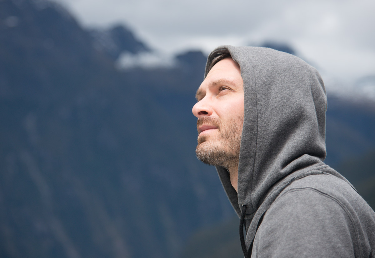
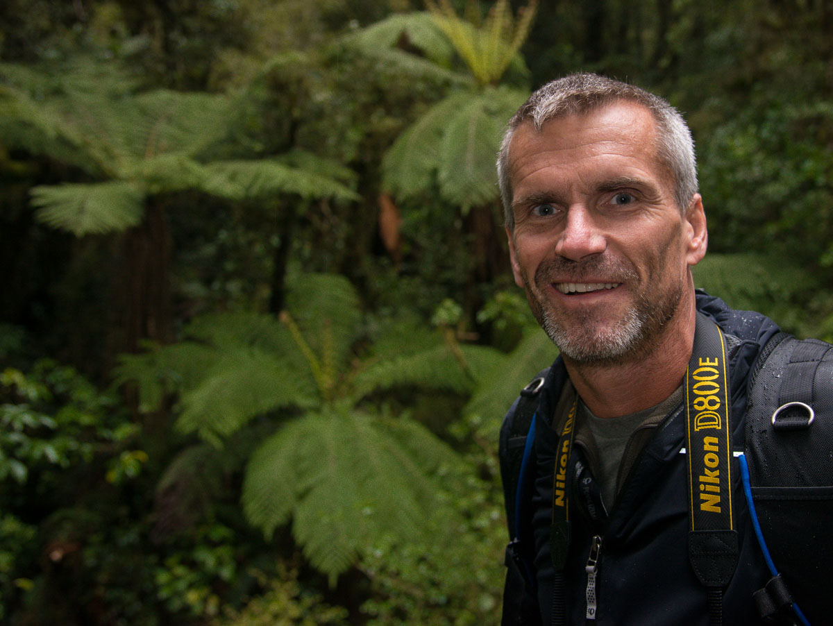
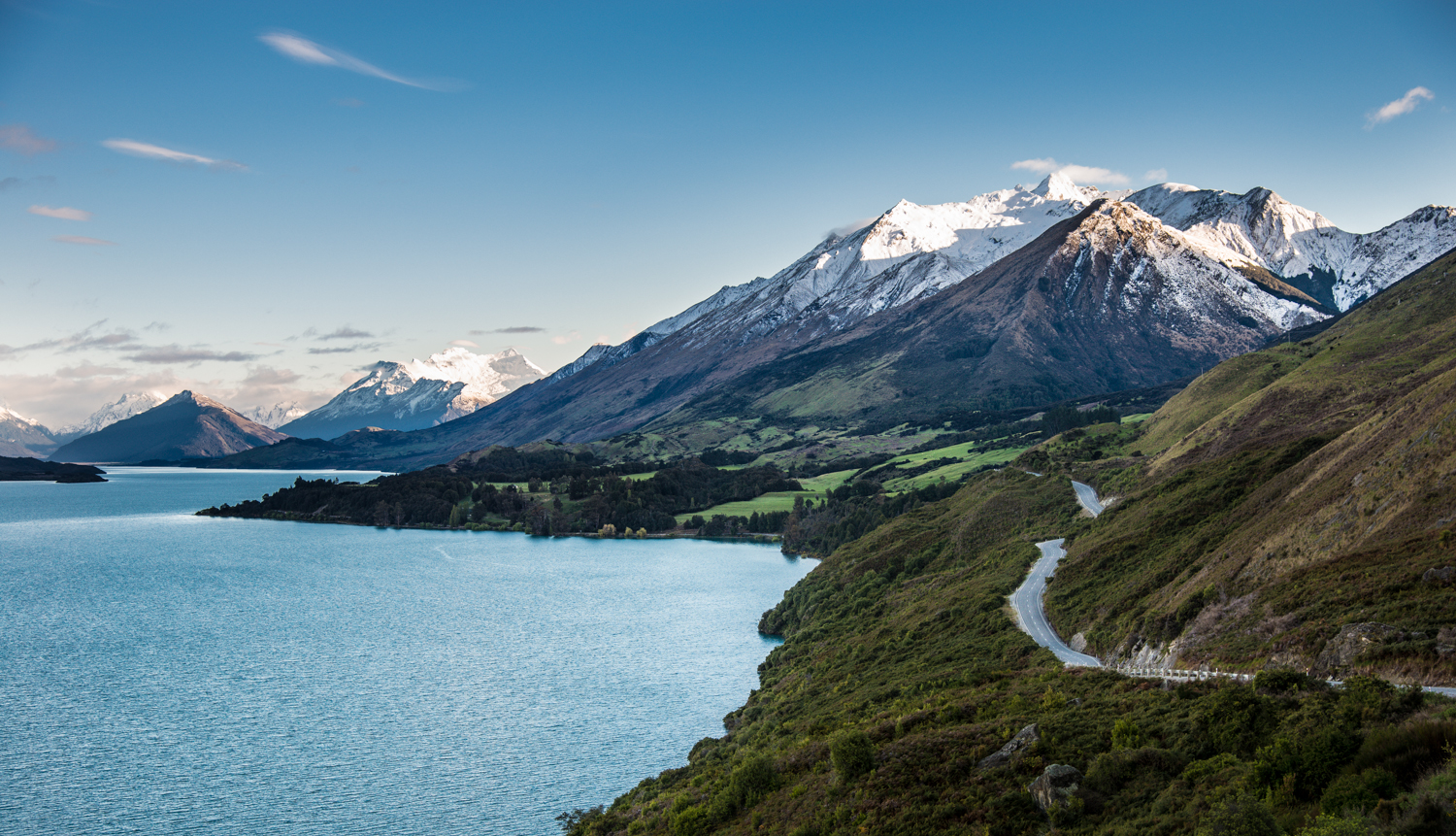
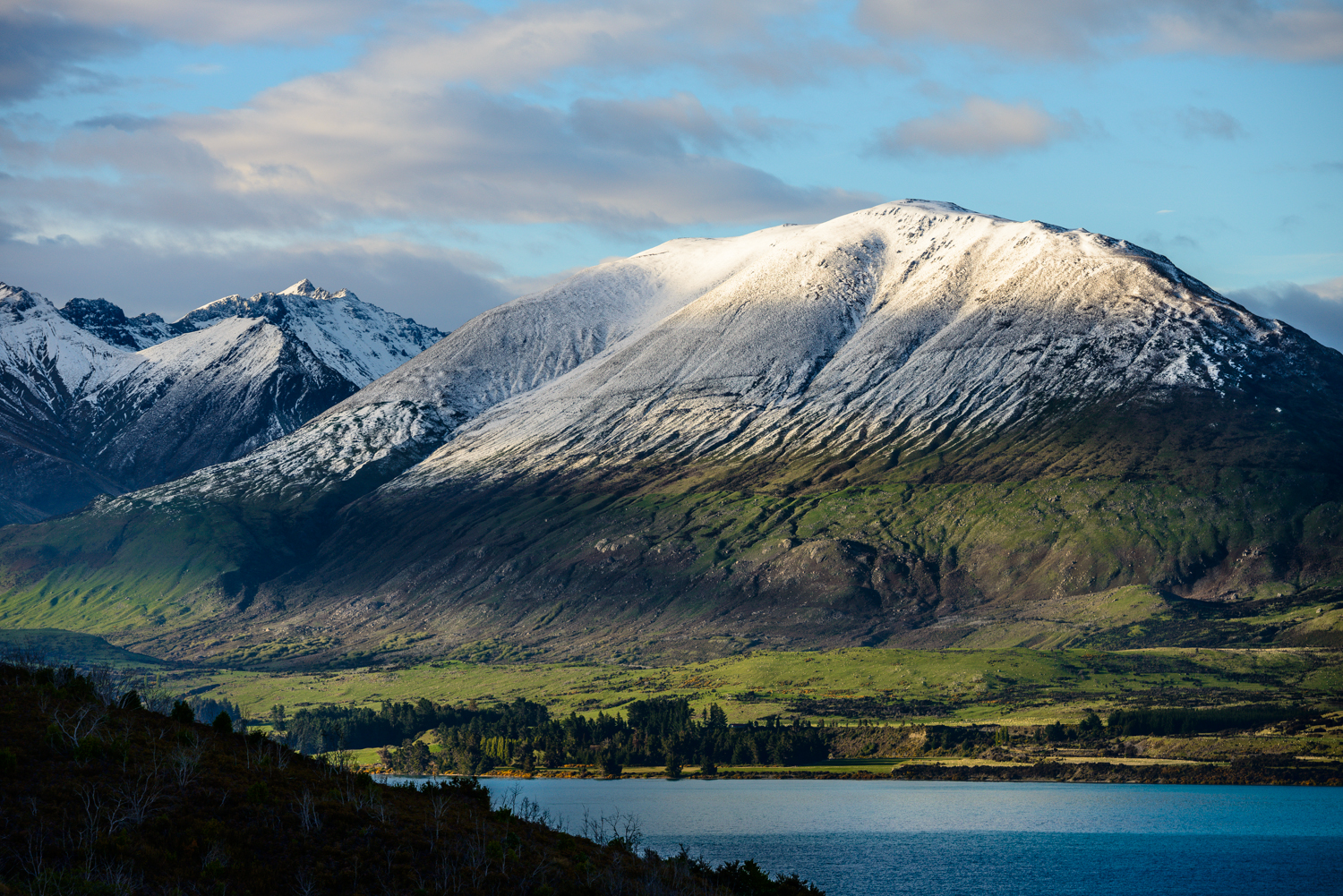
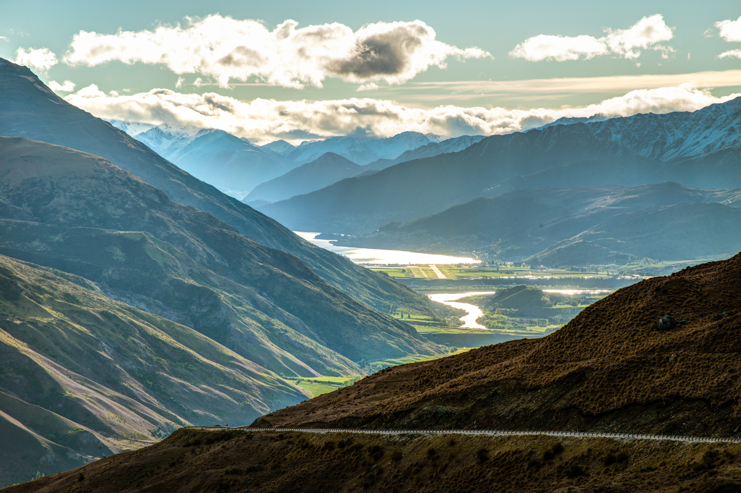
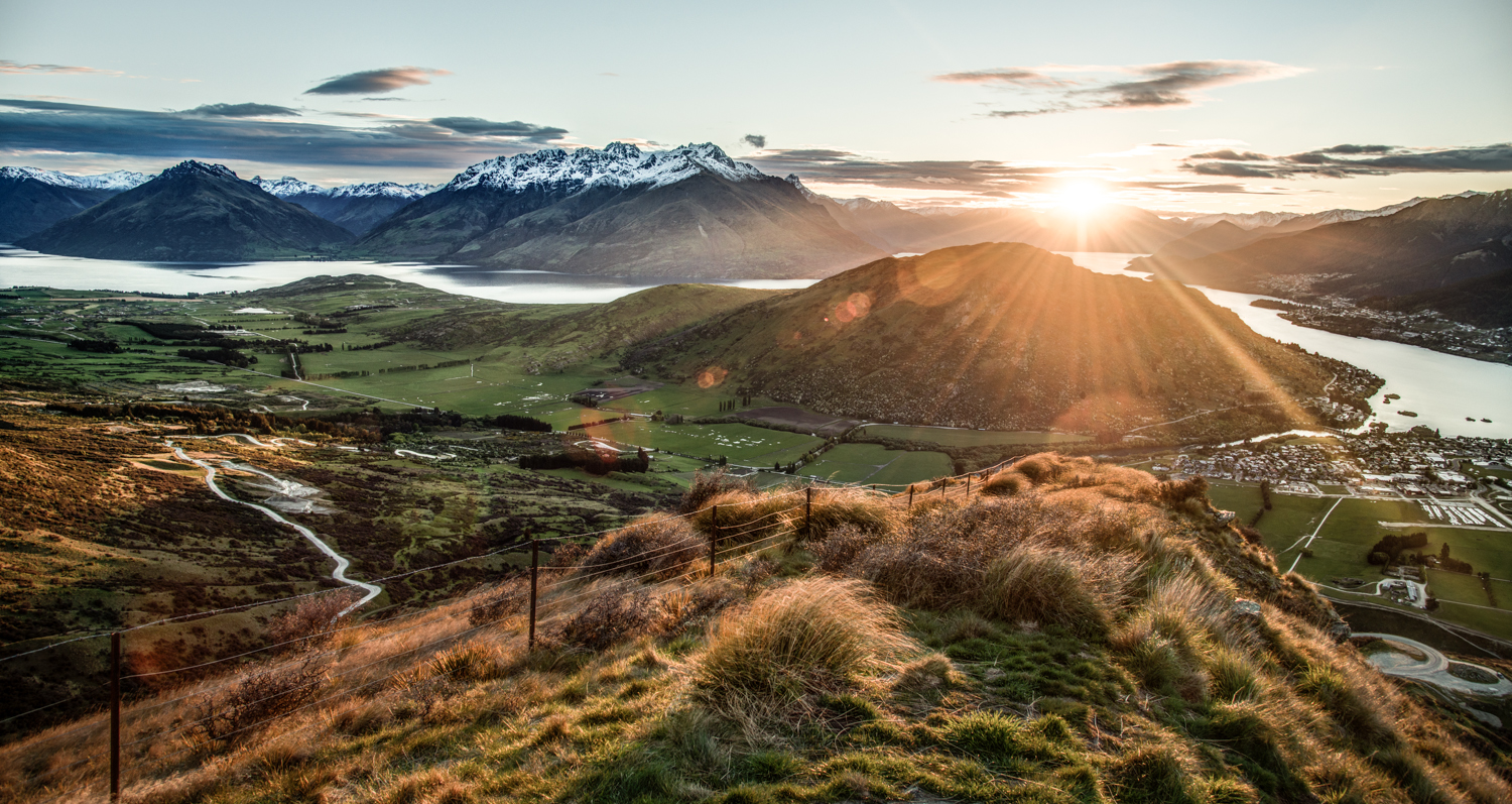
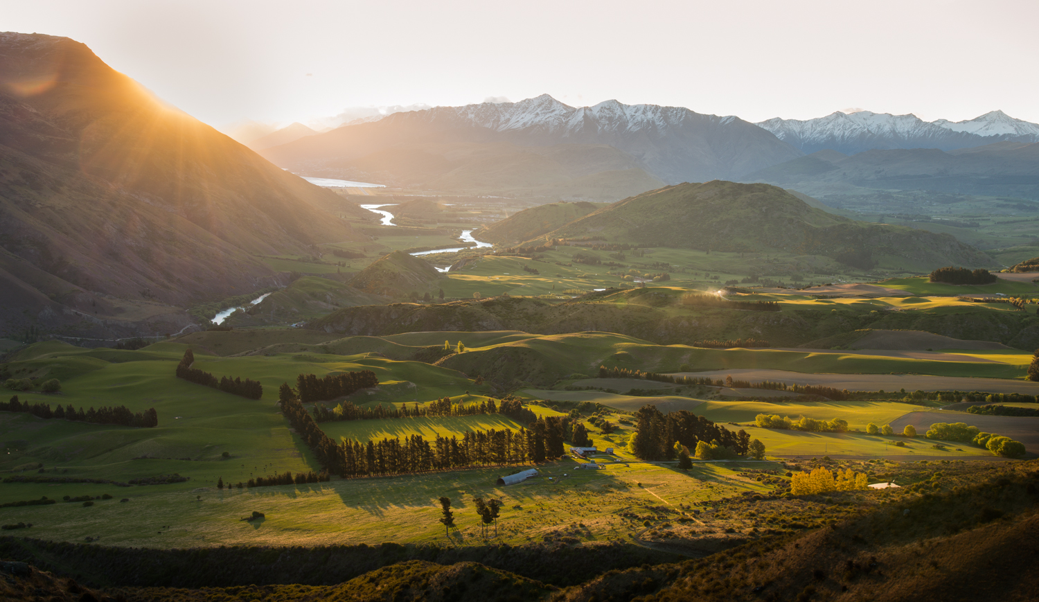
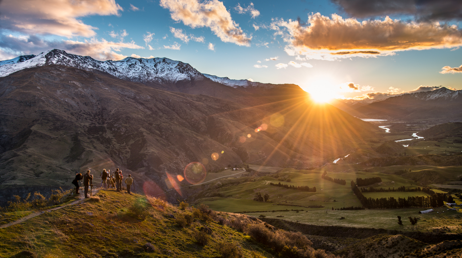
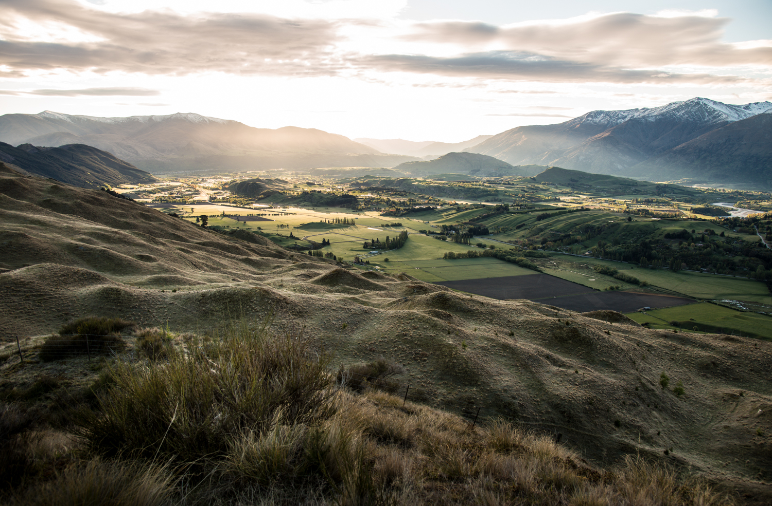
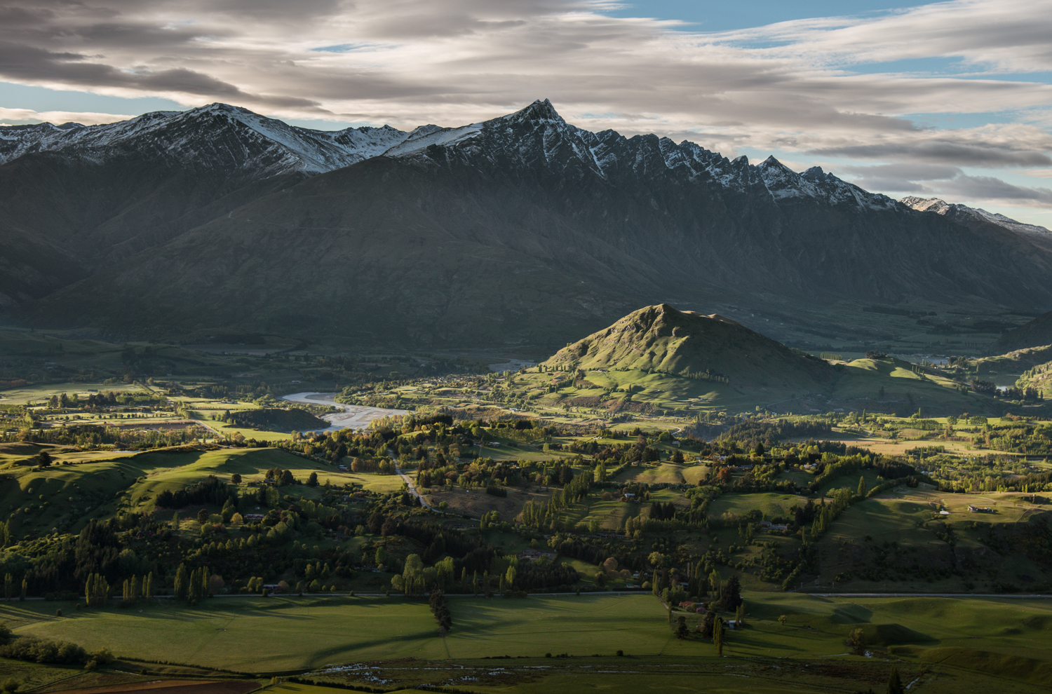
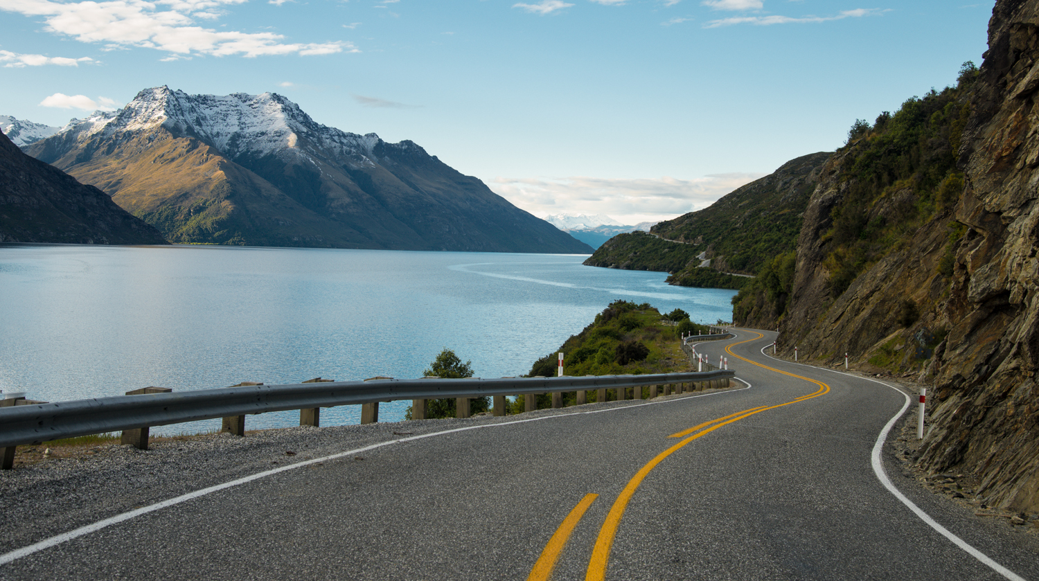
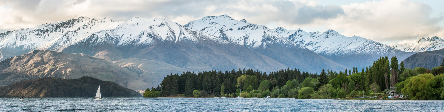
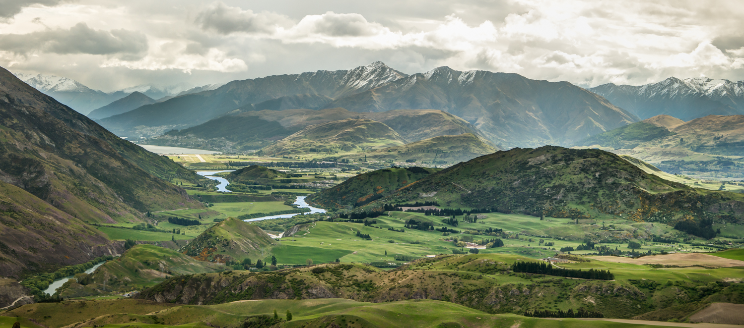
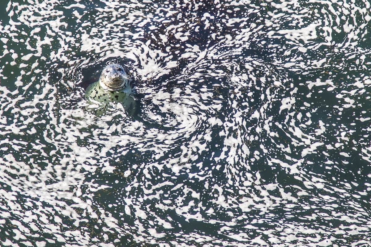
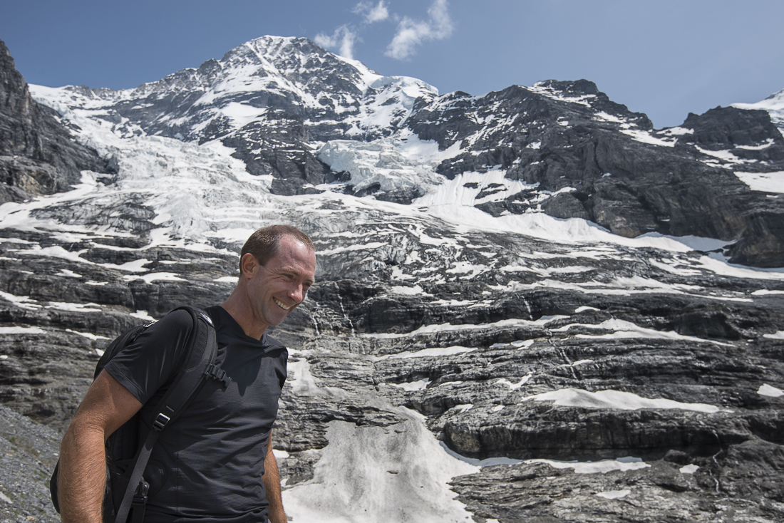
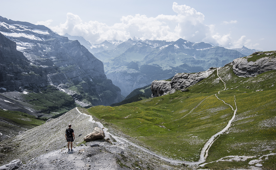
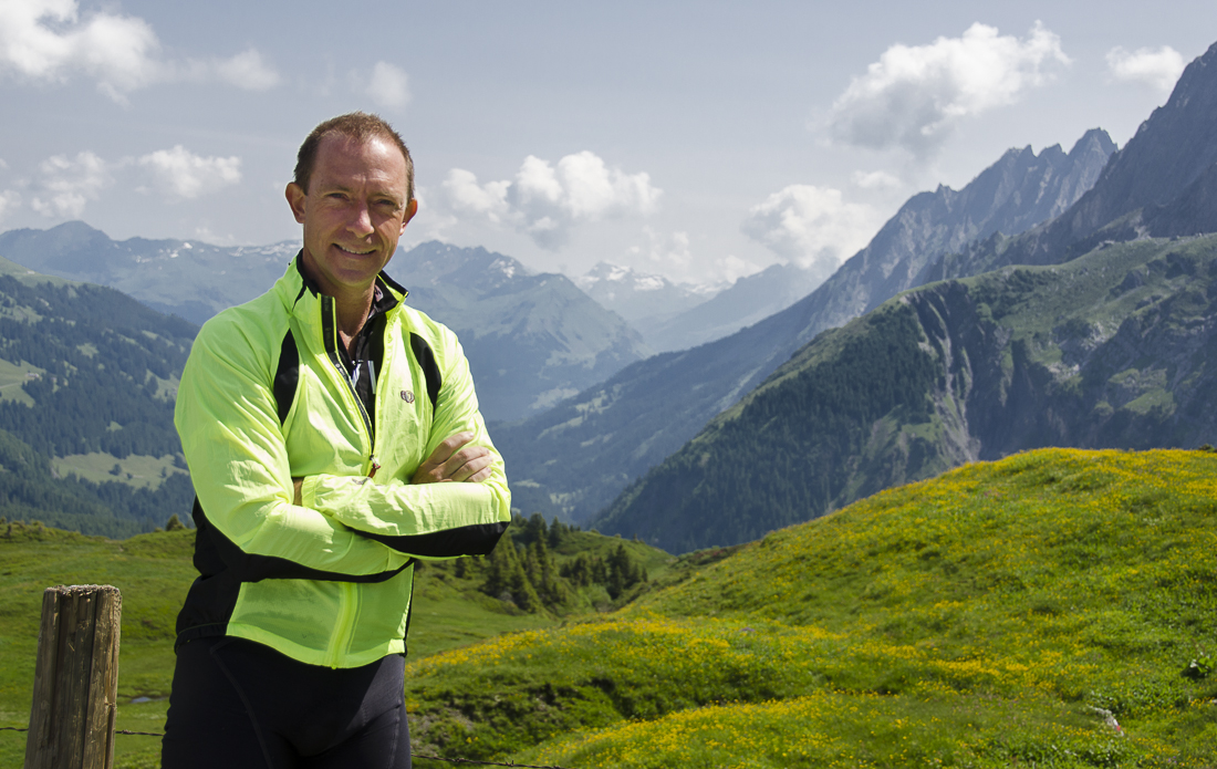
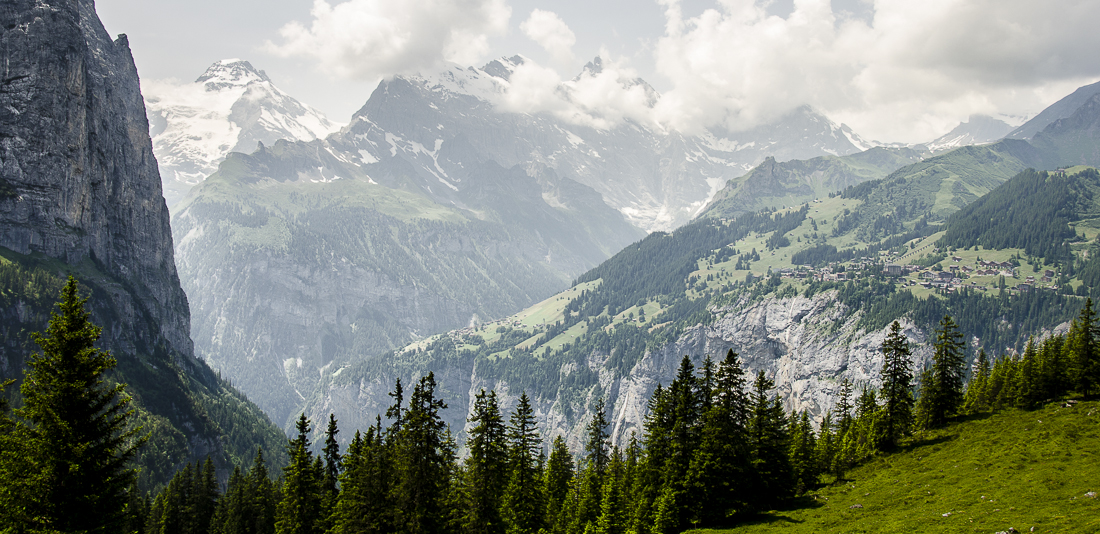
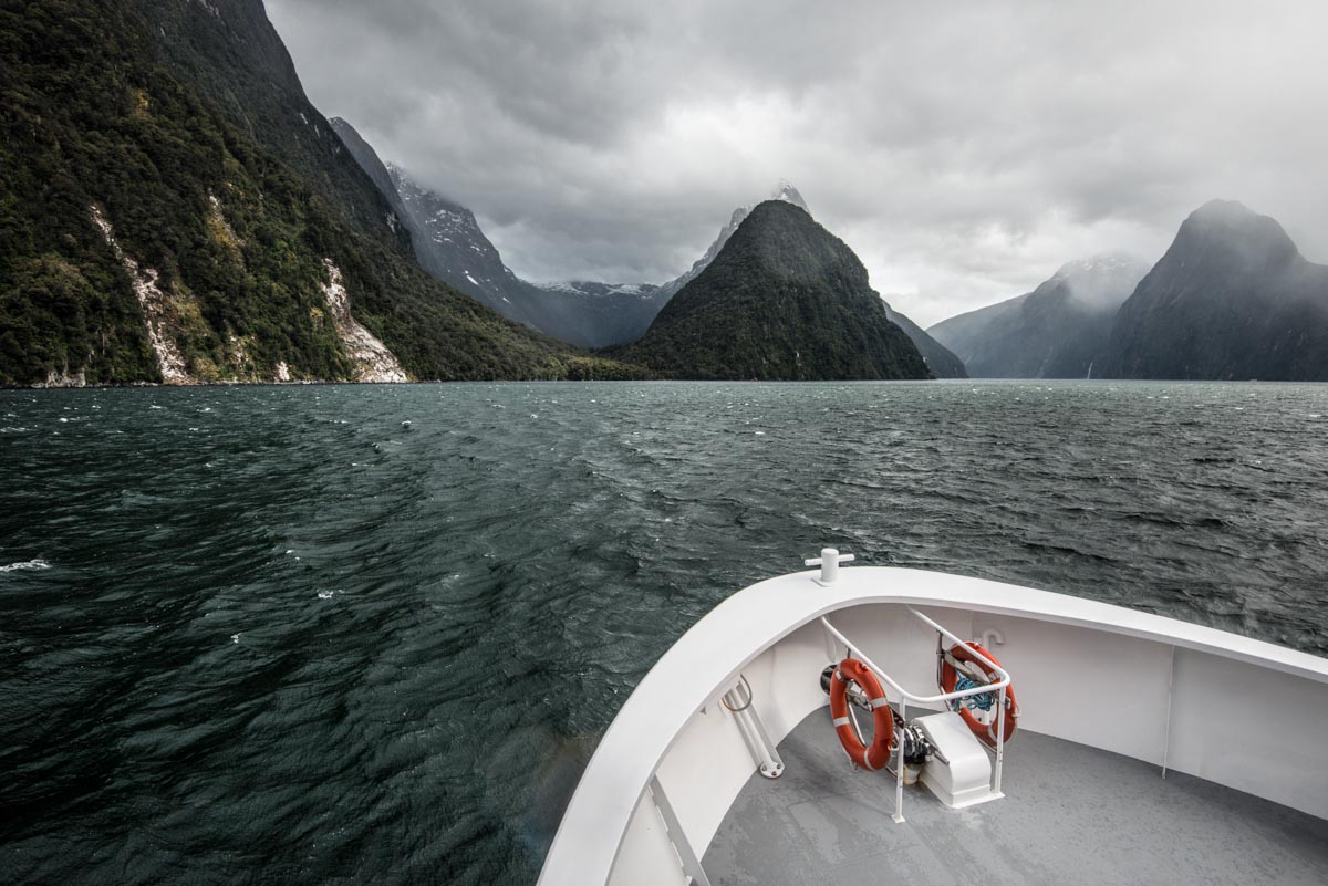
That pointy peak you see in several pictures is Mitre Peak – named after a bishop’s hat, which has roughly the same shape.  The dark blobs on that rock (with a boat in the background) are sleeping seals.  The humans you see in a couple of shots are American photographers who were my hitchhiker/travel buddies for a few days (Mark Hubbard and Josh Whiton).  The shots below are from the long out-and-back road that leads out to Milford Sound.


Kiwi Springtime: Queenstown, New Zealand

New Zealanders refer to themselves as “Kiwis.”  And of course most Americans are aware of the brown, furry fruit of the same name.  But if you’re tracing the original source of the term “kiwi,” be aware that the chicken-sized bird came before that egg-sized fruit.

A Polynesian tribe known as the Maori are considered the aboriginal people of New Zealand.  Apparently, they arrived by seagoing canoes (from Tahiti, perhaps) around the year 1300 — about 350 years before Dutchman Abel Tasman first arrived on New Zealand shores.  “Kiwi” is the Maori name for a brown, round, furry-looking chicken-sized flightless bird that’s native to the islands and which has become the national symbol and namesake.   The fruit originally known as a Chinese Gooseberry first became a popular agricultural crop in New Zealand in the early 20th century, and was renamed “kiwi fruit” about 50 years ago.

The first leg of my Kiwi adventure has centered around Queenstown — a smallish town on New Zealand’s larger, southern island.  The nearby mountains  (the ones beneath those pink sunrises) are aptly named The Remarkables; my late spring (October/November) arrival is too late for skiing.

I know all too well that photographers can use Photoshop or similar tools to make some fairly ordinary scenes look spectacularly wacky.  That’s not what’s happened here — and not really my ‘thing’:  the light and the colors really do look this way.  I use some of the same tools to try to get a realistic image that does justice to this spectacular scenery.

Queenstown was my first stop in a country roughly the size of Colorado (if you stretched Colorado out and pulled it into two parts).  Onward.

.

.

Most of these shots are around Queenstown and Lake Wakatipu — almost all in the early morning or late evening.  The ones that look like a golf course are a golf course called The Hills — apparently a famous one and one that’s covered with modern-ish art sculptures.  The two long skinny horizontal pictures with water in the foreground and the tree-in-water and sailboat pictures are at at Lake Wanaka — about an hour northeast of Queenstown.

_JCE0918.jpg_JCE1079.jpg_JCE1114.jpg_JCE1276_7_8a.jpg_JCE2158_60_62.jpg_JCE1463.jpg_JCE1482.jpg_JCE1558.jpg_JCE1635.jpg_JCE1748.jpg_JCE1936.jpg_JCE2014.jpg_JCE2042.jpg_JCE2718_19_20.jpg_JCE2346.jpg_JCE2369_70_71.jpg_JCE2387_8_9.jpg_JCE2577.jpg_JCE2591.jpg_JCE2859.jpg_JD89527.jpg


Photographers:  3 or 4 of these pictures are “HDR” shots that use 3-4 different images (same scene, different exposures) and crunch that down so you can see both the deep shadows and the bright skies and sun.  Hopefully you can’t tell which ones.   Mostly I get the same results with the D800 + Lightroom.  I tried to force myself to use a tripod, especially on scenes where I’m ‘bracketing’ multiple images for HDR.  But I hate it — it slows me down and cramps my (literal) style.  It’s amazing how well the software can align handheld shots.  I’m putting that damn tripod back in the suitcases.


The Way Out West: San Francisco and Santa Cruz, CA

I was a week early and about a billion dollars short of being able to compete in the America’s Cup sailing race, which started Saturday in San Francisco bay.  (I also lack the requisite sailing know-how).  But the  fog parted long enough last week to let me watch the USA Team (Oracle) practicing for the big event.  Those boats can go 50mph!  They have a 140-ft-tall vertical rigid “wing” rather than a traditional canvas sail, and they essentially just fly along a few feet above the water with a tiny surfboard-sized fin sticking into the surf to keep them on track.   


I spent a week sightseeing and visiting friends in San Francisco and in Santa Cruz, which is 60 miles to the south, on the north side of Monterrey Bay.  The San Francisco Bay area is hardly the furthest point in the U.S. away from Texas (or Oklahoma) – at least if you’re just measuring miles.  But the people and the ‘culture’ may be as far from ‘Texan’ as anywhere in America.  There are a surprising number of white men in dreadlocks.

Rest assured that every restaurant menu in Santa Cruz will include the words “sustainable,” “local,” “organic” “gluten,” and “GMO.”   I went with friends to a vegan café where every item on the menu had a name like “I Am Renewed” and “I Am Accepting.”  Ironically, the “I Am Fulfilled” was a smallish vegan salad.  I had the “I Am Transformed” (which tasted a lot like a black bean taco), with a side of “I Am Refreshed.”  (And I Am NotMakingThisUp).

AND:  The Mexican food restaurants do not serve chile con queso!! It’s anarchy out there, I tell you!

_JD82927.jpg_JD82933.jpg_JD82976.jpg_JD83142.jpg_JD83046.jpg_JD83098.jpg_JD83226.jpg_JD83560.jpg_JD83602.jpg_JD83655.jpg_JD83723.jpg_JD83764.jpg_JD83780.jpg_JD83831.jpg_JD84001.jpg_JD84012.jpg_JD84020.jpg_JD84137.jpg_JD84315.jpg_JJC8871.jpg_JJC8909.jpg_JD84279.jpg


The urban-looking pictures are San Francisco; the lighthouse, the giant redwood the seal and the coastline are around Santa Cruz.  The fancy place in the first two shots is the Palace of Fine Arts.  The iconic row of “Painted Lady” houses is at Alamo Park.  In the orange sunrise shot, that’s Alcatraz you see peeking through the fog.  The graffiti truck and the American flag are in China Town.  All the nighttime shots are of (and around) the Ferry Terminal and the Bay Bridge to Oakland.  A big thanks to my Costa Rica / Leadville buddies Peter and Jana Thomsen for hosting me in Santa Cruz, and to their niece Kasondra for being my tour guide in San Francisco.

Switzerland 2013: Jungfrau

More pictures from the “Jungfrau” region of Switzerland.  The area — south of Interlaken — is named for its tallest, snowiest peak.

A few times during the past couple of weeks, I was on a bike, just laughing aloud – seemingly for no good reason.  I think it sometimes just struck me how ridiculously great it was that I’d somehow found my way onto some of the most beautiful hillsides in the world, coasting my bike in zigzags down the path like a 12-year-old.

My friend (and riding buddy on this week’s rides), Scott Humphries, reported that he’d heard me singing a couple of times as we descended.  I’m sure he did.  Much like normal people do in the shower, on a bike I often sing whatever song pops into (or sticks in) my head.  So this time “Edelweiss” (the Sound of Music song about alpine flowers), and 38 Special’s “Hold on Loosely” were in my repertoire – the latter being a pretty decent ‘80s Rock primer on how to manage the handlebars of a mountainbike during a bumpy, difficult descent (“hold on loosely; don’t let go; if you cling too tightly, you’re going to lose control”).

Admittedly, the long, steep uphill climbs are not nearly as lighthearted.  Those usually involve me monitoring my heart rate and trying to manage my breathing in synch with my pedal strokes.  But the already-stunning views from the mountaintops are twice as satisfying when you know you earned it by getting up there under your own power.

_JD80985.jpg_JD81217.jpg_JD81492.jpg_JD81735.jpg_JD81760.jpg_JD81838.jpg_JD81862.jpg_JD81877.jpg_JD81880.jpg_JD81895.jpg_JD81919.jpg_JD81946.jpg_JD82003.jpg_JD82057.jpg_JJC8112.jpg_JJC8301.jpg_JJC8354.jpg_JJC8512.jpg_JJC8563.jpg

Scott’s and my last (very long) Swiss bike ride involved a couple of significant navigational errors and a steady afternoon rain, the combination of which resulted in our decision to call it a day and load ourselves and our bikes up for a train ride back to Grindelwald.  A very sweet, very talkative 70-year-old lady – a native of the area — asked to sit with us.  The train car was practically empty; she sat with us because she wanted to talk.  Her monologue brushed on weather, geology, politics, sports…you name it.

At one point, she lamented the tour groups that come through her town for a one-day, prescribed visit to the single most famous tourist sight in each region, then pile back on their bus to do that again in the next city.  She thought they short-changed themselves – and her country:  “They don’t even see it.”  Having spent the prior two weeks covering just about every trail and path in the area, I was delighted and contented to know that I had avoided that mistake.


* * * * *

Lest anyone think I’ve totally lost my mind (or that I lost it in ways that were not previously obvious), rest assured that the craziest-looking trails in these pictures were from HIKES – not bike rides.  Neither my nerve or my bike-handling skill is sufficient to attempt those paths on wheels.  Many of the destinations can be reached by train, gondola, hike or bike.  Most of the hikers (not us) take a train to the top and then just walk down.

And our treks on foot were hikes — not real mountain climbing (e.g., with ropes or picks).  Scott and I wondered why we didn’t see any climbers attempting the impressive rocky north face of Mt. Eiger — the one that looms directly over Grindelwald.  It’s been done, apparently, but the statistics on the number of folks that had died trying explained why we didn’t spot any brave souls up there last week.

In the grid of pictures above, the ferry boat is on Brienzersee, one of the lakes surrounding Interlaken.  The flowery bridge is the famous, ancient one in Lucerne (halfway to the Zurich airport).  In the second big picture from the top, that little clump of buildings on the green hillside with all those roads going to it is Klein Sheidig – at the top of a 3,000 foot climb I did three times on the bike and once on foot.  The snowiest pictures are of the Eiger glacier – part of the UNESCO World Heritage site that covers much of this area.  That’s Scott Humphries in several of the pictures.  Believe it or not, he swung by Grindelwald on his way home from Croatia – where he’d been on a biking trip with his wife, Stacy.  He was a reluctant but cooperative model:  mountain pictures can be a little ‘blah’ without something in the foreground, and often he was the only choice available! 

Switzerland 2013: Back to Grindelwald

The first of (probably) two batches of pictures from a couple of great weeks spent in and around Grindelwald, Switzerland.

Last year I visited Grindelwald, Switzerland for just a couple of days.  I promised myself I’d come back this year when I could stay longer, so for the last couple of weeks I’ve been holed up in an apartment on the ground floor of a hillside “chalet.”  (If “chalet” sounds especiallyglamorous, you should know that almost every home here is built “chalet” style).  All the pictures on this page were taken with a camera pointed toward the town of Grindelwald – from a dozen different angles as I biked and hiked and rode trains and gondolas in every conceivable direction to and from town.

The best part?  I’ve had two friends come (separately) to visit and join me in what would seem like an exhausting series of hikes and bike rides.  Each of them are former law partners of mine at my old law firm (Gibbs & Bruns).  Scott Humphries (shown in bike gear here) tagged in shortly after Jeff Kubin (in the blue jacket) left.  Fortunately, they’re both easy to get along with, and energetic enough to keep me pretty busy ‘hosting’ them here in Grindelwald.  My rough tally is that in the last two weeks, I’ve biked or hiked a total of at least 35,000 feet of vertical climbs.

Three big peaks tower over the south side of Grindelwald, Switzerland – Wetterhorn, Shreckhorn, and Eiger.  Most of the town sits on the southern slopes of a mountain called Reeti, so practically everybody has a view (from their “chalets”!) of Mt. Eiger and the other rocky peaks.  As you look through the gaps between the three, you see even-higher even-snowier peaks.  In the gaps and high valleys, there are are several glaciers, most of which have apparently been retreating for hundreds (or thousands) of years – and certainly since the 1880s when they started keeping records.  This may be a good thing — many of the towns are built where big Ice Age glaciers used to be.

One downside of this part of Switzerland is that some things (especially restaurants) are astoundingly expensive.  Pick a seemingly-casual restaurant at random and they’ll probably have at least a few entrée options topping $35US or more (and very few under $20).  It’s not unusual to have to pay $5 for a Diet Coke.  I got some insight as to why things are so expensive here when I saw what had to be done to repair the roof on a condo building next door to the apartment I rented:  They had to use a helicopter to lift the lumber onto the high hillside chalet-style roof.

As a couple of the pictures reflect, there are cows all over the grassy hillsides.  Their grazing is usually restrained by one-strand temporary electric fences that are moved regularly.  There’s no barbed wire here.  Most of the adult cows (mostly milk cows) have bells, so you hear the clanging constantly.  I assume they need the bells to find the cows that they lose because their fences are so flimsy.  Supposedly the best milk-producing cows get the biggest, nicest bells.  It seems pretty funny to give a cow a (heavy, awkward) trophy as a reward for producing milk.

Several bike rides went right through the cows’ very-aromatic gathering places.  A dozen or so flies would start following me and essentially orbit my head for miles up the hill – until the road leveled so I could go fast enough to lose them.  I felt like Pigpen from the Peanuts cartoons.


_JD81408.jpg_JJC8158 Gross Scheidig panarama.jpg_JJC8250.jpg_JJC8335.jpg_JJC8344.jpg_JJC8427.jpg_JJC8448.jpg

My favorite shot (at the top of this post) is from a hike near Pflingstegg, looking back down toward town; a nearby sign said there was (somehow?!) a restaurant somewhere up near the glacier if we’d just keep hiking another couple of hours, but it was already late evening and, besides, I wasn’t fully convinced how there could be a functioning restaurant that far back in the wilderness.  The waterfall you see in a few shots (one of hundreds in the area) is near a hilltop area called First (prounounced “feerst”).  The shots (below) with the musicians are from a weekly street festival here — the pictures aren’t much good, but, hey, if you’re interested in Swiss folk music….

_JD81554.jpg_JD81591.jpg_JD81609.jpg_JD81625.jpg

The next post will have pictures from the area a little further outside Grindelwald.