Category Archives: Landscapes

The View from Capayque, Bolivia

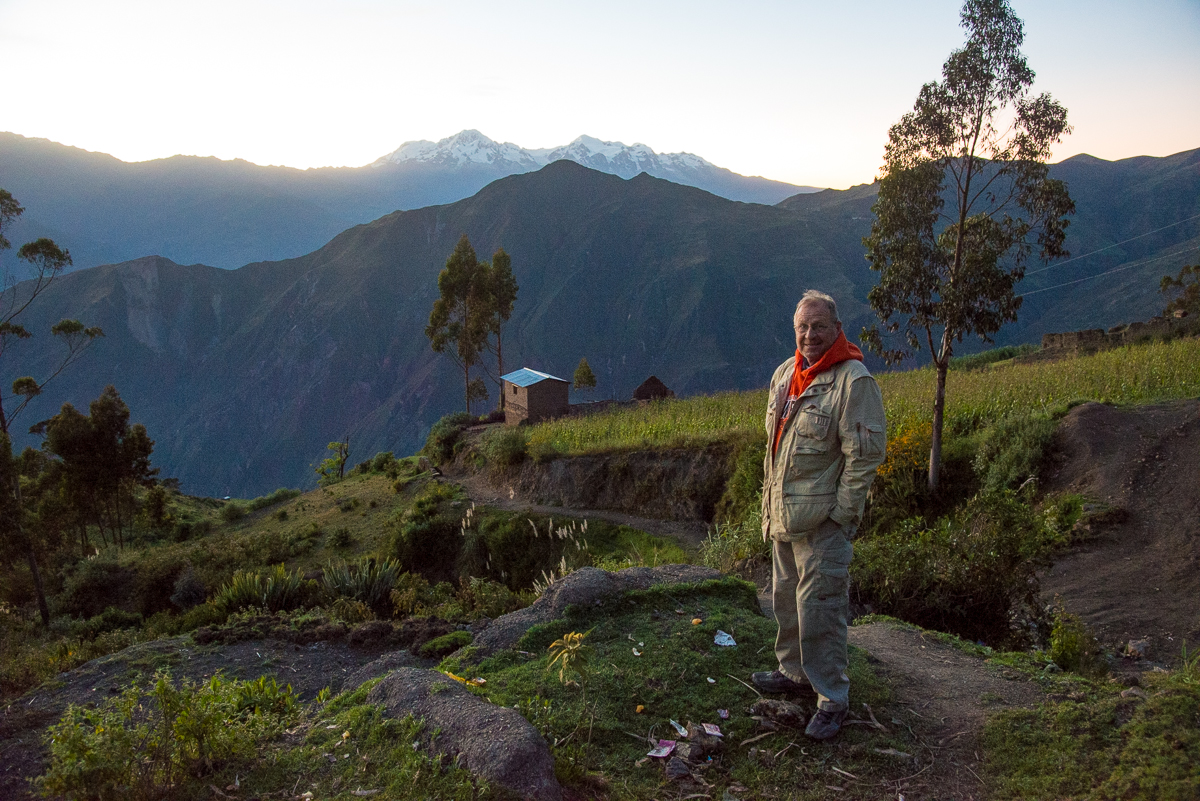
#3 of several posts (starting here, with more to come) about the tiny Bolivian village of Capayque.  I traveled there with a Methodist mission team from Stillwater Oklahoma that was providing much-needed healthcare and setting up a medical clinic in the town.  

_JD81482

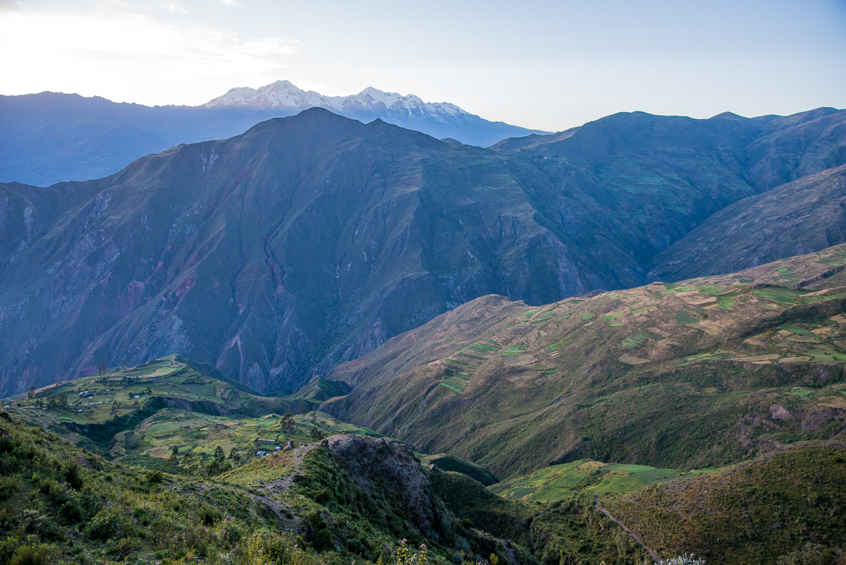
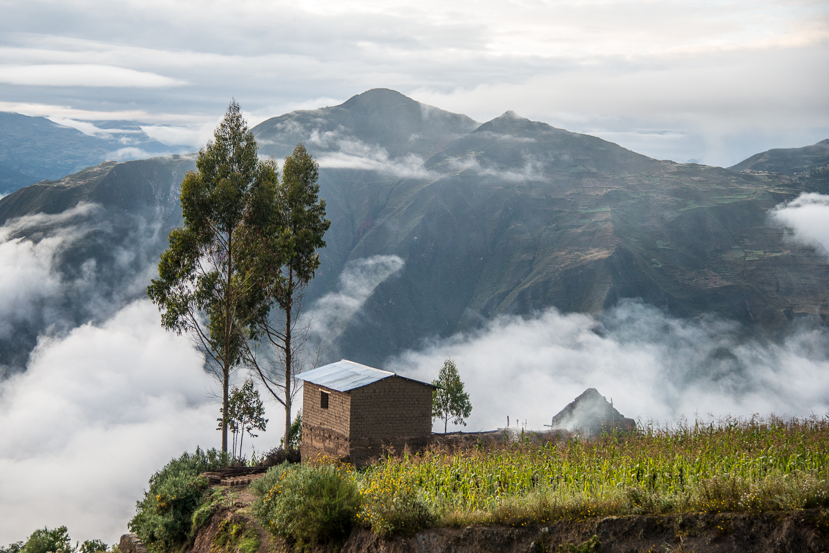
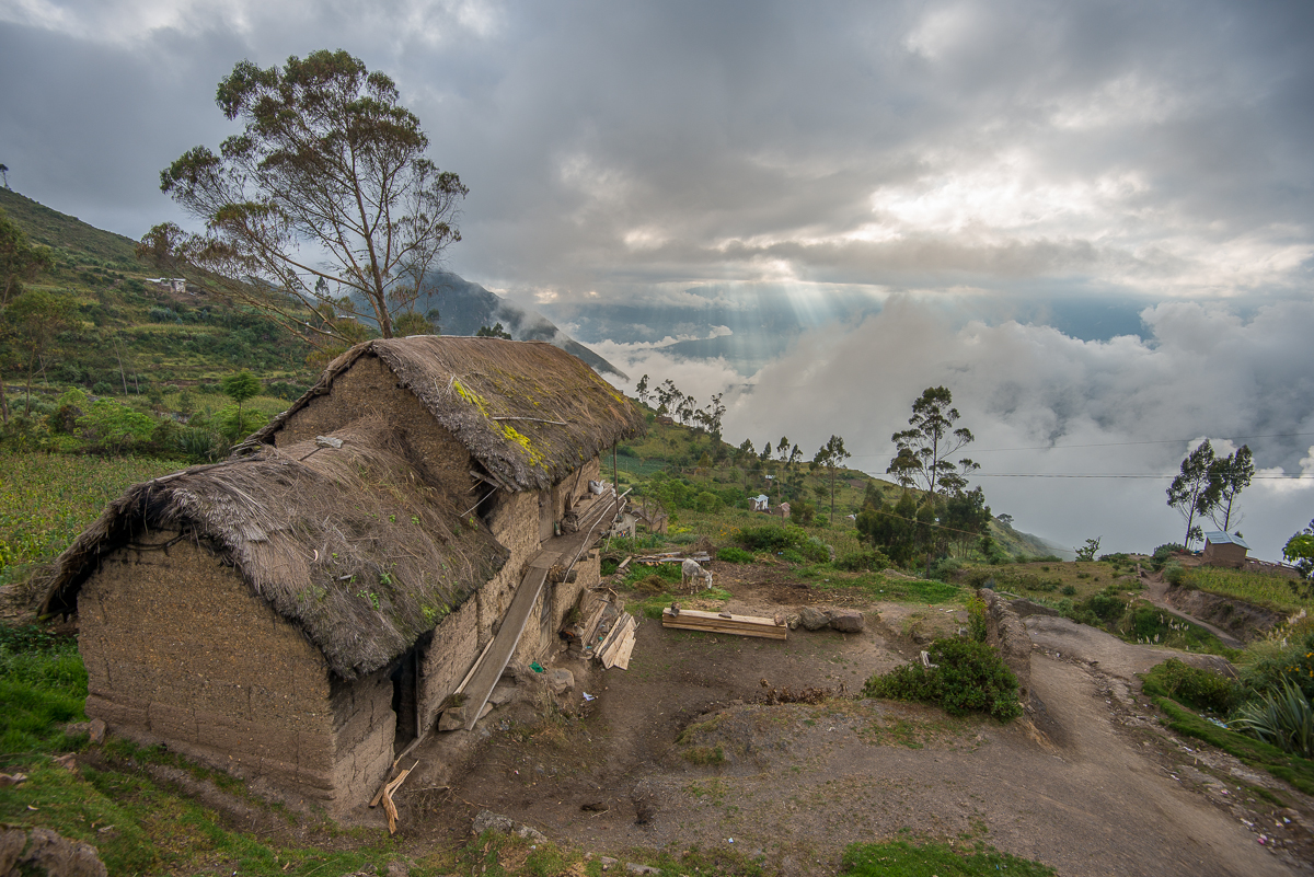
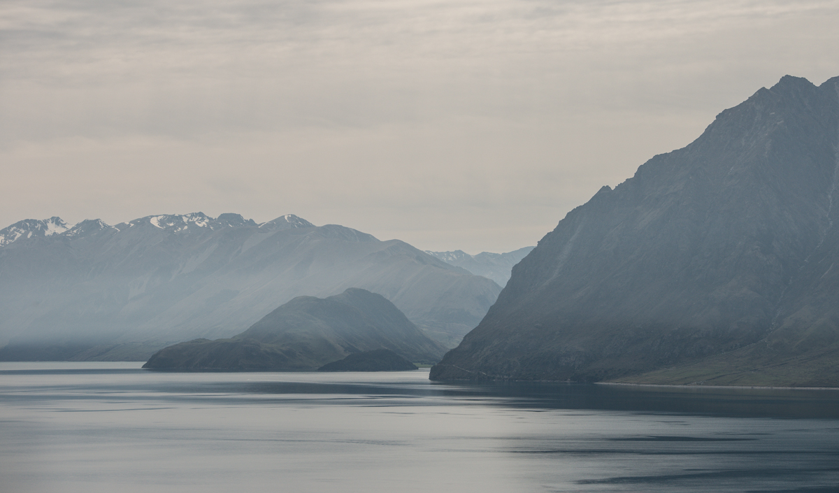
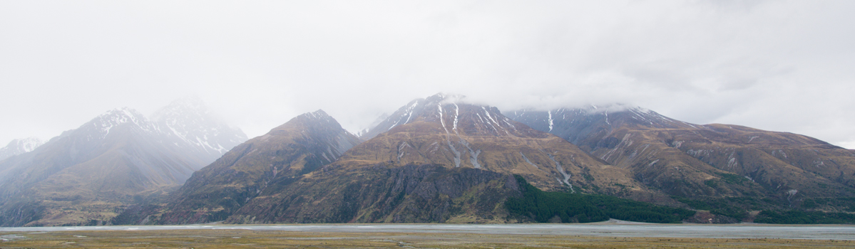
Early morning view to the east from Capayque

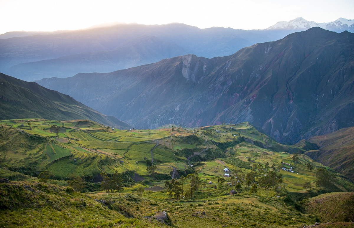
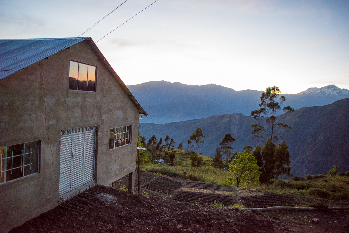
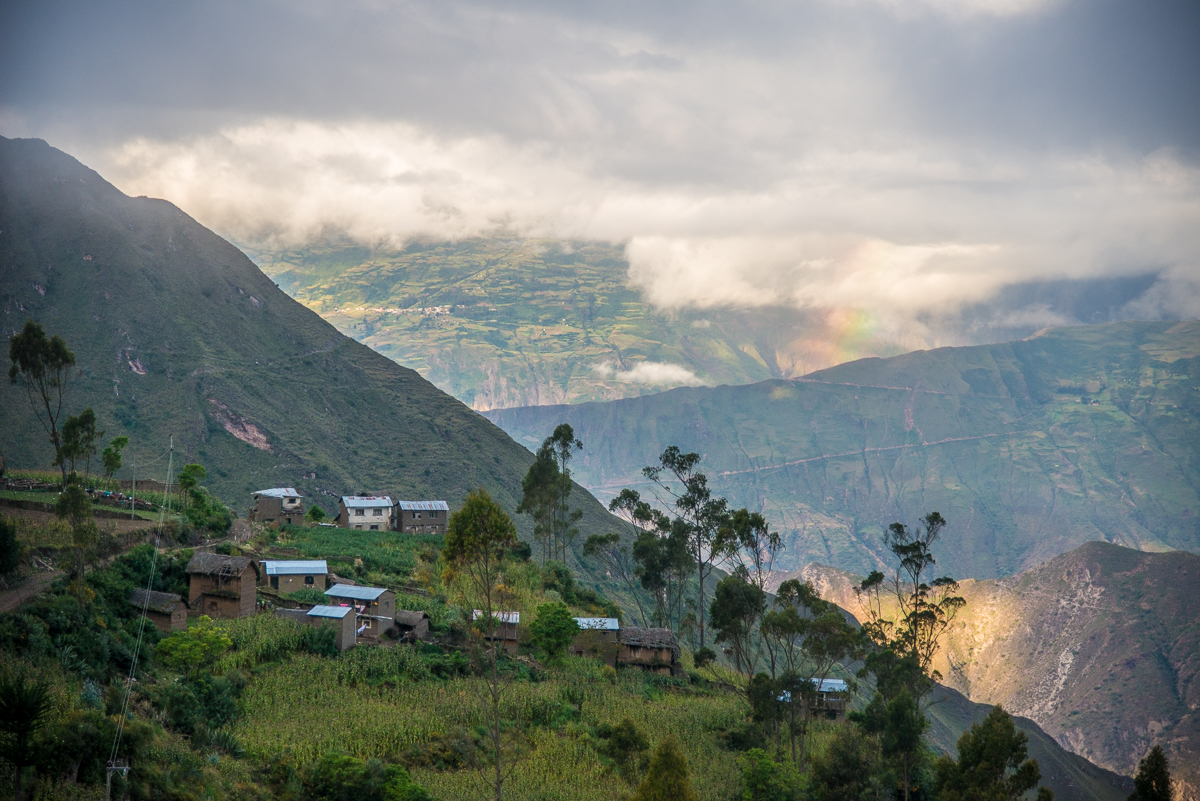
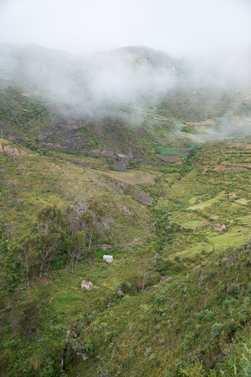
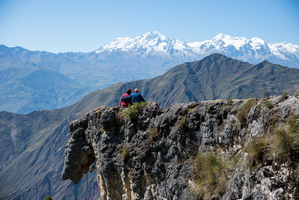
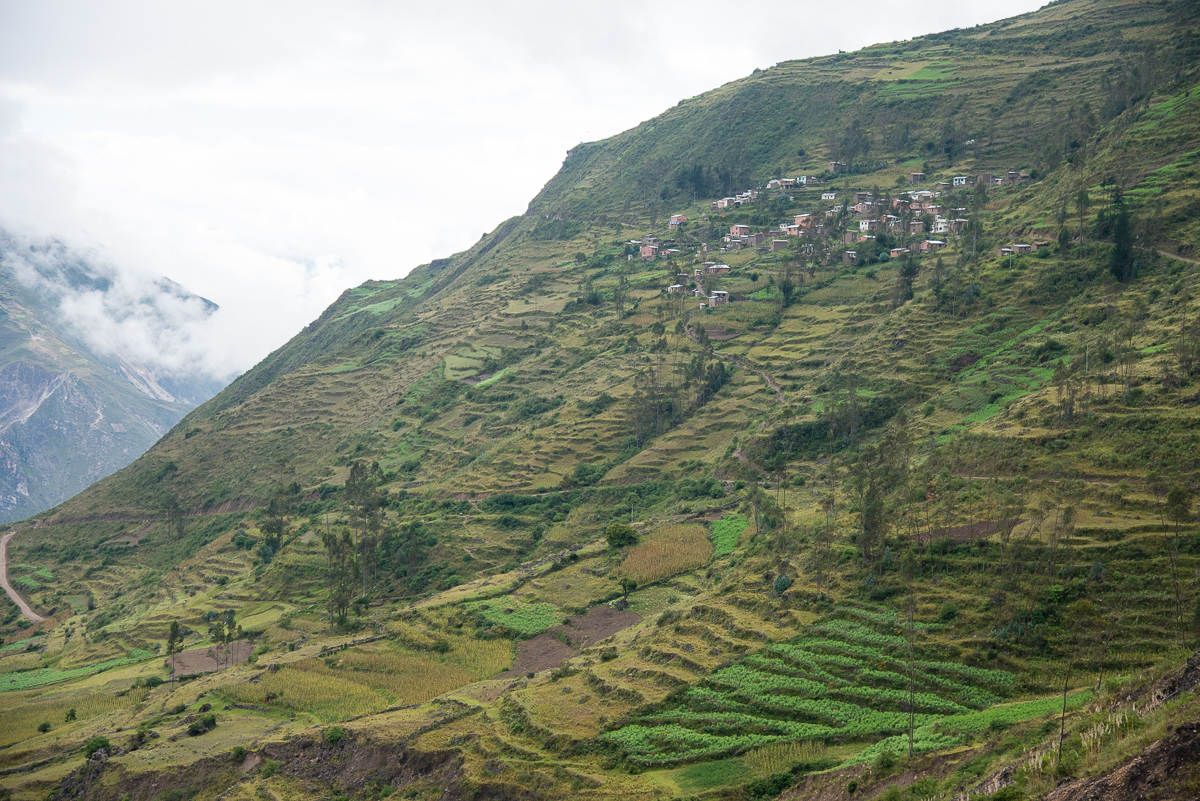
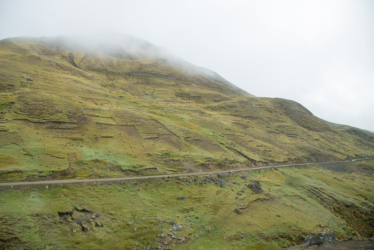
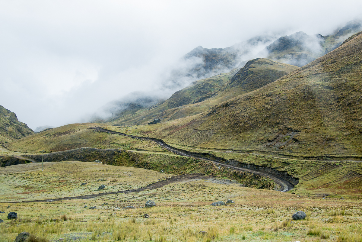
Capayque, Bolivia is a small village in the Andes, sitting at about 11,500 feet above sea level, about two-thirds of the way up from the valley way below and the mountaintops looming above.  On the rare day when the place isn’t mostly in or above the clouds, you’ll be staring at a snow-peaked 22,000 foot mountain just to the east.  From Capayque, you can see a half-dozen other (even-smaller) communities on other ridges and across the valley.

_JD81518

_JD80399

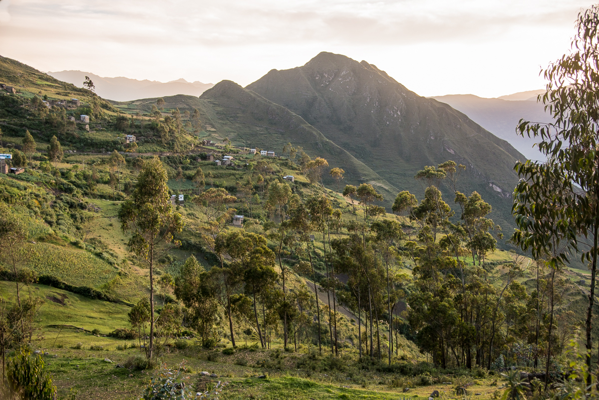
The air is very thin at 11,500, so it can be tough to get around — especially for lowlander Gringos unaccustomed to high altitudes.  The temperatures generally stay between 30 and 60 year-round, though it feels much warmer if the high-mountain sun breaks through.  More often than not, you can look down into the valley and see clouds below you.

_JD81477.jpg_JD81462.jpg_JD81482.jpg_JD81363.jpg_JD80358.jpg_JD80399.jpg_JD80360.jpg_JD80368.jpg_JD80371.jpg_JD80375.jpg_JD80597.jpg_JD81369.jpg_JD81378.jpg_JD81518.jpg_JD81588.jpg_JD81761.jpg_JD81740.jpg_JD82213.jpg_JD81532.jpg

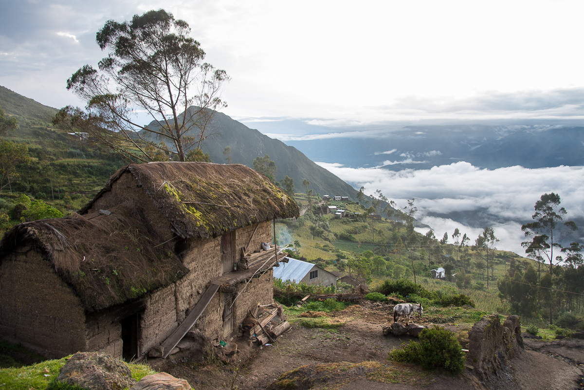
As described in a related post, day to day life here isn’t radically different than it probably was 1000 years ago on these same mountains.

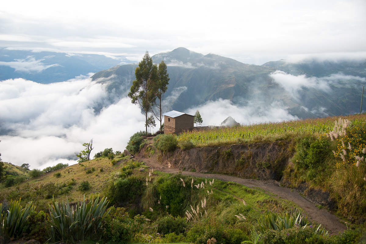
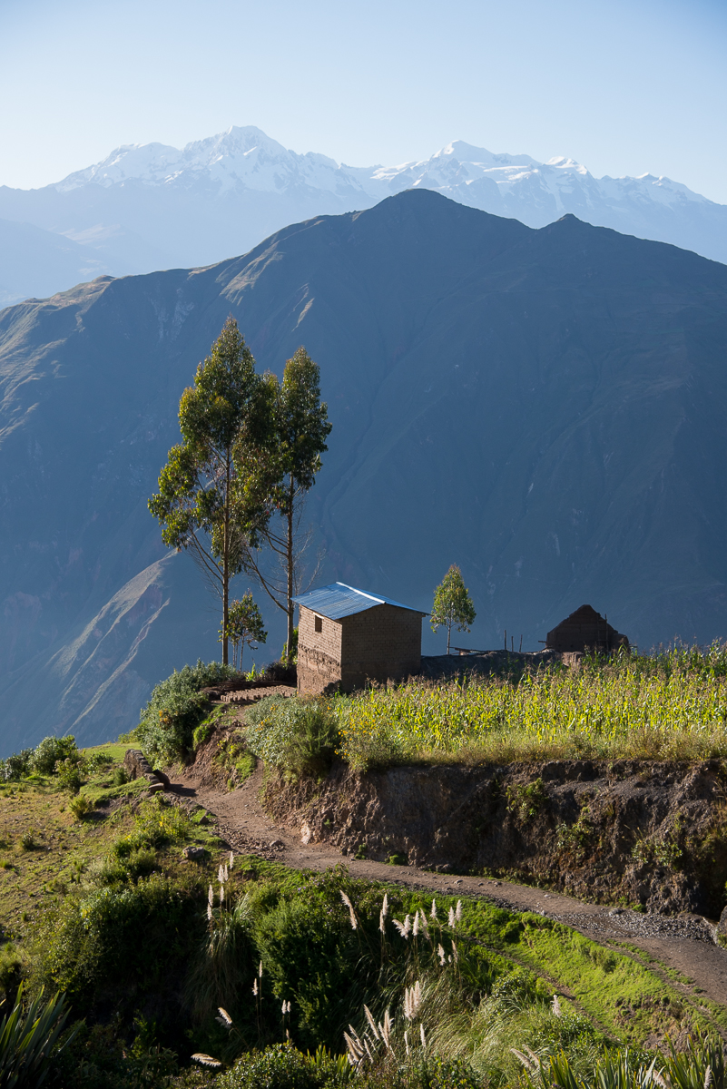
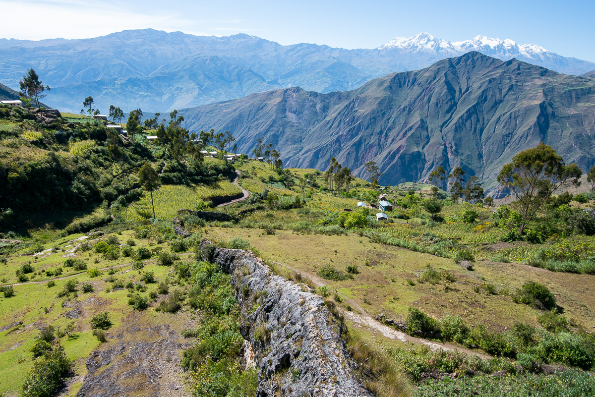
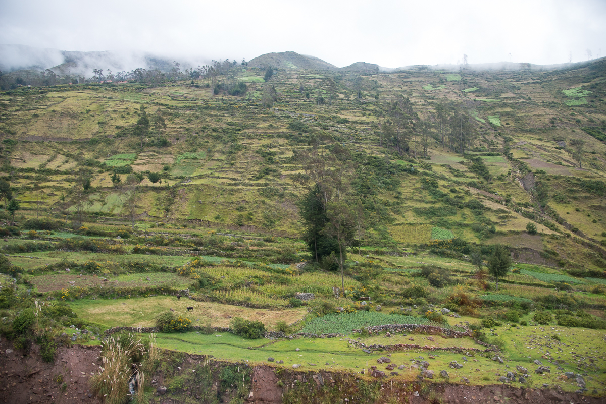
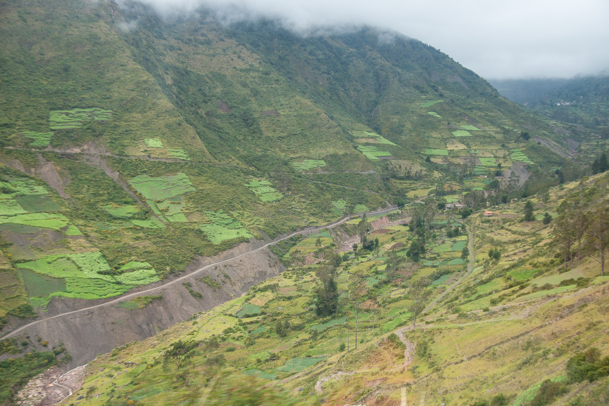
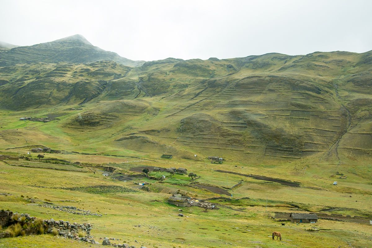
Like most of the hillsides anywhere near Lake Titicaca, the surrounding mountains are striped with horizontal terraces – creating flatter step-like areas better for farming.  Many are in current use, but many (perhaps most) look like they were built long ago and haven’t been used in centuries.

The region around Lake Titicaca was part of the ancient empire of Tiwanaku.  The area has been populated and farmed for 3,000 years.  The Tiwanku empire reached its peak around the 8th Century A.D., when the city of Tiwanaku (on the flatter “altiplano” 50 miles south from Capayque) had an as many as 100,000 residents.*  Estimates of the population in the surrounding countryside are varied and controversial, but the startling scope and span of those ancient terraces hints at the existence huge populations – to build and cultivate the terraces themselves, and to create such great demand for food as to make it necessary to farm so much of the hill country.

The Tiwanaku society mostly disappeared around the 12th century — long before Europeans arrived.  It’s likely that whatever was left of it became part of the Inca civilization.

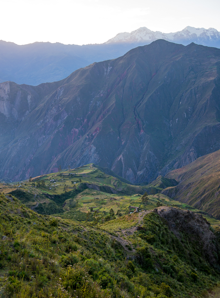
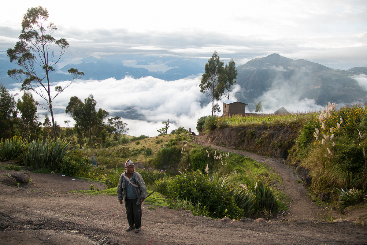
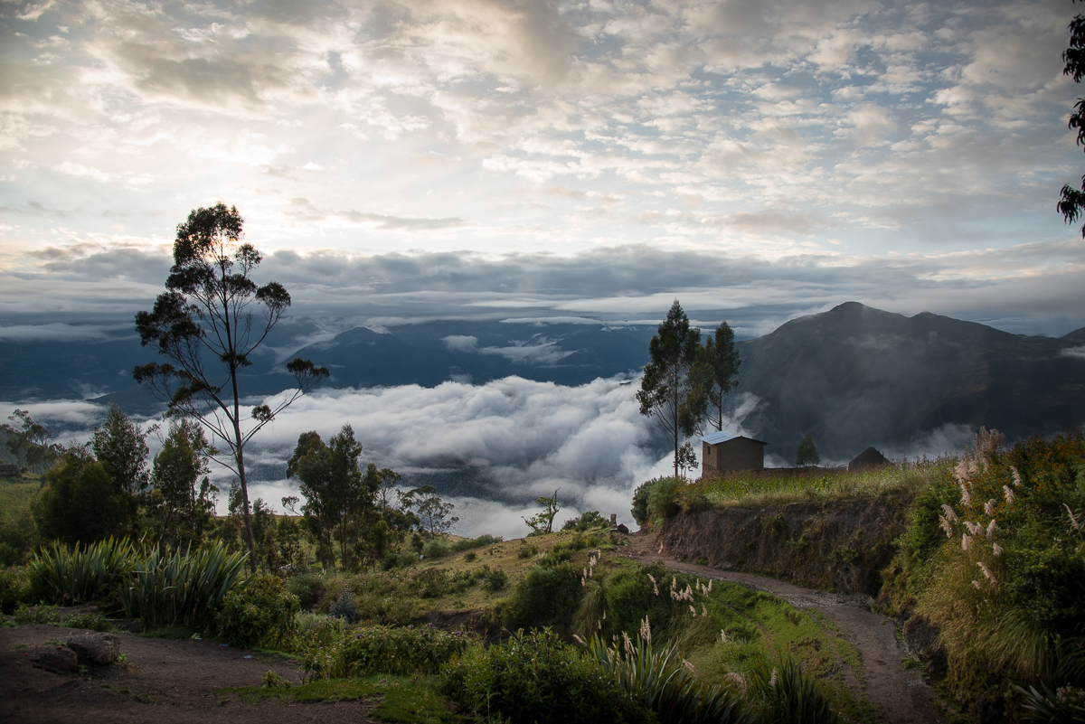
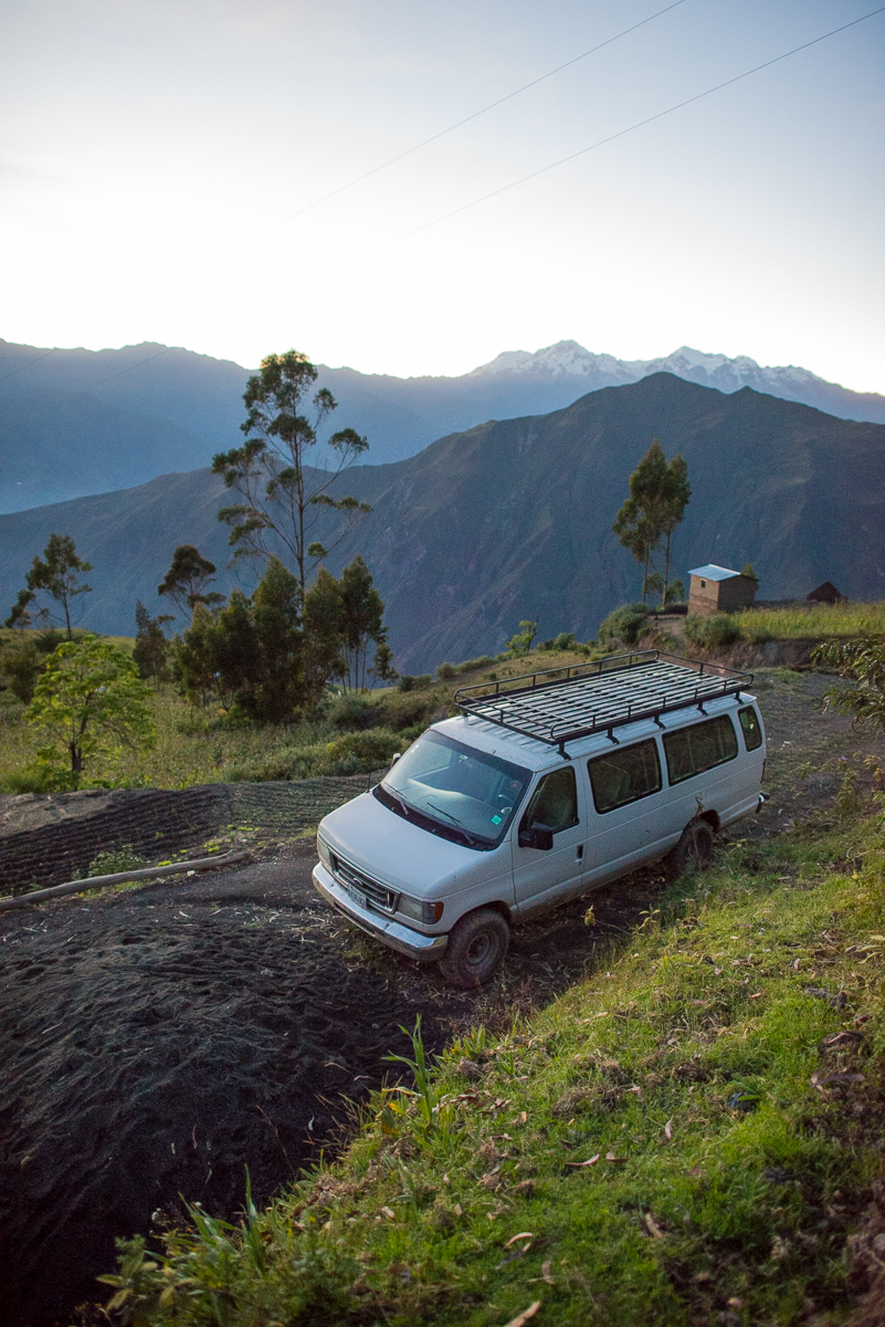
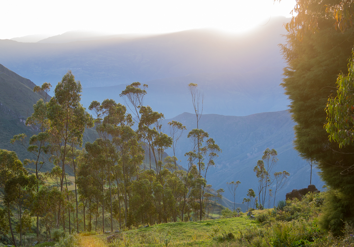
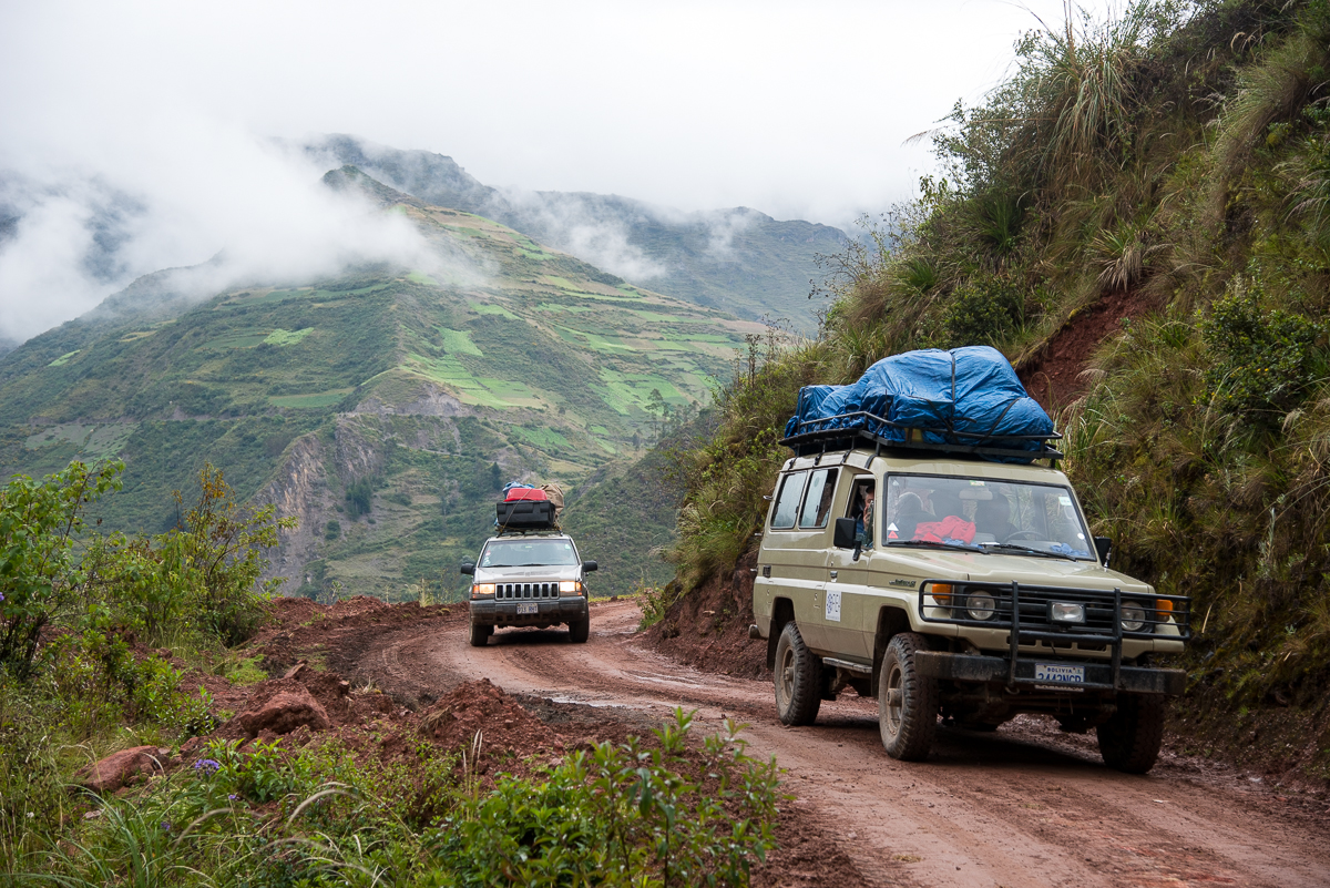
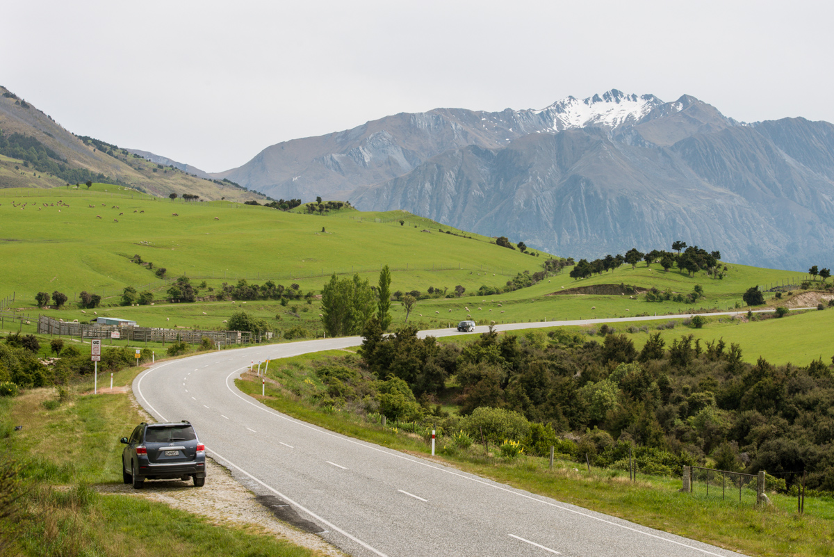
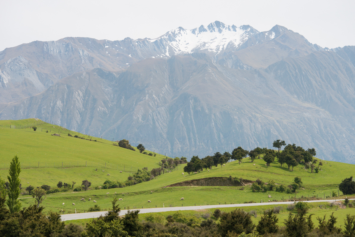
The shots below are from the road to/from Capayque.

_JD82874.jpg_JD82927.jpg_JD82946.jpg_JD89571.jpg_JD89583.jpg_JD89576.jpg_JD82845.jpg

_JD89571

Tikal, Guatemala: After Dark in the Great Plaza

Over a thousand years ago, the temples and altars of Tikal’s Great Plaza were the site of gruesome rituals of human sacrifice.  At night, there are no lights, and the low, scream-like roar of howler monkeys fills the air.  It’s an eerie place to be when the grounds are deserted and the sky is dark.

_JCE2417

Tikal Temple II

It’s an amazing experience – at any hour – to be amid Mayan temples that have stood more than a millennia.  Friday night I had the chance to be essentially alone there after dark and after the park had officially closed, with the chance to make the whole place my private photo studio.  Though I lit up the temples for these pictures, in reality there were no lights except a half moon and our handheld flashlights.

_JCE2429

Tikal Temple I

Tikal National Park is Guatemala’s most popular; it enshrines some of the most famous and prominent remnants of the ancient Mayan World.  At Tikal’s center are the temples of the Grand Plaza.  Each day, hundreds (sometimes thousands) of visitors tour the park.  Each evening, a few dozen stay ‘til dusk to watch the sun set behind the Temples.  I stayed even later – until it was truly dark and everyone else had gone home.  Two park rangers waited patiently (sort of) and escorted me (and my local guide, “Henry”) out of the park long after they’d done their nightly sweep of the grounds to make sure no one else was left on the grounds.

_JCE2443

Temple I


Those night-time images aren’t Photoshop tricks.  Henry and I were giddily watching them show up on the back of the camera as we moved my big tripod around the Grand Plaza in the dark.  There is no electricity and no lighting at the Temples, so the light on the temples is from his flashlight, which I borrowed and used to “paint” light on the stones and trees during the long 30-second (or so) exposures).  The streaks in the sky are clouds; in that amount of time, they moved quite a bit (happily, the stars did not).  I haven’t picked a favorite image yet – I still can’t quite believe I was there.

_JCE2310

Sunset from Tikal’s Northern Acropolis

All this capped off a long day:  I’d been in the park at 4:30 a.m., too, in the pre-dawn darkness.   Each morning a few dozen folks climb to the top of Temple IV to watch the sun rise over the Grand Plaza.   I got there extra-early, and just in time to get a couple of shots before clouds and fog took over the entire view.  By the time the rest of the sunrise “crowd” arrived, there wasn’t much left to see (bottom).

_JCE1950

Tikal’s Temple IV, just before dawn.

_JD86850

Foggy sunrise, Tikal Temple IV

Through the middle of the day, I’d driven through the jungle to see the ruins at the town of Uaxactun.  Mostly by accident, I’d wound giving rides to four locals, including a 100-year-old blind man who needed to get home to  Uaxactun.  Normally the guards at Tikal would never have let me stay at the temples at night (which is why  you never see nighttime pictures).  But they were the same guards who’d asked a favor of me earlier in the day and who’d seen me doing multiple favors that day for locals.   So they sat patiently for at least an hour, giving me a once-in-a-lifetime photo opportunity.


New Zealand Roadtrip

Of course New Zealand has plenty of famously beautiful spots, but maybe the most striking thing about it is just how pretty the ‘ordinary’ roadsides and countrysides are.

I wound up with several images that hadn’t found a ‘home’ in the prior posts, so I had to add one more.  Most were just stops along the road as I logged 2,000 or so miles criss-crossing the South Island.  I’d also planned to see the North Island, but I somehow never made it that far and had to fly out of Christchurch instead of Auckland.  Plenty to see here.  In case it’s not already obvious, I like just driving around seeing the sights (and the sites).

I spent another night in Queenstown and made another trip through Wanaka after I did my first post.  Thus the nighttime shot from the gondola above Queenstown, and the shots of the sailboats and the somehow-famous semi-submerged tree at Lake Wanaka.  The glacier is Fox Glacier — on the West (Tasman) coast about halfway up the South Island.  My favorite image here is the one of the Waiau River, up near Hamner Springs.  Those wild yellow flower bushes were amazing.

Since a couple of the shots have sheep and deer in them, I’ll offer one last set of New Zealand factoids — about animals.  New Zealand has no indigenous land mammals (there are a few bats and several sea mammals).   Also no land snakes.  Whether you ascribe this to Noah or to Darwin, it’s a fascinating curiosity that New Zealand was (forgive me) mostly ‘for the birds!’  The absence of mammalian predators has lots of impact:  Many of the bird species (including the kiwi itself) are flightless, for example.  And when humans (starting with the Polynesian Maori) brought with them (purposefully or inadvertently) mammals like deer, rats, and possum, they multiplied like crazy to the point they all became major pests.

Today there are lots of mammals.  Plenty of cattle, and sheep that outnumber humans 10 to 1.  The deer ‘problem’ has been solved by domesticating them; there are huge high-fenced fields of hundreds of deer, grazing just like cattle and creating a significant venison industry.  Amusingly, I decided to be sure I got a nice New Zealand Merino Wool sweater while I was here.  When I tried on my favorite, they bragged that it was actually 40% possum.  I told them that wouldn’t seem very luxurious in the U.S., but they insisted that the south-seas Australian brushtail was a different animal altogether.  I was dubious on several levels.  But I bought the sweater.

_JCE3272.JPG_JCE3307.JPG_JCE5510.JPG_JCE5530.JPG_JCE5535.JPG_JCE5545.JPG_JCE5556.JPG_JCE5565.JPG_JCE5567.JPG_JCE5601.JPG_JD81468.JPG_JD81533.JPG_JCE5624.JPG_JD81566.JPG_JCE5637.JPG_JD81383.JPG_JD81419.JPG_JD81433.JPG_JD81445.JPG_JD81956.JPG_JD82108.JPG_JD82129.JPG


By the time you’re reading this, I’m already home in Houston — mostly likely planning another trip. 


New Zealand: Abel Tasman National Park

Abel Tasman is a big name in New Zealand.  You may think you’ve never heard of him, but you’ve heard of the Tasmanian Devil (from Bugs Bunny if not from the local zoo).  That little devil was named after the Australian island of Tasmania, which in turn was named after Abel Tasman.  He was the Dutch explorer who first sailed to New Zealand back in the 1640s.  Today, New Zealand’s longest glacier, its second-highest mountain, a river, a lake, a rock band, a national park, and the entire Tasman Sea between New Zealand and Australia are named for him.

Tasman stopped for water in New Zealand, wrongly thinking it was part of Argentina.  The friendly Maori locals attacked him and killed some of his sailors.  He bravely sailed away, never to return.

A lot of the European explorers of that era were “discovering” lands that had been inhabited by humans for thousands or even tens of thousands of years.  But the arrival in New Zealand of the Europeans and the ‘aboriginal’ Polynesian Maori was a virtual dead heat by those standards — the various tribes of Maori arrived starting around the year 1300 and apparently spent much of the next 500 years warring among themselves for control of lands (occasionally eating the conquered, and maybe a few 18th-century European missionaries).  It was the Brits who ultimately took control in the 1800s, so British customs, language, culture (and left-sided driving) prevail today.

The Abel Tasman National Park is New Zealand’s smallest national park — and perhaps that’s fitting, given his short and inauspicious time here.  (I’ve spent more time here than he did, after all, and my interactions with the locals have been much more amicable).  The main activity at the Park is hiking — mostly along the coast, from beach to beach through rain-foresty jungle.  I spent a couple of days here.  There are ‘huts’ where you can sleep inside the isolated parts of the park, but I’ll admit I caught the water taxi out and slept in a snug bed at a little ‘lodge’ back in the town of Motueka.


_JD81701.JPG_JD81724.JPG_JD81762.JPG_JD81765.JPG_JD81781.JPG_JD81891.JPG

Mt. Cook, New Zealand

2013 was my Year of Mountains!  I hiked and/or biked them on four continents in Patagonia, Europe, Colorado, and here.  Next year?  Beach!!

Pennies aren’t lucky in New Zealand.  In fact, so ill-fated is the New Zealand one cent piece that it’s been extinct for over 20 years.  So, too, is the New Zeland nickel a numismatic dinosaur.  The smallest coin is a dime (worth about 8 U.S. cents).  How refreshing it is not to fill one’s pockets with coins that buy nothing.   And to see prices (except gas)* almost always rounded to the nearest dime or dollar.  How many collective seconds, minutes and hours do American waste shuffling copper coins, making change, and accounting ‘down to the penny’?  We could learn some things from the Kiwi.

And sales tax (actually a “goods and services tax”) is built in to the retail prices — not calculated anew on each transaction and awkwardly added on after the fact like we do in the States.  So if something is priced $1.00, that’s actually what you pay.  Coincidentally — but further contributing to Kiwi transactional simplicity  — ‘tipping’ is not part of the traditional custom or culture here.  Of course in tourist areas it’s not unheard of, but it’s not an expectation and your credit card slip won’t even have a place to add the tip.  No pennies, no tax, and no tip unless you want to.  Thus when the cafe menu at Mt. Cook Village said my fish and chips would be $18, that’s what they meant:  $18.  I got a $2 coin back from my $20 bill.

The nearby mountain — the tallest in the country — is over 12,000 feet, which means Mt. Cook rises about 10,000 feet above the surrounding terrain.  I did a 3+ hour hike to get sort of close and to see the 7-mile-long Hooker Glacier dumping icebergs into muddy Hooker Lake, but the clouds never really parted enough to see the whole of Mt. Cook all at once.  That picture at the top of the post — showing at least most of the mountain without cloud cover — was taken from the highway about 20 miles from the mountain as I drove away in the late afternoon.  I took this in the first 30 seconds after hopping out of the car, then stood around nearly an hour waiting for the clouds to part again and give me another chance once I got into a better spot.  That didn’t happen.

_JD80805.JPG_JCE5017.JPG_JCE4992.JPG_JCE5081.JPG_JD80759.JPG_JD80771.JPG_JCE5107.JPG_JD81006.JPG_JD80624.JPG_JD81131.JPG_JD80665.JPG_JD80725.JPG_JCE5331.JPG_JD81031_2_3_4_5-Edit.JPG

The picture (below) with the crazy-blue lake and the mountain (still covered mostly by clouds) in the distance is from Lake Pukaki — about 40 miles south of Mt. Cook.  It gets the turquoise color from the silt that comes out of the glaciers.  The glowing blue of the lake even made the clouds above it look a strange bright blue.

*Gas is around $2.30.  Per LITER.  So over $9 a gallon.