Category Archives: Photography

Scotland 2014: Oban, Staffa and Iona

_JD87291

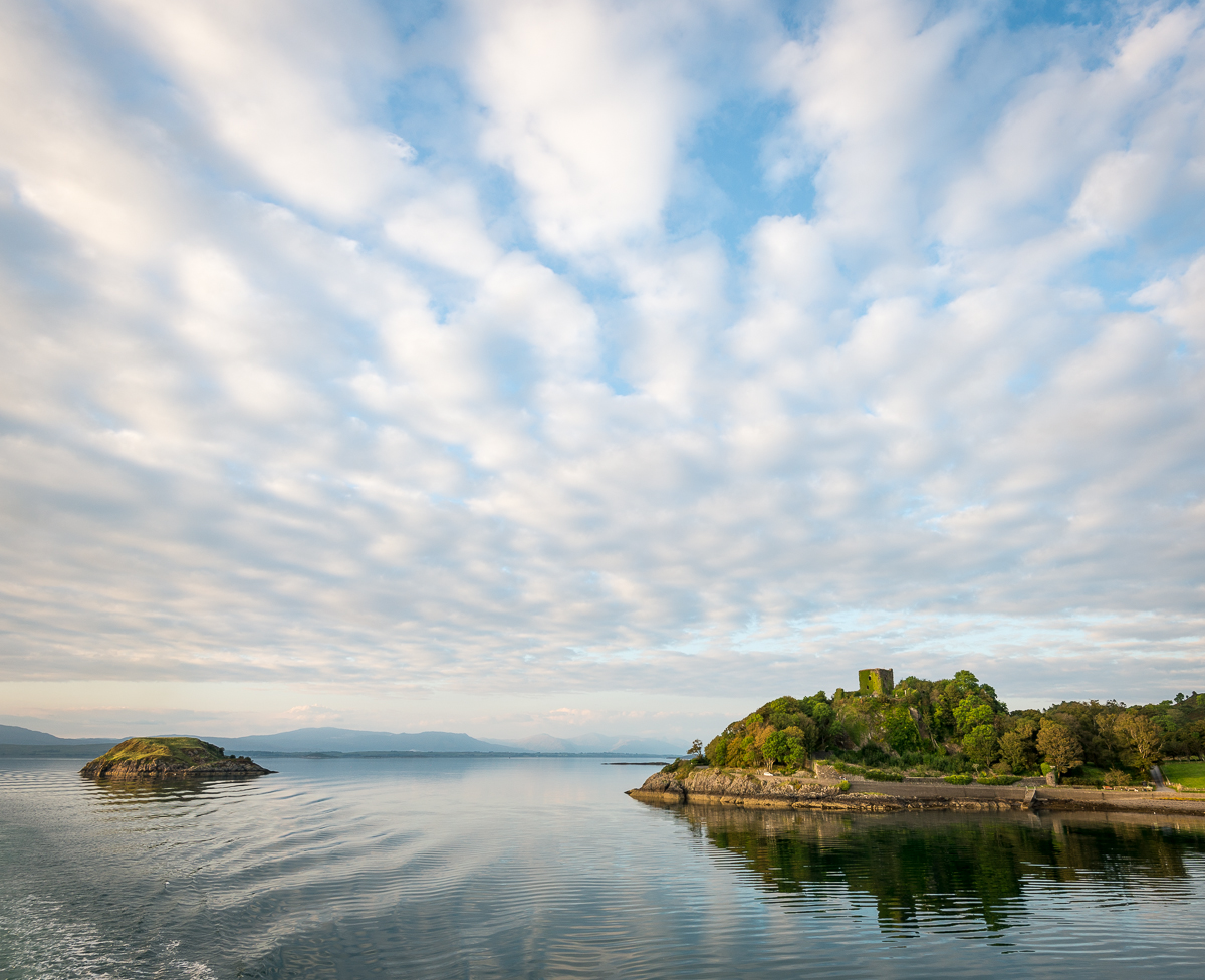
Dunollie Castle, at the north end of Oban Bay

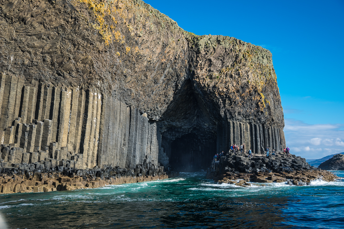
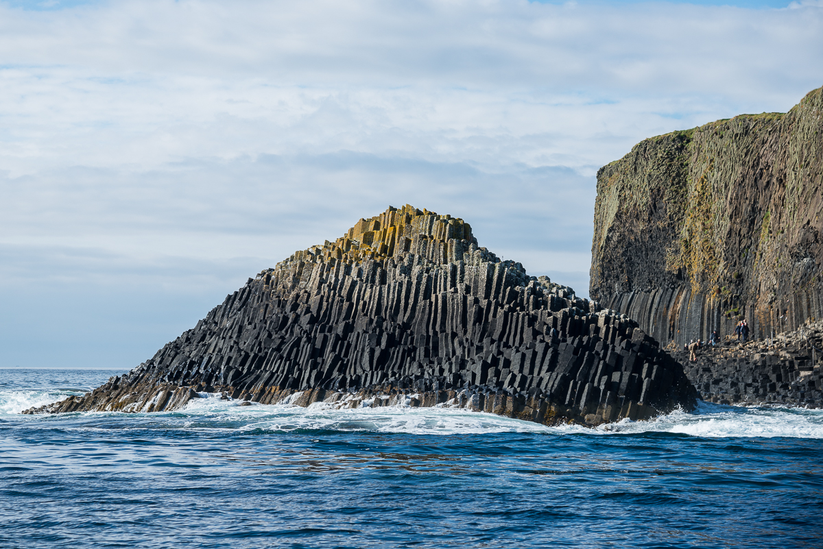
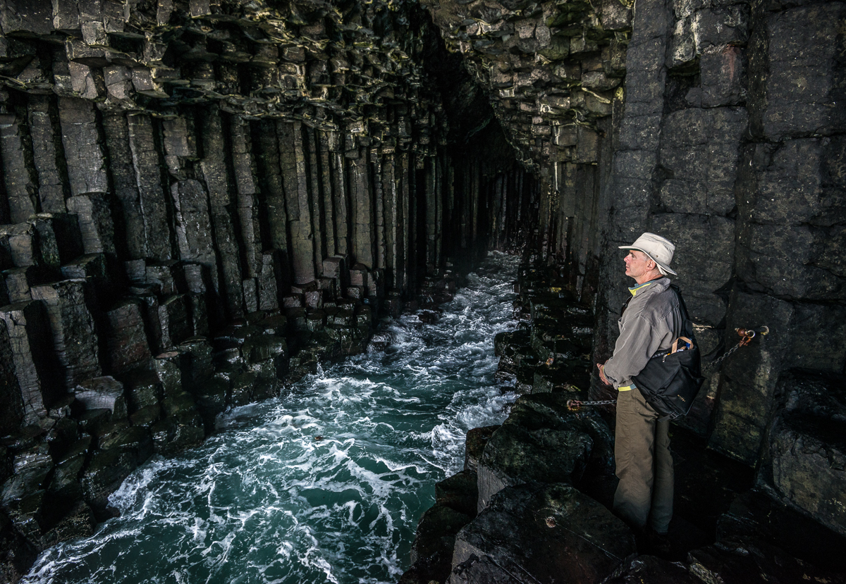
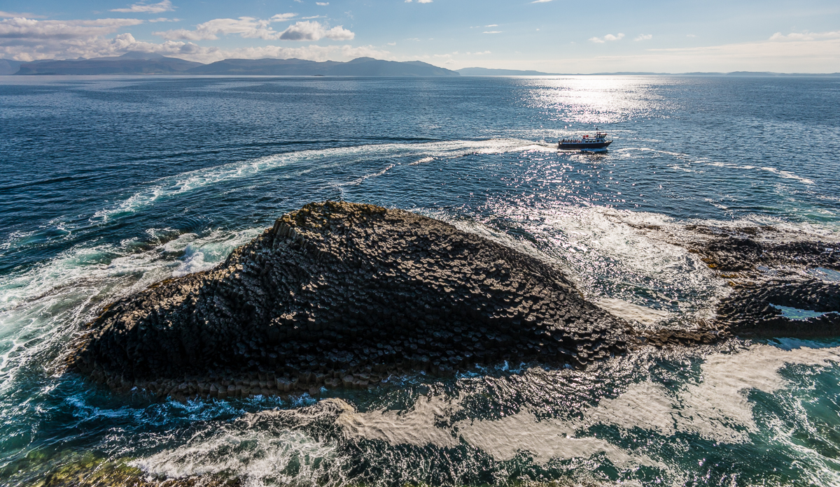
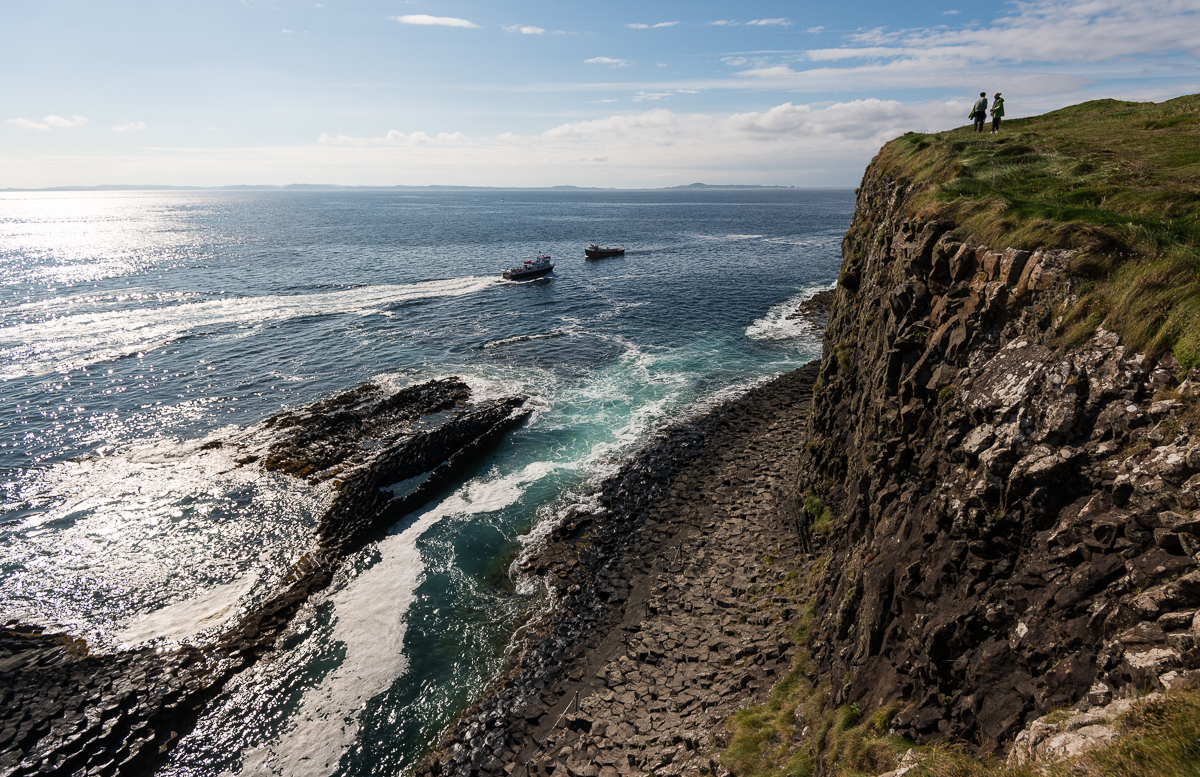
Scotland’s odd little Inner Hebrides island of Staffa is famous for more than sightseeing.  The 19th Century composer Felix Mendelssohn wrote a now-famous overture about it:  the Hebrides Overture (a.k.a. “Fingal’s Cave”).  Too bad there was no orchestra around to play it when I went to visit.  (You can listen to it here if it’s not playing automatically:  http://www.vicenzapuericantores.it/mp3/mendelssohn_hebrides.mp3 ).  The Isle of Staffa is just a few hundred yards across, and is a geological fluke.  It’s a volcanic island with a huge layer of crystalized basalt columns.  Its most famous feature is that sea cave Mendelssohn focused on, now called Fingal’s Cave. It’s about 200 feet deep.
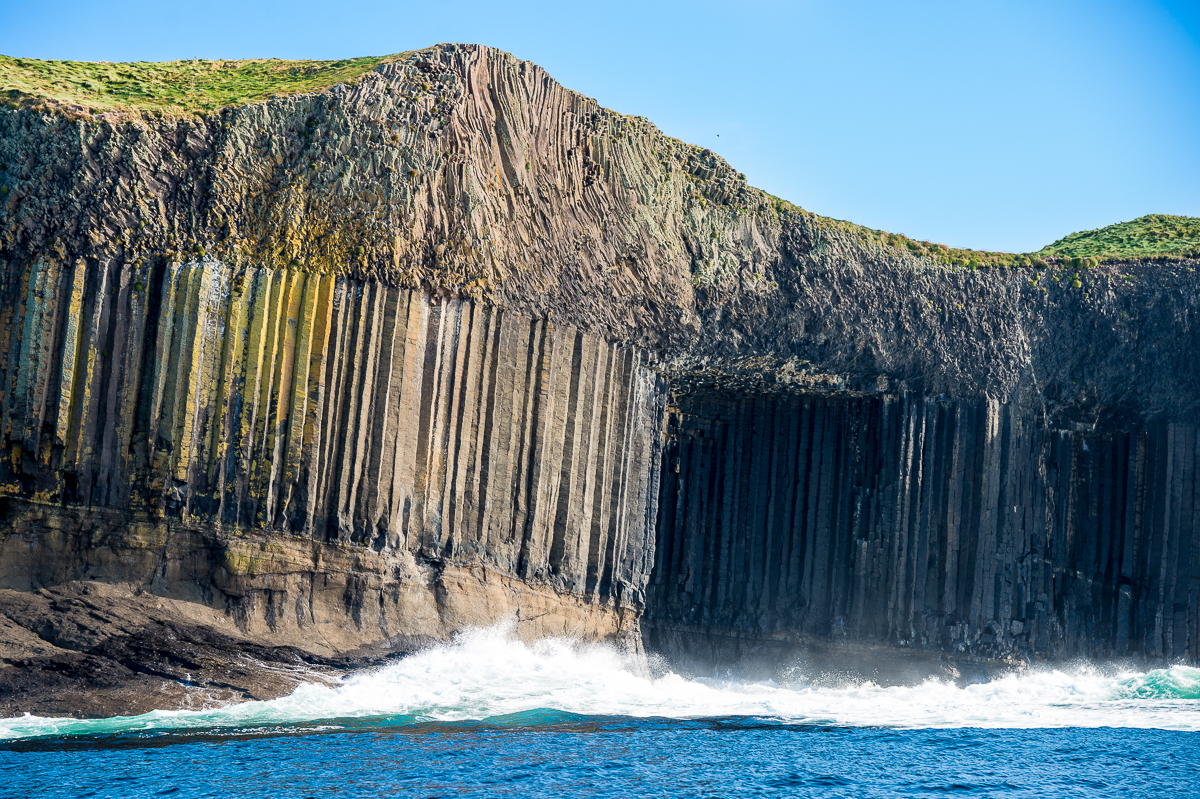
_JD86541

Staffa


_JD86541.jpg_JD86562.jpg_JD86589.jpg_JD86818.jpg_JD86852.jpg_JD86863.jpg_JD86977.jpg

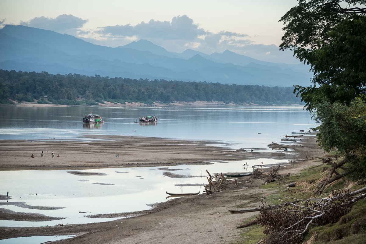
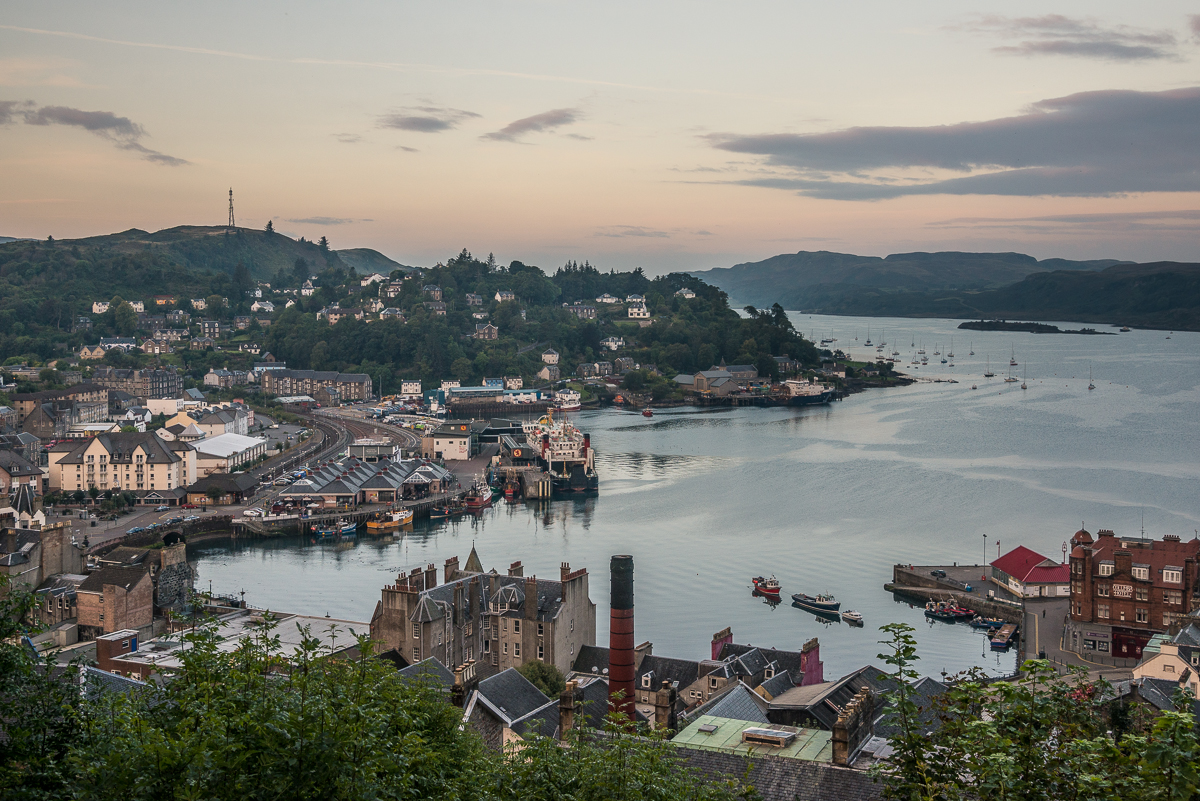
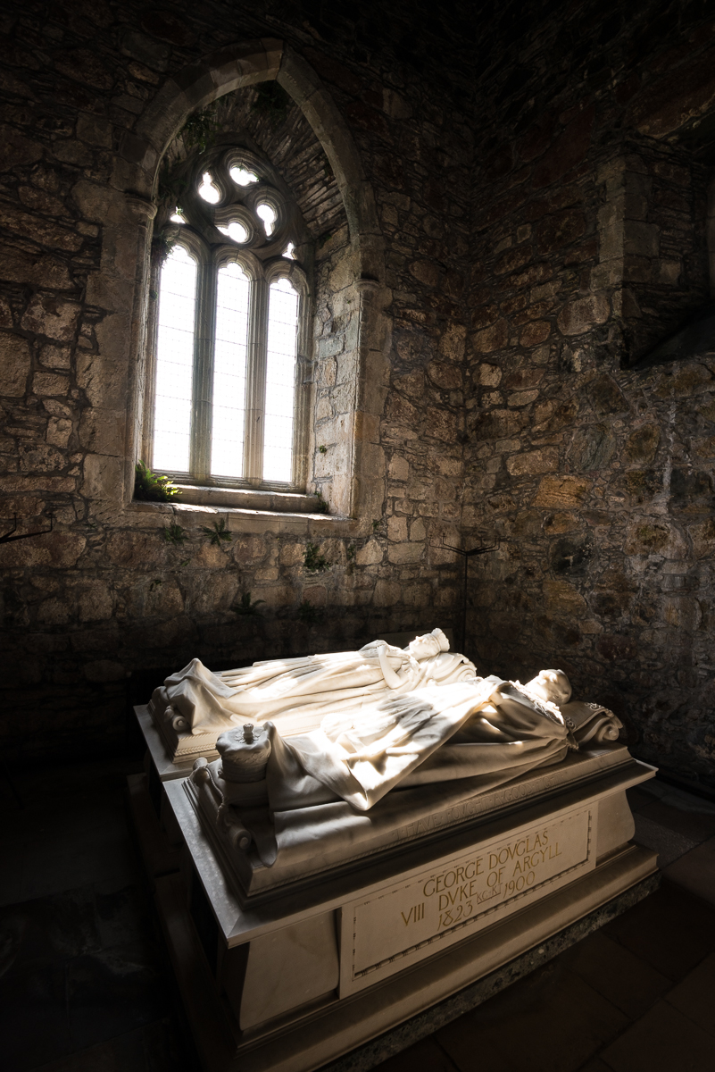
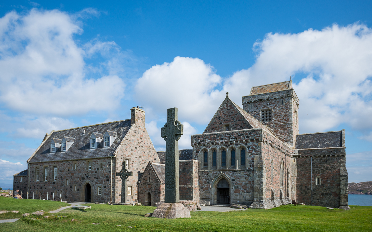
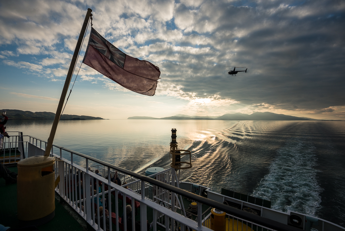
The trip back from Staffa consists of an ferry ride to the Isle of Iona, another ferry to the Isle of Mull, a car ride to catch the ferry back to Oban on the mainland.  The church in the pictures is the Iona Abbey, established in 563 A.D. by now-Saint Columba and now a busy pilgrimage destination for folks who (for some reason) want to visit Columba’s grave.  That prominent stone cross, St. Martin’s Cross, is over 1200 years old.  The pretty pictures of the bay and from the ferry are Oban Bay.

_JD85676.jpg_JD87086.jpg_JD87134.jpg_JD87191.jpg_JD87246.jpg_JD87291.jpg

_JD85676

_JD86977

2014-09-26 19.28.14_resized-2

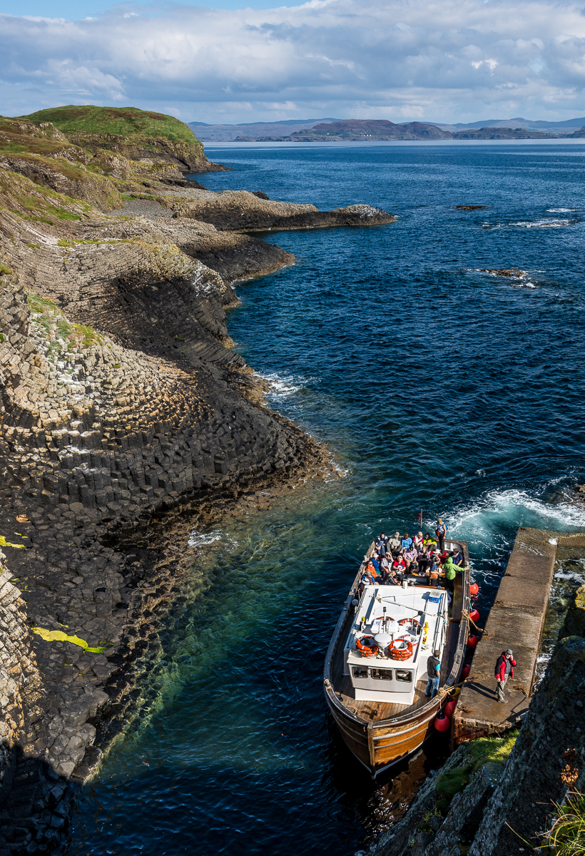
I was lucky to be able to travel Scotland with Jim Richardson and a couple of Scotch natives as guides. Jim is a long-time National Geographic photographer and is their go-to guy for Scotland; he’s been there dozens of times. In fact, the August 2014 edition of NatGeo has one of Jim’s photo essays from Scotland as its cover story. Great to have Jim to show about a dozen of us around  Scotland. That’s Jim in the red jacket waiting on the dock in the picture above (apparently someone from the group was late getting back to the boat . . .)

Scotland 2014: Gylen Castle

_JD86154

The Scottish Isle of Kerrera is just a few hundred yards off the mainland west coast, near the town of Oban in the southern part of the Inner Hebrides.  A few dozen people (one of whom tends to 100 or so pet parrots) live there.  The sightseeing highlight is Gylen Castle, built on the south end of the island in about 1582.

To get to Gylen, you take a short ferry from Oban, then walk about three miles.  The ferry is a small one-car ferry, so you just stand where the one car would normally be.   When you get out near the castle, there’s no visitor center, no admission charge, no security guards or park rangers.  It’s just out there by itself like it has been for the last 500 years.

The castle was built by the MacDougall Clan and used in support of James I – then the king of a united England, Ireland and Scotland.   In the mid 1600s, he was at war with the “Covenanters” (crazy Presbyterians, apparently).  They laid siege to the MacDougall Clan soldiers at Gylen.  Apparently the castle’s defense systems had one big flaw – access to fresh water.  The very thirsty soldiers holed up inside were eventually coaxed into coming out voluntarily, only to be promptly killed by their surrounding attackers.

_JD86317

Gylen wasn’t a true “castle,” but was more of a small watchtower or fort.  Its perch above the waters  was a perfect vantage point to watch for threatening ships entering the Firth of Lorn near Oban.  Now that same perch makes modest Gylen one of Scotland’s most picturesque spots.

_JD86023.jpg_JD86196.jpg_JD86347.jpg_JD85845.jpg_JD86381.jpg_JD86436.jpg

 _JD86053

Festival in Chissi, Bolivia

I sometimes make a hobby out of choosing a random side road somewhere in the world and just seeing what I find.    ——       I should make clear that these images are from Chissi, a town far away and very different from Capayque, the village that has been the subject of several recent posts.

_JD89089

_JCE4859

_JCE5067

I turned down the dirt road toward the Bolivian pueblo of Chissi just hoping to find a better view of the Lake Titicaca shoreline near the Strait of Tiquina.  But as I drove down the hill into town, I could see some sort of event going on in a big field — with dozens of people all in bright pink costumes.  Of course I drove right toward it.

As the pictures show, the men’s costumes were the gaudiest rhinestone-cowboy looking things you’ve ever seen – even putting aside the fact that they were hot pink.  The women’s costumes were slightly less outrageous – Bolivian women wear those tall “bowler” hats and those broad skirts all the time as everyday wear, so the costume just spruced up their usual wardrobe profile and turned it pink.

It was the day after Easter, and apparently Sunday’s religious celebrations give way to a carnival-like Easter Monday celebration with lots of costumes, dancing, a town feast, and quite a lot of beer.  I parked at the edge of the field and walked toward the action.

Besides my being out of costume, I was the tallest person in town, the only one with light-colored eyes, the only one with clipper-cut hair, and the only one who spoke English.*  It took about 10 seconds before I was invited into their circle, about 20 seconds before I was presented with a cup of beer and about 2 minutes for the crowd to form around me for a group photo, then about another 2 minutes ‘til I was put into one of those pink vests and hats and instructed to pose for more ridiculous pictures.

_JD89436

The band (trumpets, baritones, drums and a cymbal) would play for 20 minutes or so (and the costumed folk would dance), then rest for 20 minutes or so (and the costumed folks would drink more beer).  At about 1 o’clock, the whole group danced down a path through town; several of my new friends grabbed me and pantomimed “comidas” (food).  We all ate the same thing:  A bowl (no silverware) with a chunk of “carne” (maybe beef, maybe not), a couple of different potato-like things, a roasted-in-the-peel plantain, and some lettuce and tomatoes.  It was a lot of food, but they’d made a big deal out of presenting it to the conspicuous gringo so I stuffed myself as best I could.

The photographic challenges were many.  The Bolivians seemed to be either painfully bashful about being photographed or uncontrollable hams, with no real middle ground.   I was almost constantly being tugged at and urged to take a different picture or try to answer a question.  As is often the case, it was hard to both participate in the event and photograph it.

I showed these pictures to another Bolivian man from the opposite end of the country.  He thought these were Peruvian traditions and costumes – and indeed Chissi is just 20 miles or so from the Peru border.   For those readers who have seen my recent posts from Capayque (in the mountains on the opposite side of Lake Titicaca), I should emphasize that this is a very different area.  Chissi is just a couple of miles from the main highway and — as the cervezas and elaborate costumes reflect — these folks clearly had a lot more disposable income than the people of remote Capayque.

_JCE5169.jpg_JCE4789.jpgc50-_JCE4901.jpg_JCE4725.jpg_JCE4764.jpg_JCE4776.jpg_JCE4806.jpg_JCE4832.jpg_JCE4859.jpg_JCE4911.jpg_JCE5067.jpg_JCE5145.jpg_JCE5186.jpg_JD89089.jpg_JD89260.jpg_JD89436.jpgc12-_JD89070.jpg_JCE4581.jpg_JCE4736.jpg_JCE4778.jpg_JCE4796.jpg_JCE4838.jpg_JCE4870.jpg_JCE4901.jpg_JCE4947.jpg_JCE5158.jpg_JCE5182.jpg_JD89051.jpg_JD89065.jpg_JD89070.jpg_JD89141.jpg_JD89143.jpg_JD89153.jpg_JD89216.jpg_JD89231.jpg_JD89355.jpg_JD89249.jpg_JD89257.jpg_JD89269.jpg_JD89106.jpg_JD89413.jpg_JD89451.jpg

I stayed about four hours in Chissi – scrapping my plans to visit the ruins at Tiwanaku that day and putting my pitiful Spanish to the test with the simplest communications.   What country am I from?  Yes, I think your pueblo is bien (or was it bueno?).   Smile for a foto?  Comidas?  (Si!)  Mas cerveza?  (No, gracias,  I’m driving back to La Paz this evening.)  I wound up racing back to La Paz mostly in the dark, through a two-hour Bolivian traffic jam coming back into town.

There was a simultaneous celebration going on a few dozen yards away, which seemed to be some kind of harvest festival.

There was a simultaneous celebration going on a few dozen yards away, which seemed to be some kind of harvest festival.

_JCE5000.jpg_JCE5031.jpg_JCE5036.jpg_JCE5045.jpg_JCE5052.jpg_JD89390.jpgc34-_JD89451.jpg

All this happened on my first full day in Bolivia – driving around by myself before I met the group in La Paz that went to Capayque.   My habit of turning down random side roads in search of something interesting was surely rewarded once again.

I’d like to think that if a Spanish-speaking Bolivian stranger wandered into the middle of a small town festival somewhere in America, he’d be welcomed and embraced to a similar extent, but I don’t know if that’s true.  Let’s hope so.

_JCE4465.jpg_JCE4490.jpg_JCE4733.jpg_JCE5180.jpg
Notice the Gringo in the back row.

Notice the Gringo in the back row.


–  –  –

* I suspect I was also about the only adult who was wholly sober, and the only person with any substantial amount of hair on his face or arms.  It seemed like I may also have been in a minority who had no visible gold on the their teeth.


Faces of Capayque, Bolivia

Another in a series from the First United Methodist Church of Stillwater Oklahoma’s mission group, providing healthcare (and more)  in Capayque, Bolivia.

_JJC9202_JD80927

_JJC9228_JD80724 _JD81100 _JD82580 _JJC9108

My primary role as part of the team in Capayque was as a photographer.  Beside pictures for my own use, I’m hoping some of the images can be used by the Bolivian and Oklahoma churches to raise money or awareness for the work they’re doing down there.

Also, I took along a small portable printer and enough paper to crank out hundreds of prints to give away to the people in Capayque — most of whom seemed to have few if any pictures of themselves or their families.  This was a big hit with the townspeople — almost toooo big a hit.  Everybody wanted a print.  And then another; then another….  They yelled “Foto!  Foto!”  at me (making a rectangle shape with their fingers) every time I showed my face.  There were borderline mobs chasing me a couple of times.  Hopefully, some of these folks who would never have had a picture of their mom or dad or kids or grandparents will have one to keep and remember.

I was amused and interested that the folks there were terrible “posers.”  They’re not accustomed to having their picture taken, so too often they were ridiculously stiff and stoic, or embarrassed and giggly and hiding their faces.  I used a lot of my pitiful Spanish to try to coax a smile (though several times I realized my subject spoke only the Aymara language).

I’ve already shown a few of the “portraits” I took for this purpose; here are some more.  It’s also a good chance to see close-up what the mostly-indigenous people of this region look like.

(The big photo gallery just below may take a minute to load.)

At the school, I was recruited to take a group picture of the entire school.  The principal wanted to hang it in his office.  Even though my printer would print no bigger than a 4×6, this was all they’d have.  I got some shots of the school assembly they did on Monday morning.  We were treated as visiting dignitaries mostly because Team Member “Professora”  Becky Szlichta was a teacher.   It was unclear if they did the program just for us or if they did this all the time).  I made sure I had “senior pictures” prints for all the graduating sixteen-year-old class (in the green sweaters).

_JD82274.jpg_JD82309.jpg_JD82330.jpg_JD82346.jpg_JD82365.jpg_JD82376.jpg_JD82388.jpg_JD82396.jpg_JD82399.jpg_JD82403.jpg_JD82404.jpg_JD82408.jpg_JD82430.jpg_JD82453.jpg
_JD82453

The entire student body of Capayque schools.


The View from Capayque, Bolivia

#3 of several posts (starting here, with more to come) about the tiny Bolivian village of Capayque.  I traveled there with a Methodist mission team from Stillwater Oklahoma that was providing much-needed healthcare and setting up a medical clinic in the town.  

_JD81482

Early morning view to the east from Capayque

Capayque, Bolivia is a small village in the Andes, sitting at about 11,500 feet above sea level, about two-thirds of the way up from the valley way below and the mountaintops looming above.  On the rare day when the place isn’t mostly in or above the clouds, you’ll be staring at a snow-peaked 22,000 foot mountain just to the east.  From Capayque, you can see a half-dozen other (even-smaller) communities on other ridges and across the valley.

_JD81518

_JD80399

The air is very thin at 11,500, so it can be tough to get around — especially for lowlander Gringos unaccustomed to high altitudes.  The temperatures generally stay between 30 and 60 year-round, though it feels much warmer if the high-mountain sun breaks through.  More often than not, you can look down into the valley and see clouds below you.

_JD81477.jpg_JD81462.jpg_JD81482.jpg_JD81363.jpg_JD80358.jpg_JD80399.jpg_JD80360.jpg_JD80368.jpg_JD80371.jpg_JD80375.jpg_JD80597.jpg_JD81369.jpg_JD81378.jpg_JD81518.jpg_JD81588.jpg_JD81761.jpg_JD81740.jpg_JD82213.jpg_JD81532.jpg

As described in a related post, day to day life here isn’t radically different than it probably was 1000 years ago on these same mountains.

Like most of the hillsides anywhere near Lake Titicaca, the surrounding mountains are striped with horizontal terraces – creating flatter step-like areas better for farming.  Many are in current use, but many (perhaps most) look like they were built long ago and haven’t been used in centuries.

The region around Lake Titicaca was part of the ancient empire of Tiwanaku.  The area has been populated and farmed for 3,000 years.  The Tiwanku empire reached its peak around the 8th Century A.D., when the city of Tiwanaku (on the flatter “altiplano” 50 miles south from Capayque) had an as many as 100,000 residents.*  Estimates of the population in the surrounding countryside are varied and controversial, but the startling scope and span of those ancient terraces hints at the existence huge populations – to build and cultivate the terraces themselves, and to create such great demand for food as to make it necessary to farm so much of the hill country.

The Tiwanaku society mostly disappeared around the 12th century — long before Europeans arrived.  It’s likely that whatever was left of it became part of the Inca civilization.

The shots below are from the road to/from Capayque.

_JD82874.jpg_JD82927.jpg_JD82946.jpg_JD89571.jpg_JD89583.jpg_JD89576.jpg_JD82845.jpg

_JD89571