Category Archives: Featured

Chindwin River, Myanmar: PJs, ABCs, Face Paint & World War

  One last post (#7) from the Chindwin River in Burma.  The first was here.


_5JC9441

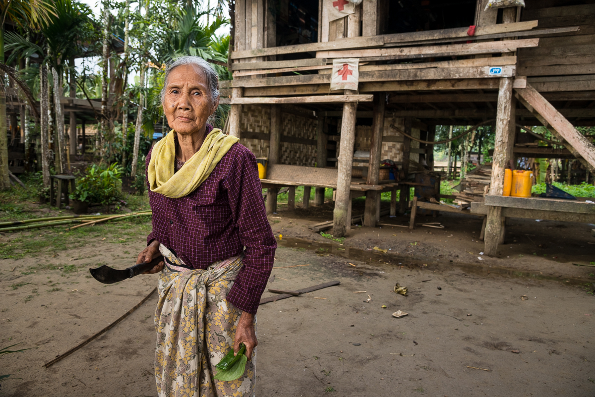
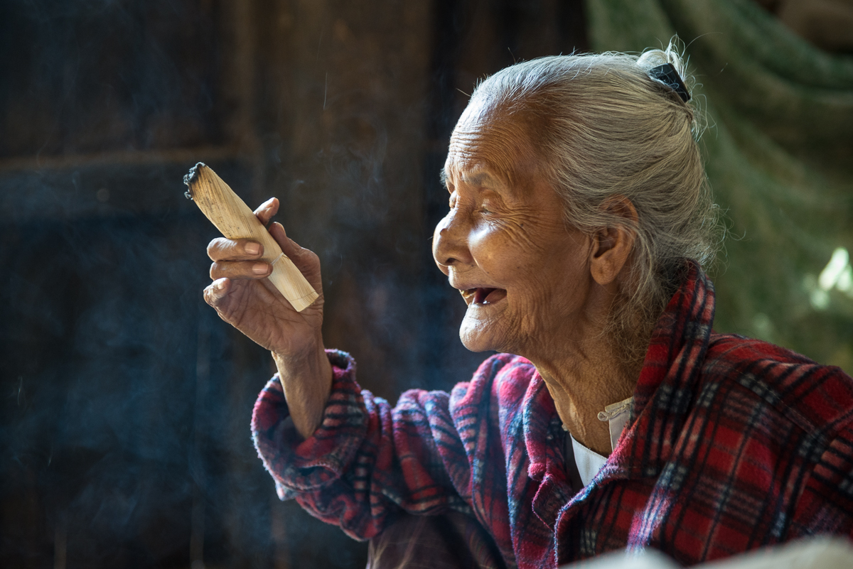
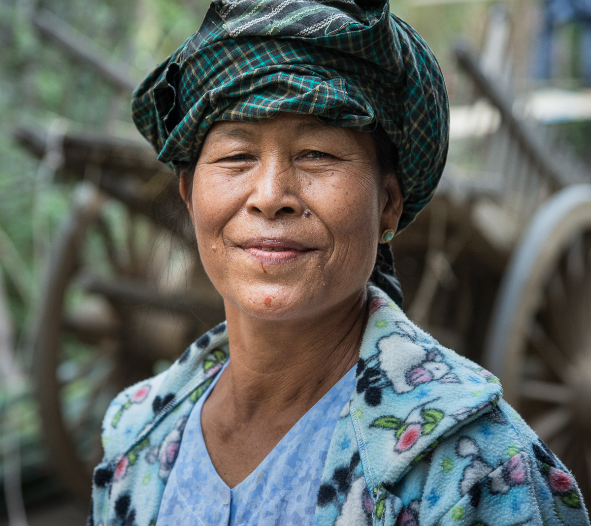
Don’t let that knife scare you. This lady is making a mouthful of Burma’s version of chewing tobaccco: betel nut. It’s a big reason so many Burmese have terrible teeth. The house behind her was a WWII Red Cross outpost.


n

_5JC9288

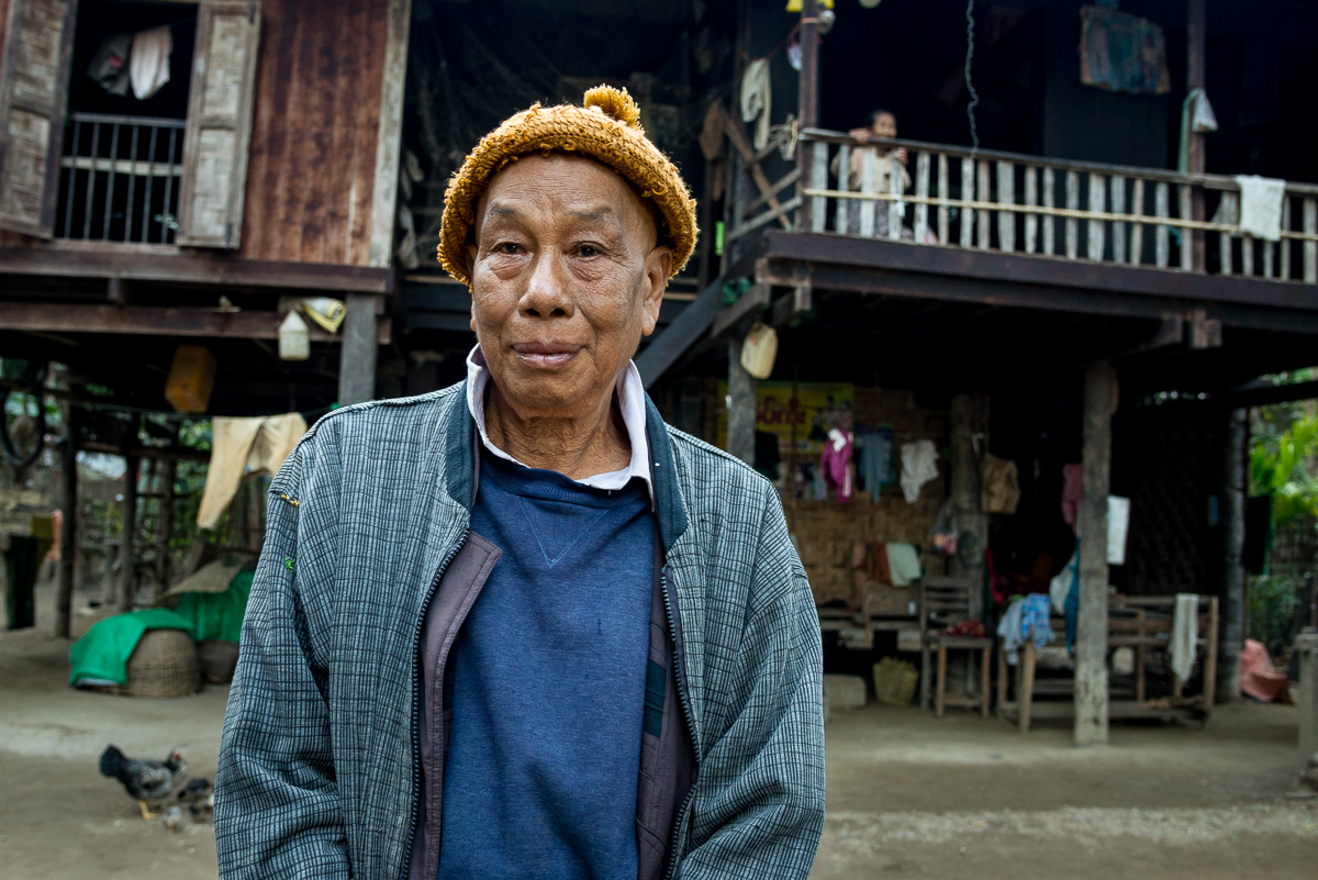
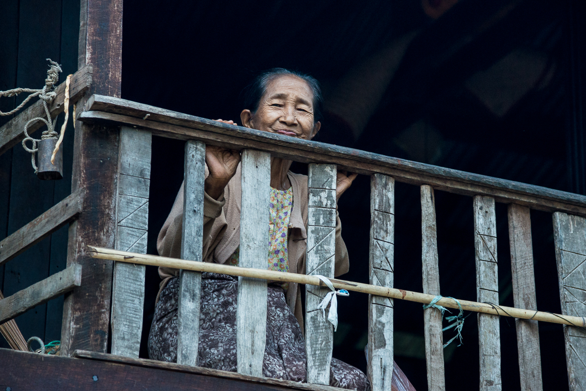
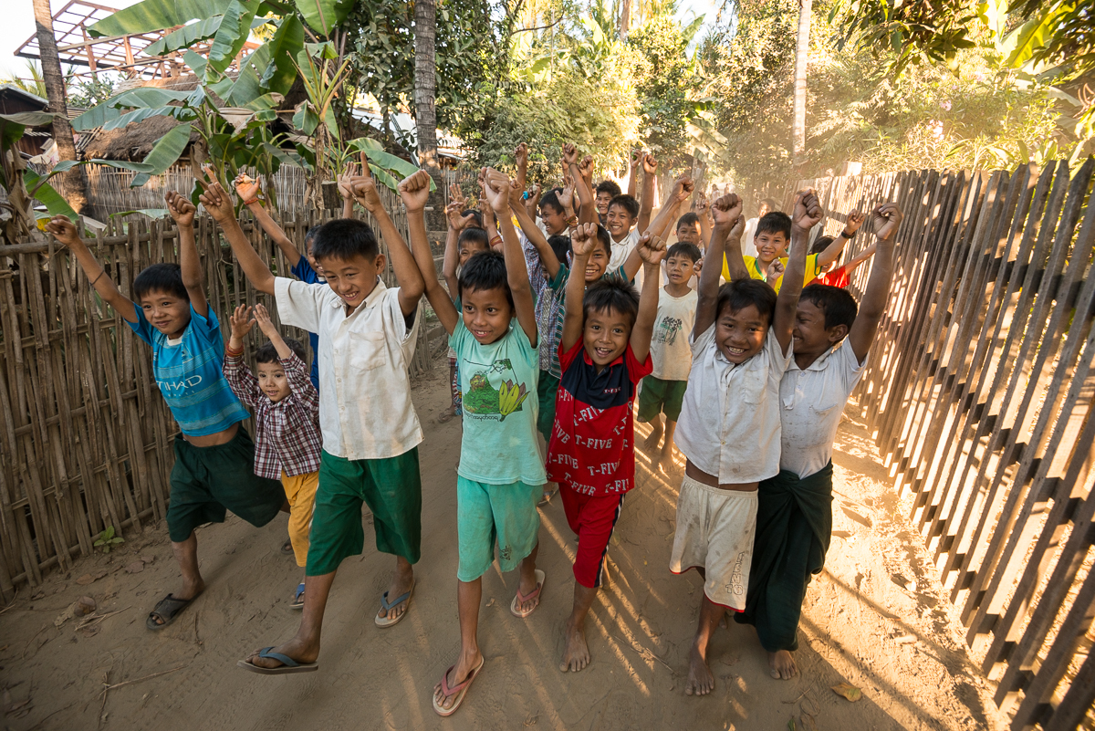
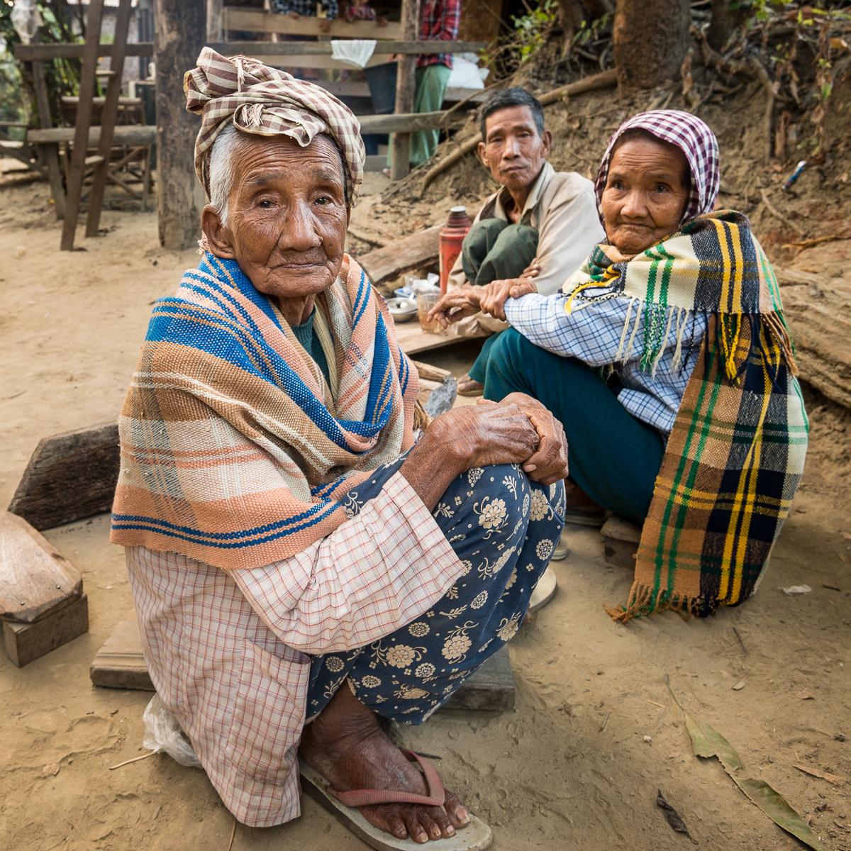
A couple of hundred people followed us around in the village of He Hlaw. I had a small parade trailing behind me when I spotted this eighty-something old man in his own front yard. That’s his very bashful wife hiding behind the balcony rail.

 *  *  *  *  *

_5JC1380

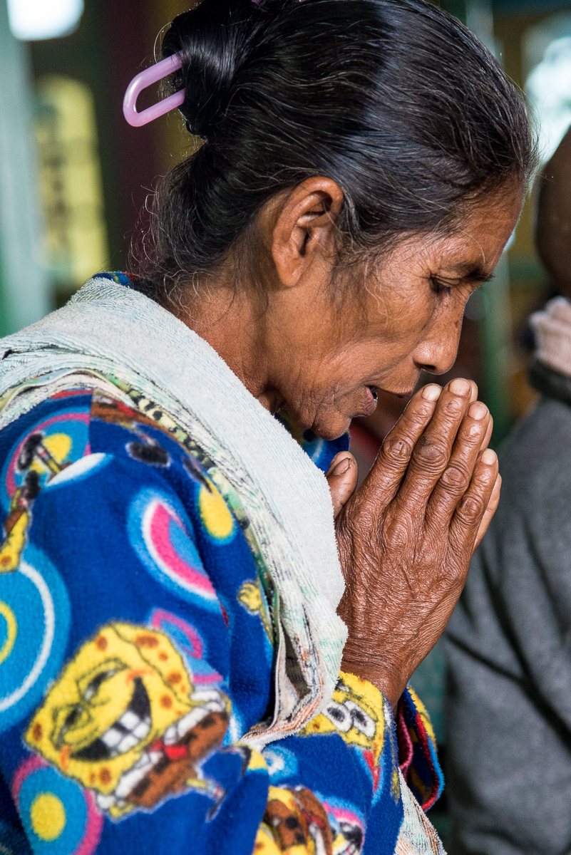
Sponge Bob PJs at “church.”

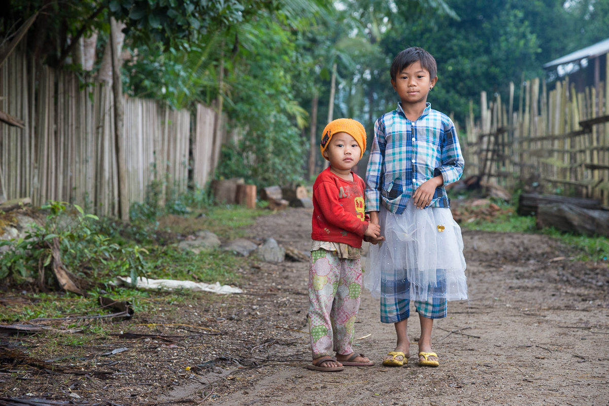
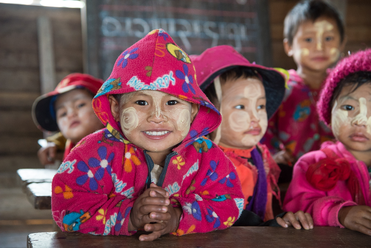
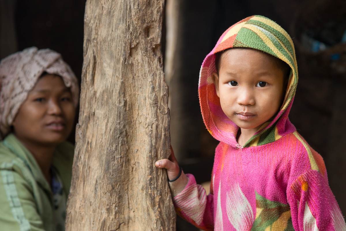
I’m sure if I’d given it any thought, I’d have assumed that most cheap fuzzy pajamas were made in China or Thailand or Bangladesh or somewhere like that, so maybe I shouldn’t have been surprised that folks in Burma’s rural Chindwin River region (surrounded by those nations) might have them. Still, I’d never have guessed that colorful fuzzy fleece PJs – some with characters like Sponge Bob, Angry Birds, and Hello Kitty –would be popular all-day everyday wear for school, church, chores and socializing.

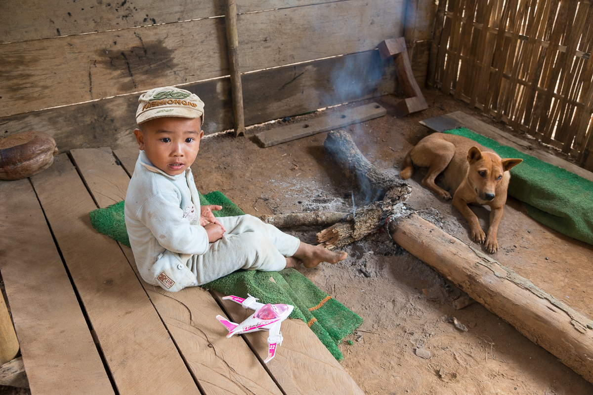
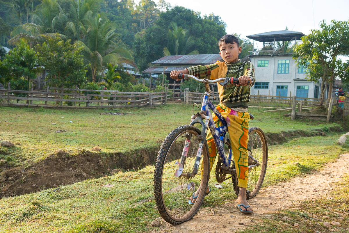
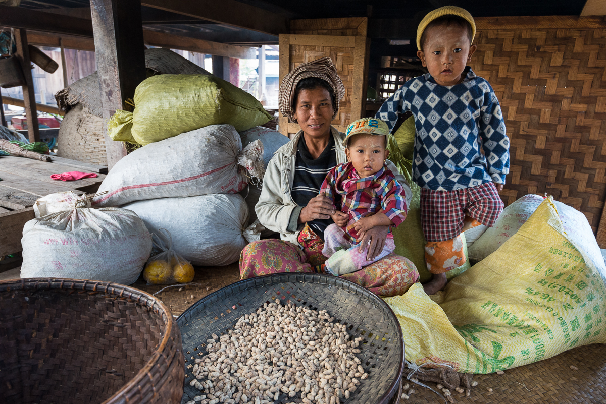
Strangely, fuzzy polyester pajamas decorated with video game mascots were among the most modern things you’d see in a place where people cook on campfires and transport things around town by oxcart.  Life on the Chindwin mixes a handful of modern advances into a setting with a few elements of the early 1900s and several aspects not much different than they were hundreds of years before.  Several towns had an electric generator – but usually only for a few lights at the monastery and maybe a handful of houses (nobody seemed to have any sort of home appliances).  In some areas, there were motorbikes in town. Diesel motors chugged up and down the river constantly. Areas of the river that were near roads or big towns had cell phone service (alas: Burmese networks that did not communicate with my TMobile phone). Most towns had a small store of some sort – sometimes with a half dozen cans of warm Coke or Sprite (alas: not Diet Coke) in inventory.

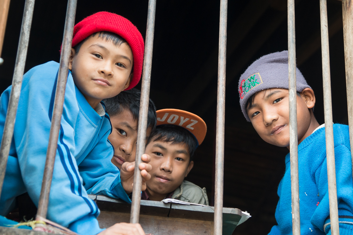
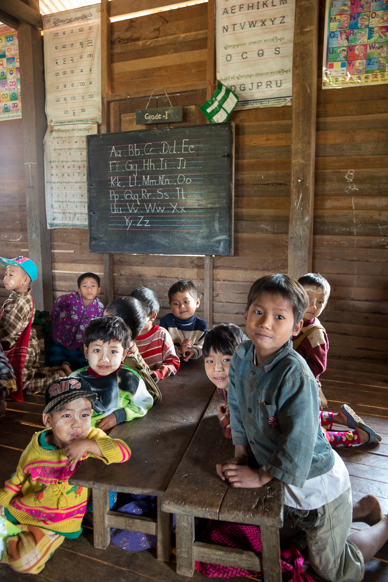
If you look around, you actually see a lot of written English — presumably a holdover from 120 years of British occupation.  Several brands and logos (alcohol, packaged food, soap) were in English. We saw school kids reciting (for us) the English alphabet and even writing simple stories in English. Still, hardly anyone could speak more than a word or two (Hello, goodbye, thank you) of English. I made the mistake of trying to speak some English to a schoolteacher who I had just watched teaching the English alphabet to her kids – she understood nothing. Though we regularly saw English on the walls of schoolrooms all over the Chindwin, we met no more than a handful of people there who were at all conversant in English.

_5JC7078

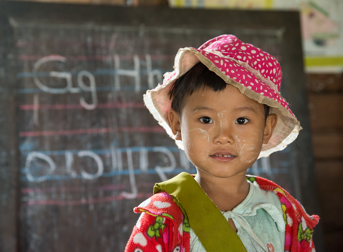
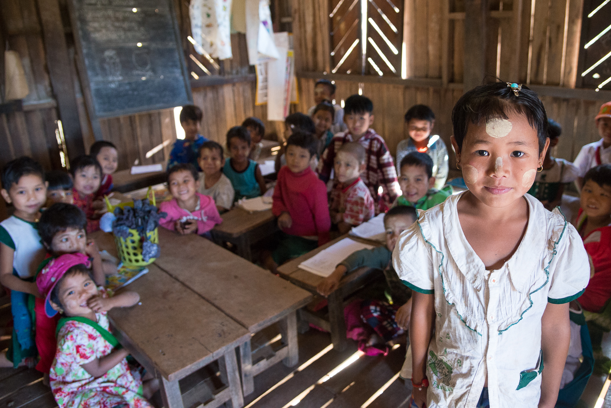
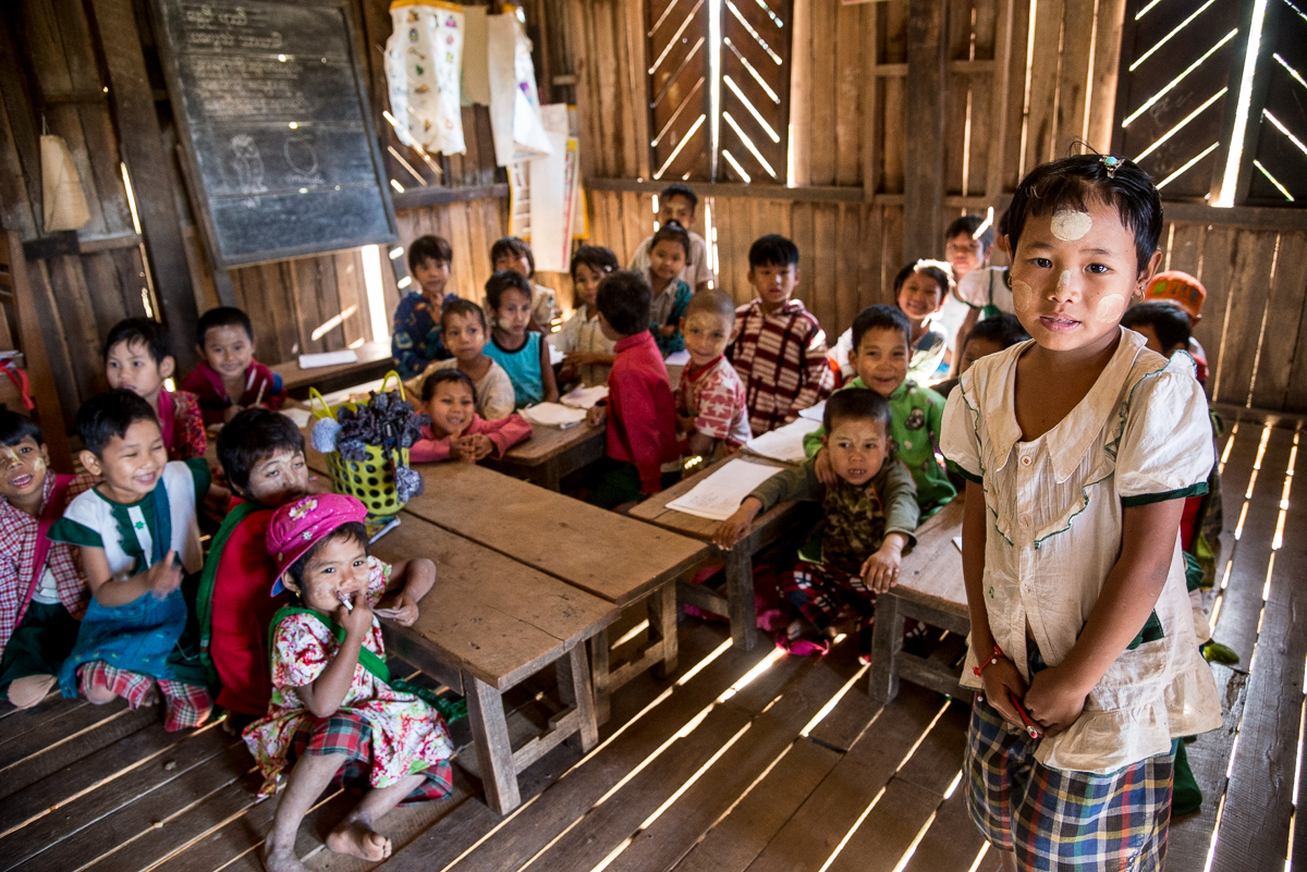
English ABCs, fuzzy PJs, and thanaka facepaint in the one-big-room grade school in the Shan village of Heinsun.

(Coincidentally, I read an article in the Economist this week on almost this exact topic.  It focused on Mexico and China, but the issue was that despite years of written classwork aimed at teaching English, very few students can actually speak any English, mostly because none of their teachers can actually speak English.)

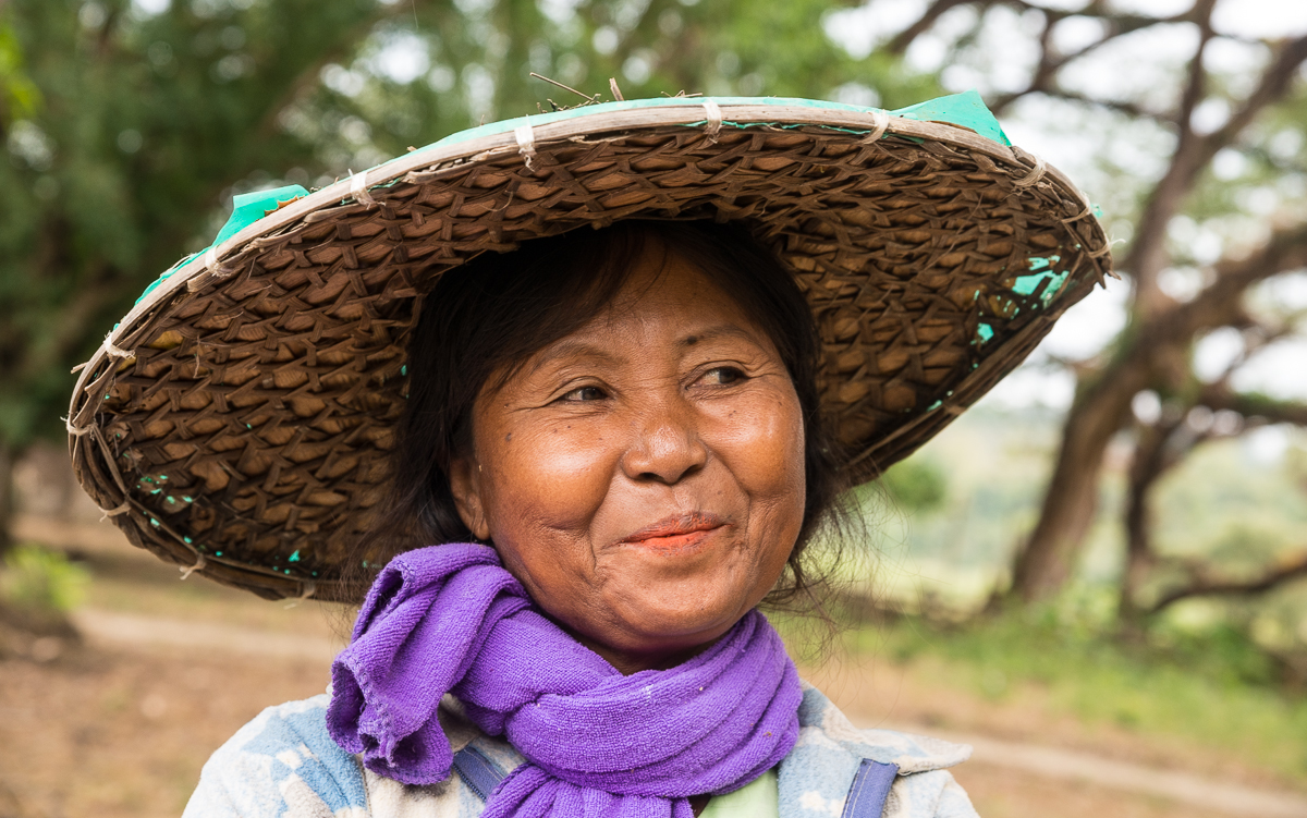
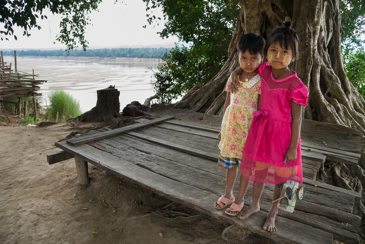
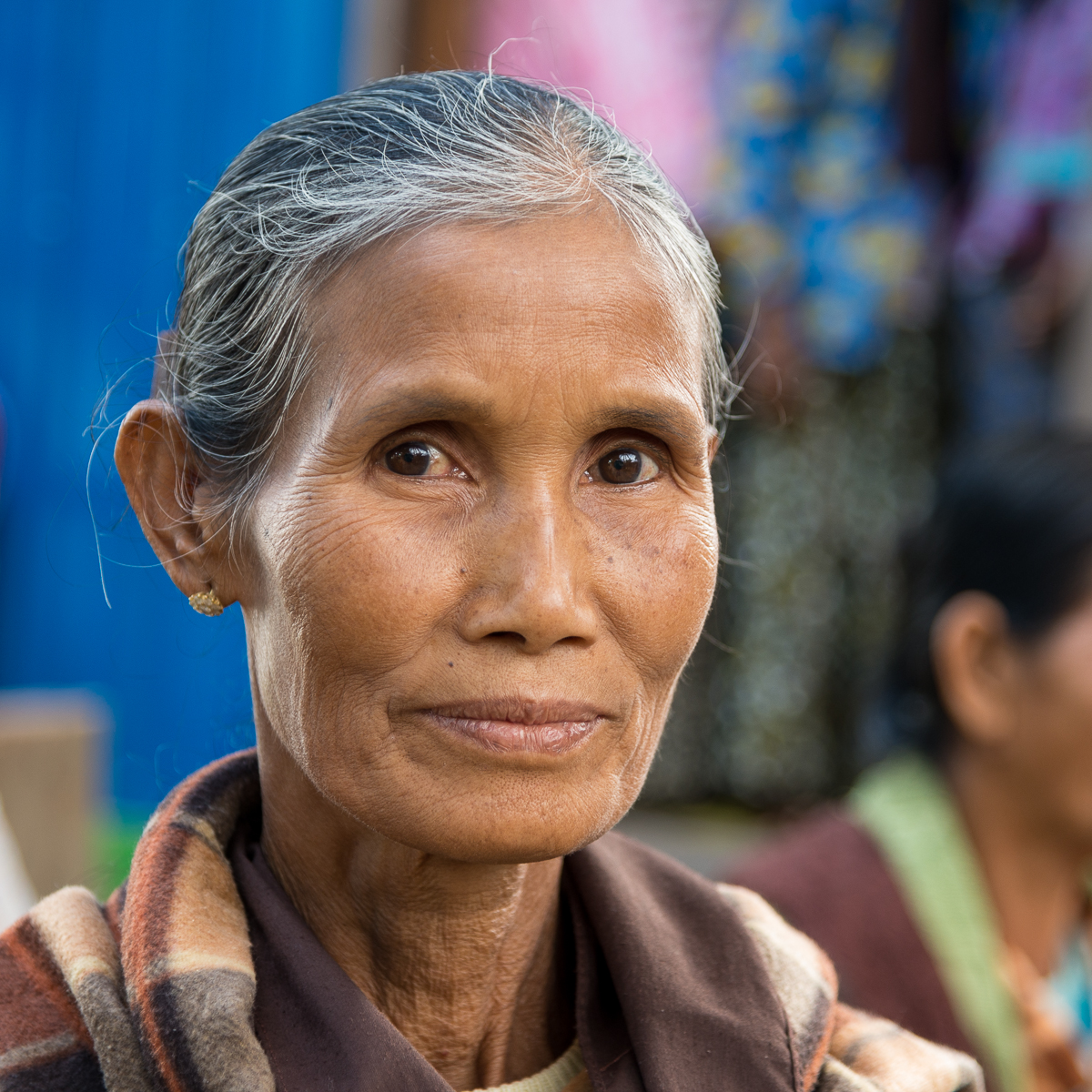
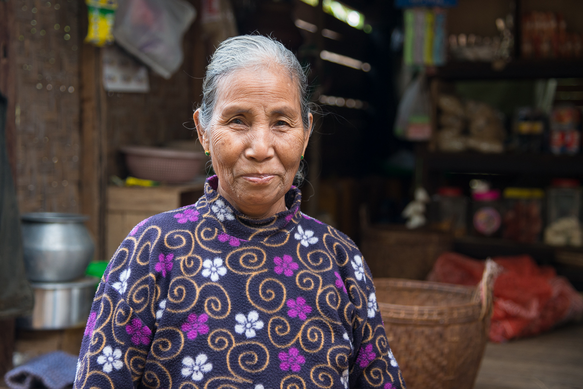
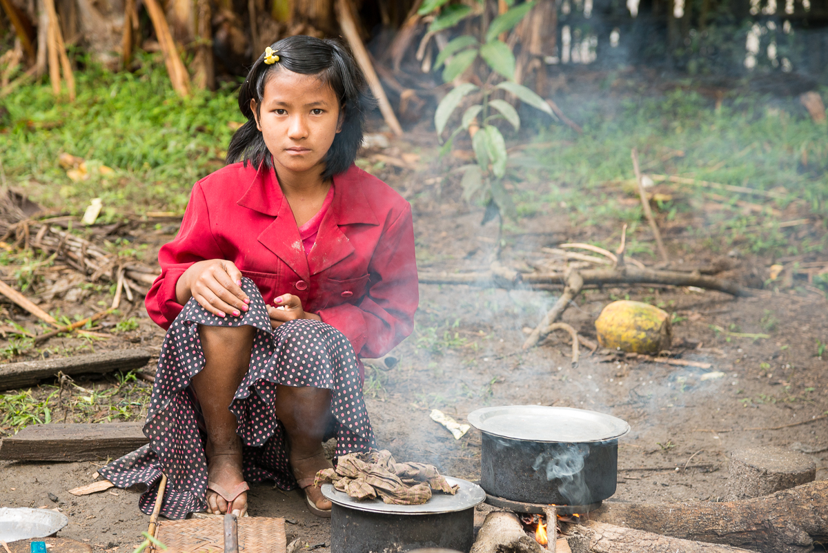
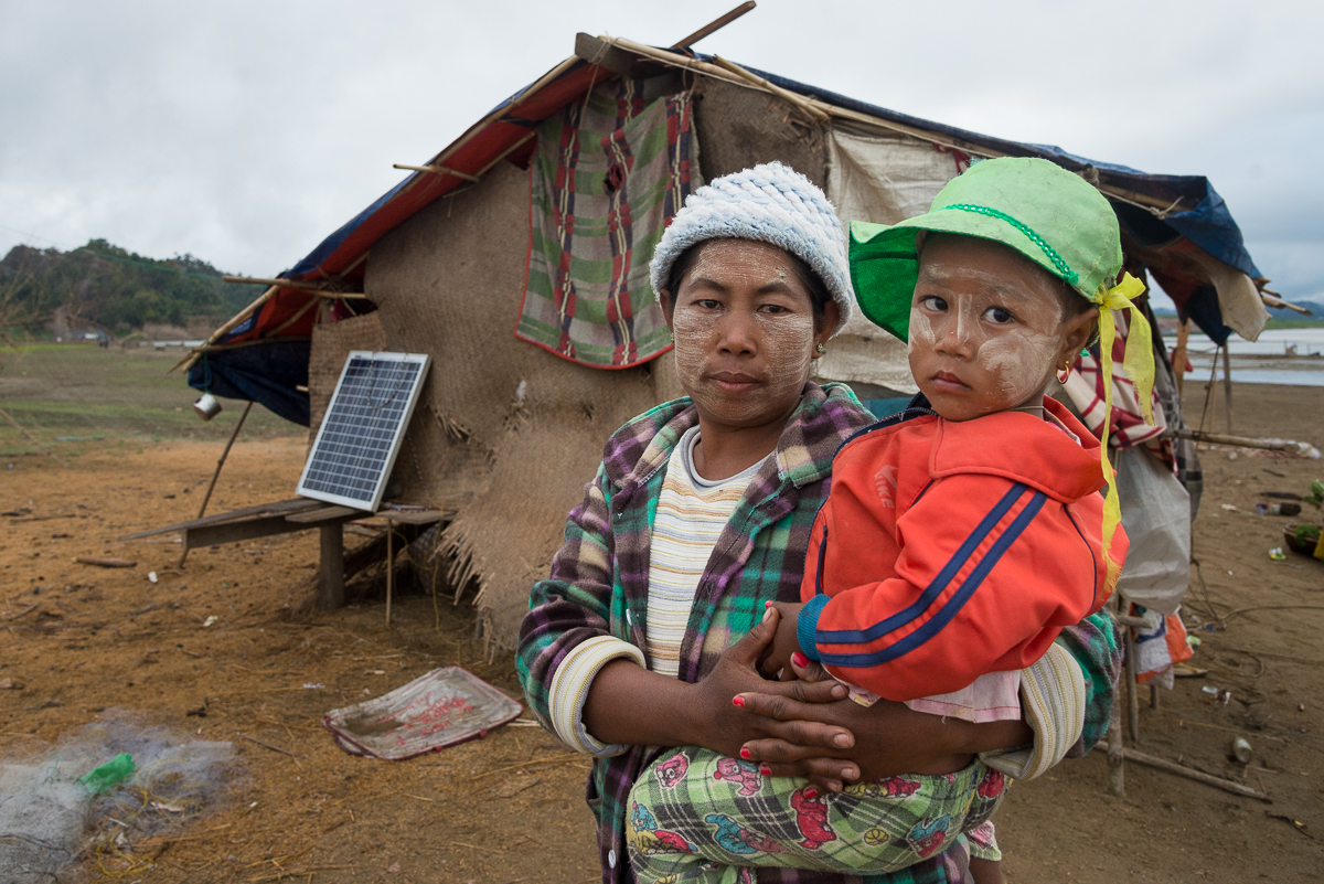
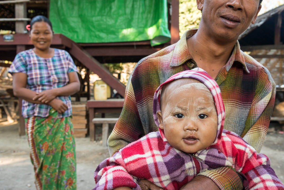
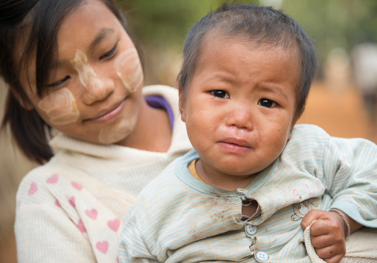
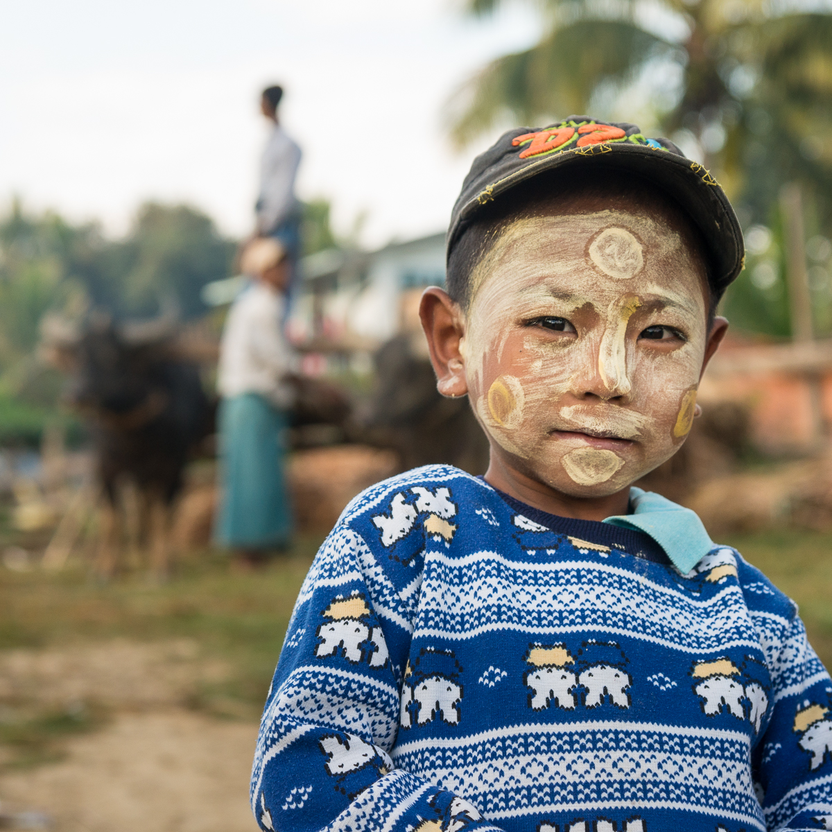
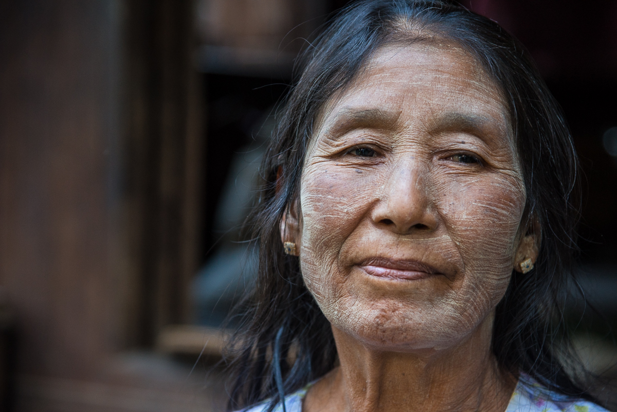
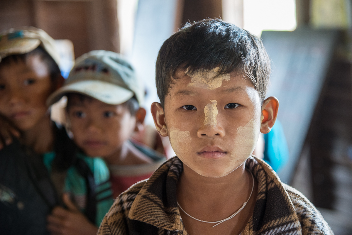
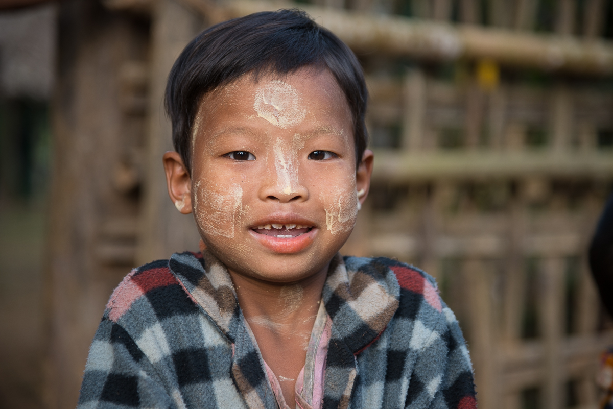
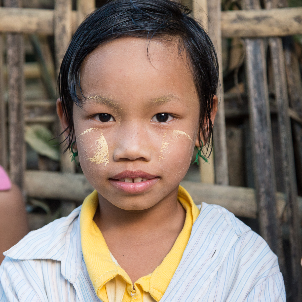
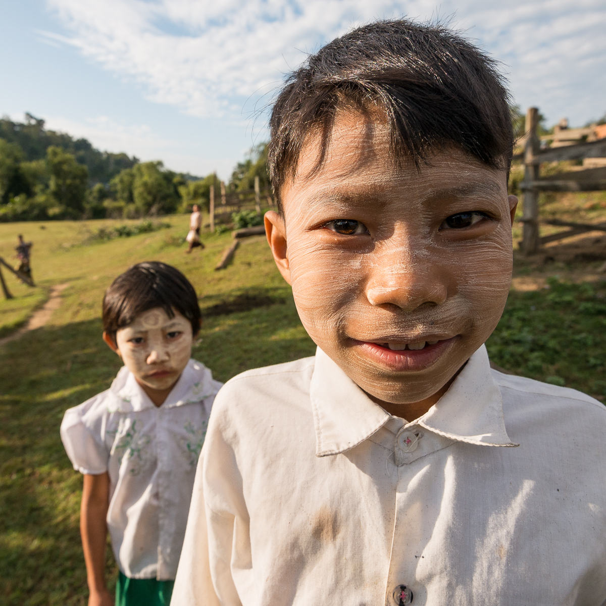
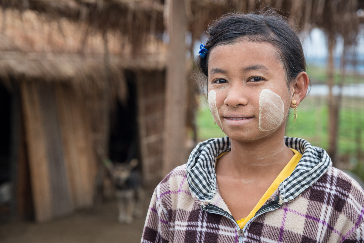
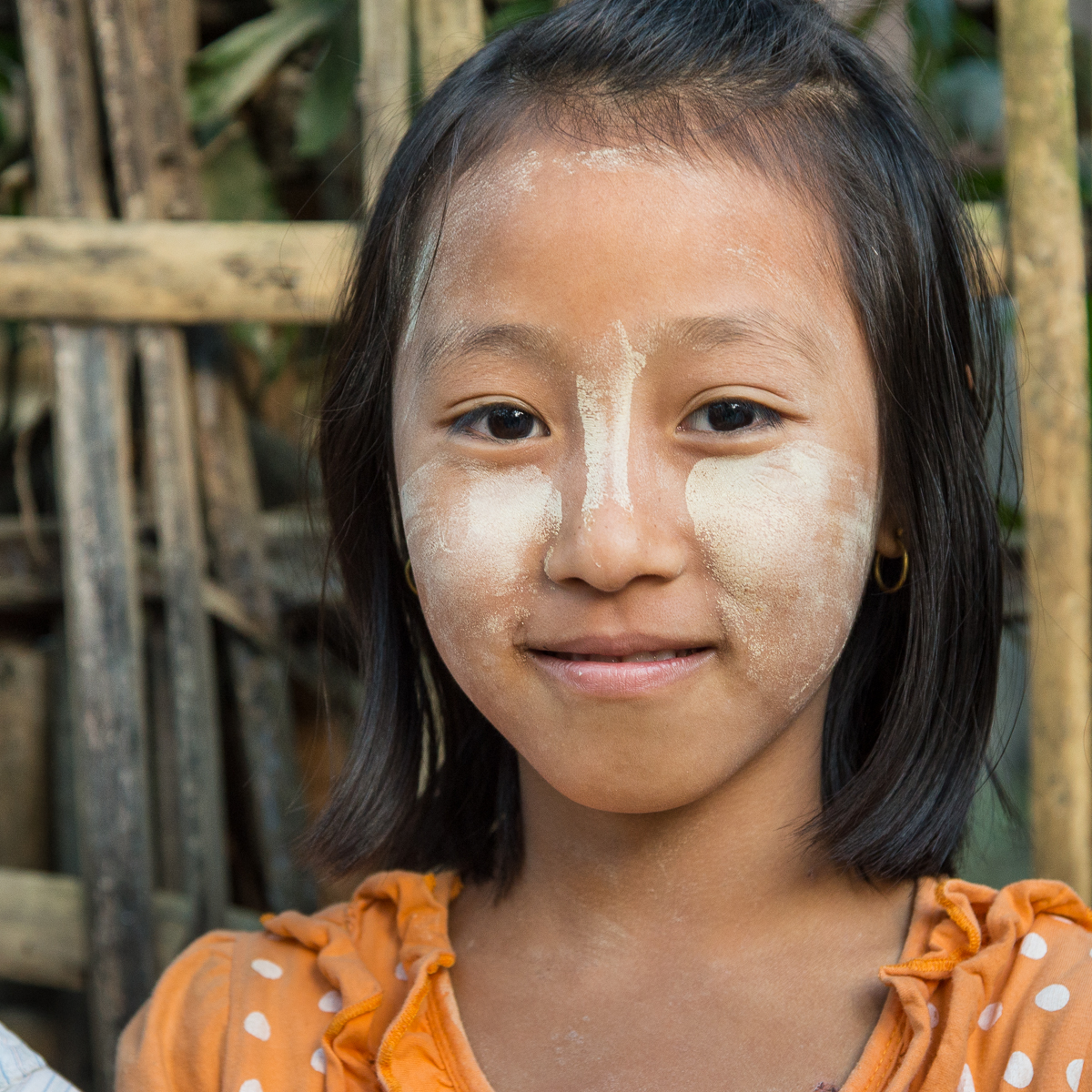
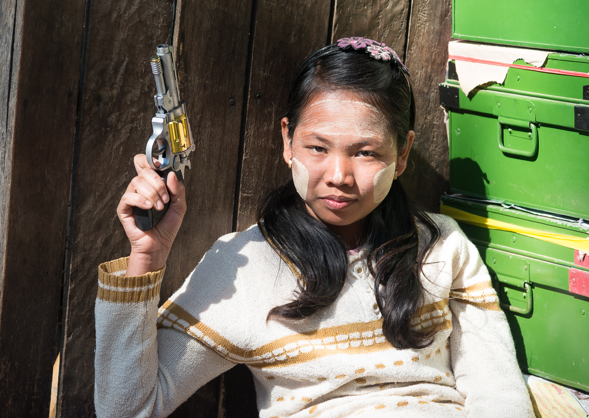
One conspicuous remnant of ancient times in Burma is thanaka — a beige paste made from ground-up tree bark and worn as a face paint.  It can be a sunscreen spread over the entire face, or a decorative cosmetic applied in patterns.  It’s everyday wear for lots of women and kids, and young, unmarried men.


Some thanaka (and PJ) examples:

_5JC8823.jpg_5JC9147.jpg_5JC7033.jpg_5JC0503.jpg_5JC1680.jpg_5JC6577.jpg_5JC7053.jpg_5JC0516.jpg_5JC9168.jpg_JCE2410.jpg_5JC0350.jpg_5JC9172.jpg_JD85983.jpg
_JCE3116

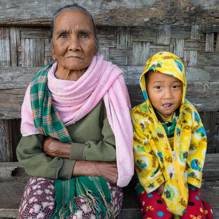
Yellow Angry Birds PJs. His grandma is wearing an inside-out green sweatshirt, and a pink towel as a fashion item.

_5JC8611

_5JC8925

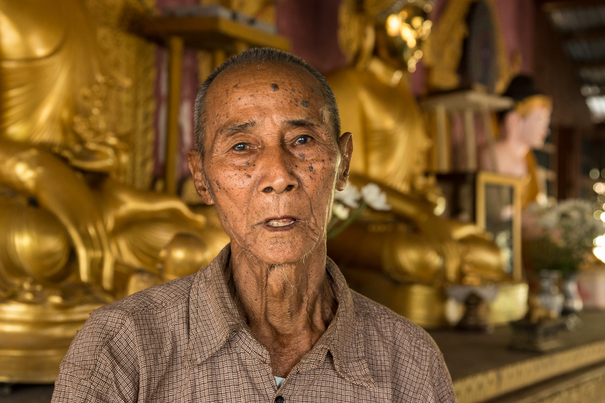
Another outside force that changed the area was World War II. An elder in He Hlaw village showed us a Buddha statue that had been damaged in WWII bombing, and introduced us to this old fellow who had fought in the war. I had to ask: Who had bombed the village? And which side did the old guy fight for? The Allies bombed it, after Japan had invaded and taken over most of Burma. And the old man had fought on both sides, switching (maybe twice?) as control of the area shifted from British to Japanese to British.

_5JC6697

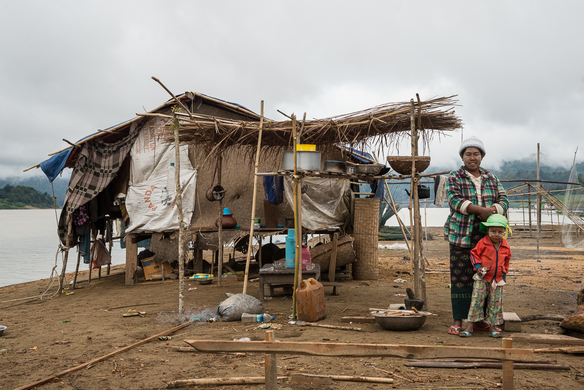
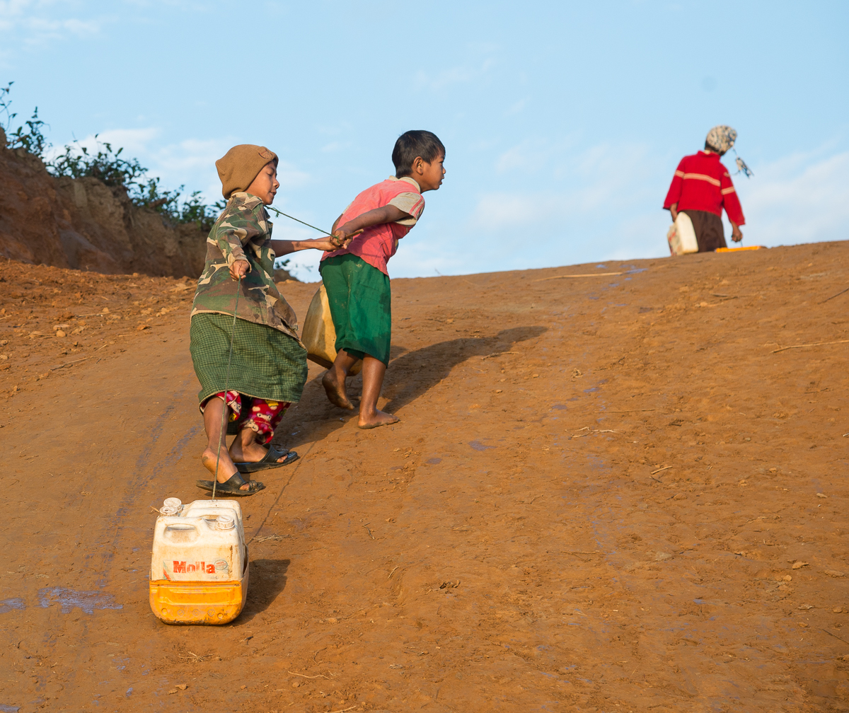
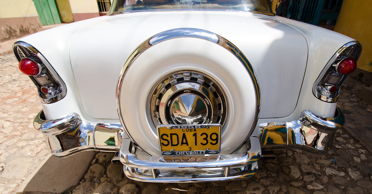
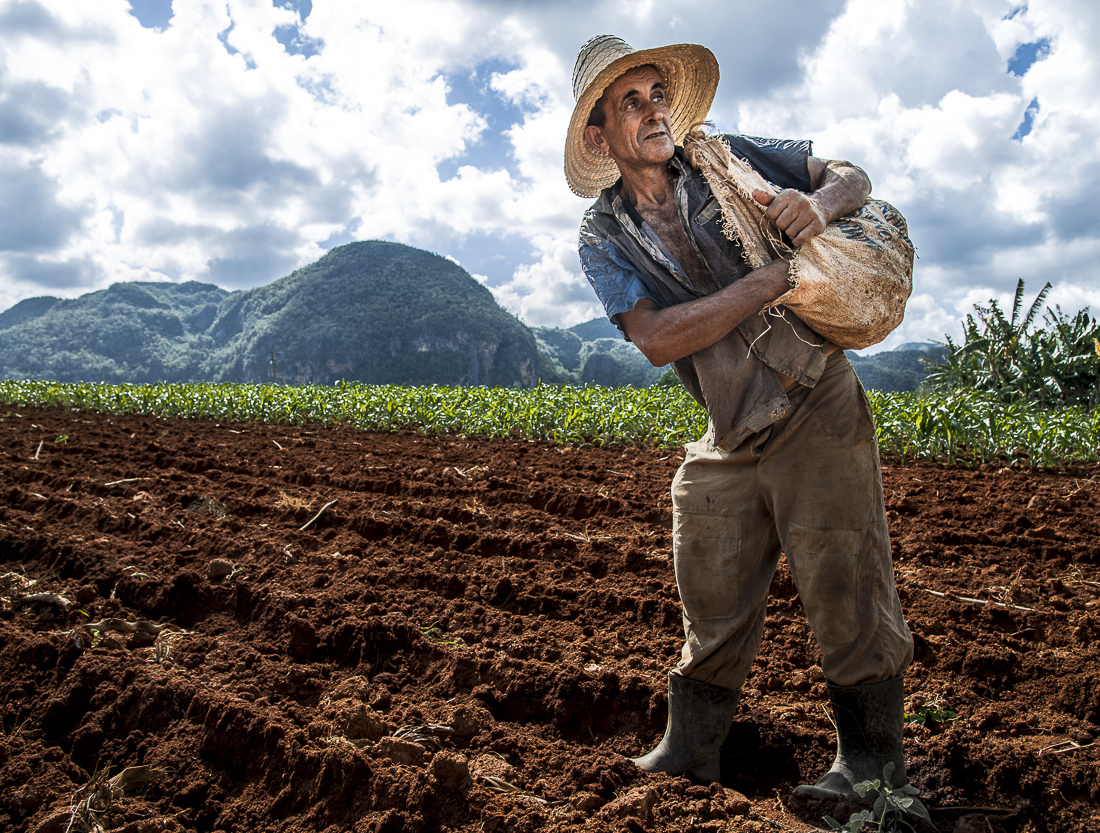
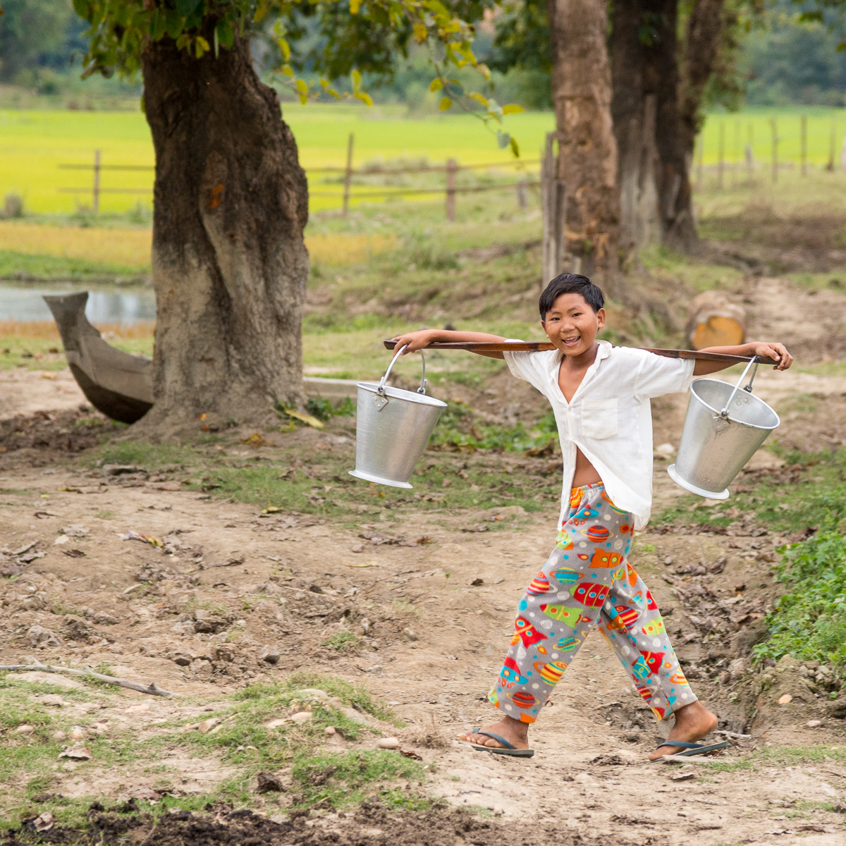
What I saw on the Chindwin echoed what I’d seen before — in Bolivia, Guatemala, even rural Cuba.  People on the Chindwin live very modestly, in conditions that we as American would find impermissible. Their homes are made of sticks or bamboo; most have no lights and none have air conditioning or appliances.  I don’t recall seeing anyone with eyeglasses and none of the communities had doctors.  Many have no more than a couple of changes of clothes. They sleep mostly on very-thin mats on wooden floors.  If American children were growing up in such conditions, the State would probably put them into foster care.  If groups of American adults were living that way, they’d take to the streets in angry protest. But the people of the Chindwin are happy, proud, dignified and content with their lives.  Maybe it’s because they don’t know of anything different or better than their own world, but the fact remains that they surely seem happier than many of the people in far weathier or more advanced areas. They are not bitter; they are kind and welcoming to gawking strangers who arrive toting expensive cameras.  They work hard to take care of themselves, their families, and their communities. We tend to assume that these folks need to learn from us about all our great modern advancements; we should learn a few lessons from them instead.


_JCE2574 2

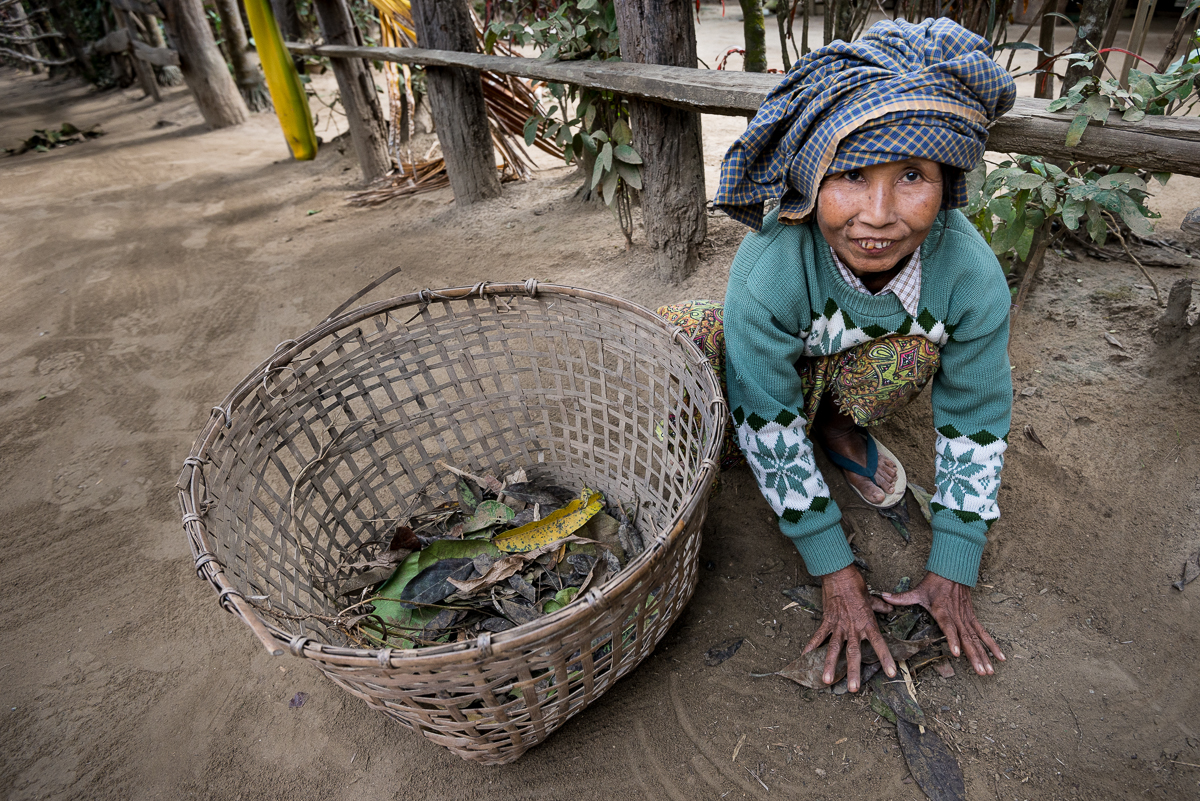
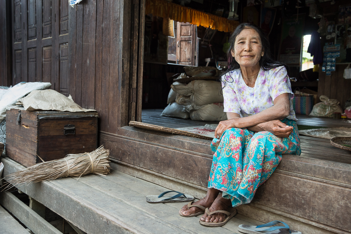
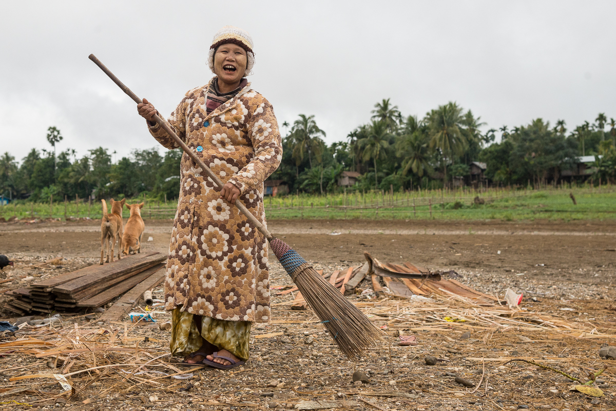
Most larger villages had a grid of wide, street-like paths with homes built along each side of the streets just like a suburban neighborhood.  This lady was cleaning up the “street” in front of her house. It’s just dirt, but they sweep it regularly to keep it neat and tidy.


_5JC9923


_5JC9132


_5JC9358.jpg_5JC8493.jpg_5JC0274.jpg_5JC6464.jpg_5JC6834.jpg_5JC0207.jpg_5JC0306.jpg_5JC0341.jpg_5JC0450.jpg_5JC0859.jpg_5JC1356.jpg_5JC1443.jpg_5JC6480.jpg_5JC6485.jpg_5JC6524.jpg_5JC6658.jpg_5JC6750.jpg_5JC6872.jpg_5JC6989.jpg_5JC7022.jpg_5JC8865.jpg_5JC9167.jpg_5JC9301.jpg_5JC9353.jpg_5JC9483.jpg_JCE2996.jpg_JCE3008.jpgc40-_5JC0341.jpg_JCE3184.jpg

_5JC1657

Scotland 2014: Lighthouses, Sheep, and Dead Economists


Yes, I’ve been home from Scotland for a while, but I’ve got a few more batches of pictures to share.

_JD89127

For 190 years, the Eilan Glas lighthouse has sat on the small peninsula off the Isle of Scalpay (a prior lighthouse was on the same spot in the 18th century).  Scalpay is a tiny island recently connected by bridge to the Scottish Isle(s) of Lewis & Harris.  The peninsula it sits on sticks well out into the Minch – the branch of the Atlantic Ocean that goes between the Inner and Outer Hebrides – which is presumably the reason someone thought a lighthouse was needed there in the first place.  In better light, you can see back to the Isle of Skye.

Honestly, it’s probably hard to be more photographically trite than a bunch of cliched pictures of a lighthouse with a sunrise in the background.  But my pre-dawn hike through the sheepfields of Scalpay was a pretty special experience, and – if I may say so myself – these pictures turned out pretty well.  I only got lost (and wet) a little on my two-hour hike — taking the long way — through coastal sheep fields back to my car.

_JD89156

_JD89014.jpg_JD89112.jpg

_JCE6337


_JD88905

Much of the land in Scotland’s outer islands is part of a Common Grazing system. Local committees generally supervise the land and decide how much livestock each farmer is allowed to graze.

This area of Scotland has lots of sheep, and lots of land dedicated to “common grazing.” In a common grazing system, grazing lands are controlled by the town or by some sort of semi-governmental cooperative, and the individual citizens have some ability to put their livestock on the land for grazing. But nobody owns the grazing land (or maybe everybody sort of does). This is especially interesting (to me) because there is a famous principle of Economics called the “Tragedy of the Commons,” which analyzes the ups and downs of common ownership of resources like this (mostly the downs – thus the term “tragedy”).   The grazing tragedy occurs because every farmer with access to the common grazing land has the incentive to graze as many animals as possible on the seemingly free public land, so the land becomes overgrazed and barren and thus no good for anyone. This rarely happens on privately owned grazing land, because a property owner tends not to spoil his own land. The moral of the story is that when nobody owns the land (or other resource), nobody has a great incentive to care for it.

Solving the “tragedy” can take two seemingly opposite courses: heavy governmental regulation (like the Grazing Committee); or private ownership of the lands. Environmentalists analogize to the concept to argue that something must be done (i.e. regulation) to prevent a similar tragedy from occurring in the “common” air we breathe and water supplies from which we drink.  Because nobody owns the skies or rivers, people are unfortunately inclined to abuse them absent some government control.  On the other hand, conservatives (more precisely: capitalists) point to the “tragedy” concept to teach that private ownership of resources (where possible) is the best way to ensure that they will be well cared for and preserved. Both these arguments are mostly correct, and that’s why the Tragedy of the Common idea is such an important, interesting concept.

Somehow it’s also interesting that Scotland was also the home of Adam Smith, the 18th Century economist and author of Wealth of Nations. Smith is the one who taught the modern world that a capitalist system – where people act in their own financial interest – generally creates better outcomes for a society because private ownership and profit interests usually lead people to direct resources to their most productive and valuable uses. It’s a little ironic that the odd pocket of common grazing systems persists in the country that is Smith’s homeland. He may be rolling over in his Edinburgh grave.

So if you ever wonder what I think about on a two-hour solo hike through quiet Scottish sheep fields on the way to and from an isolated lighthouse, now you know.

_JD80024.jpg_JD88502.jpg_JD88914.jpg_JD89416.jpg_JD89480.jpg_JD89630.jpg
_JD89630

Sheep graze near Uig Sands on the Isle of Lewis

Ironman Cairns (Australia): Swim / Bike / Rain!

I was a little busy, so the photo credits here go to others (Stacy Humphries and the photo service FinisherPix).  

0729_052284

My Australian/Texan buddy, Scott Humphries, crossing the finish line at Ironman Cairns Australia, toting a Texas Lone Star flag.

One of my best friends is Australian.  You’d never know it, though.  He moved to Texas in his youth and has no hint of an accent.  Even so – and because of those Aussie roots — Scott had my and Shane Merz’s full proxy when it came time to select which Australian Ironman site we would do this year.  He picked Cairns, a small city on Australia’s northeast Queensland coast and a primary gateway to the Great Barrier Reef.  As race day approached and the weather forecasts continued to say “Rain” every day, the phrase “Who picked this?” became a regular refrain.

0729_052499

That’s me, crossing the same finish line – quite a bit later. At least the rain had let up a little by the time I finished!

If you read this blog regularly, you may remember that my friends and I have set a goal – a “quest” — to do an Ironman Triathlon (swim 2.4 miles; bike 112 miles; then run 26 miles) on every continentAustralia was our fourth, and fortunately there was less trauma (i.e., no hospitalization required) compared to our European leg.  Though Cairns had promised to be sunny and tropical, on race day Down Under there was never a moment that it was not raining.  The ocean swim was rough enough to make me a little seasick (and the Ironman ‘crowd’ was rough enough to give me a black eye in the first ten minutes of the swim).  But we all finished just fine; in fact, the other guys each had personal bests.

DSC_0101-2

Me, Scott Humphries, and Shane Merz — minute before the swim start of Ironman Cairns Australia.

We’d debated for months exactly how to pronounce “Cairns.”  When you hear the local Aussies say it, the name sounds like those metal containers for soup (“cans”).  So arguably the “r” is silent – but not really.  They think they ARE prounouncing the “r.”  Australians describe a malt-based lager as “bee-uh” and an automobile as a “cah”, and in the same way, Cairns sounds like “Cans.”  But just as a visitor to Boston should not adopt an affected New England accent to discuss the clam “chow-dah” he ate in “Hah-vud” Square, neither should an American in Cairns pretend to pronounce the place “Cans” like the locals do.  So it’s Cairns – with an R.

DSC_0101-2.jpg0729_033891.jpg0729_028240.jpg0729_032102.jpg0729_004636.jpg0729_052284.jpg0729_052499.jpg0729_053327.jpg0729_056745.jpg0729_054260.jpg0729_054289.jpg
0729_056745

Shane Merz — crossing the line to become a FIVE-time Ironman!

0729_033891

This is me — somewhere close to the end of the bike course.

Welcome to Capayque, Bolivia!

When I signed up to join (and photograph) an Oklahoma group that was providing healthcare in a tiny village high in the Bolivian Andes, I was not expecting the elaborate welcome we got in Capayque.

_JD89656

A local Capayque girl arrives at our welcome ceremony with a handmade flower wreath.

Last week I joined a group traveling to Capayque, Bolivia – a very primitive, isolated community in the mountains of northwestern Bolivia, about 15 miles (as the condor flies) from Lake Titicaca and a rough five-hour trip from La Paz.  The group’s mission was to provide much-needed medical care to Capayque’s residents and to set up a medical clinic in the community.

This will be the first of several posts about my trip to Capayque.  Much more later about the town, its people, the Stillwater Oklahoma Methodist church group, and the activities of the week.

_JCE5554

Ray Kinnunen of Stillwater gets a ceremonial welcome in Capayque

Things got interesting immediately when we arrived in Capayque.  We were met by the entire school and much of the town – as well as the local bishop and several other local officials – for a welcoming ceremony.

_JCE5527

As the pictures reflect, we got handmade wreaths of flowers (which grow, mostly wild, in the area), and were presented with traditional Bolivian panchos, scarves and hats.  We were told that the red panchos we received were symbols of community leaders (the “head panchos,” you might say).  The ceremonies concluded with a dance down the hillside to the new medical clinic this Methodist mission group has been building for the past two years.

After the bishop inaugurated the new clinic with a few sprinkles of water, we were treated to a ceremonial community meal – with local foods spread out on blankets for everyone to share (Corn, potatoes, and a potato-like plant called “oka” were the primary menu items).

It was a fun kickoff to a interesting and productive week.  Much more to come.

_JD89994

My aunt, Carolyn Williams — an R.N. and a 16-year veteran of the Bolivian medical mission team — was welcomed back to Capayque with a prestigious red pancho.


Tikal, Guatemala: After Dark in the Great Plaza

Over a thousand years ago, the temples and altars of Tikal’s Great Plaza were the site of gruesome rituals of human sacrifice.  At night, there are no lights, and the low, scream-like roar of howler monkeys fills the air.  It’s an eerie place to be when the grounds are deserted and the sky is dark.

_JCE2417

Tikal Temple II

It’s an amazing experience – at any hour – to be amid Mayan temples that have stood more than a millennia.  Friday night I had the chance to be essentially alone there after dark and after the park had officially closed, with the chance to make the whole place my private photo studio.  Though I lit up the temples for these pictures, in reality there were no lights except a half moon and our handheld flashlights.

_JCE2429

Tikal Temple I

Tikal National Park is Guatemala’s most popular; it enshrines some of the most famous and prominent remnants of the ancient Mayan World.  At Tikal’s center are the temples of the Grand Plaza.  Each day, hundreds (sometimes thousands) of visitors tour the park.  Each evening, a few dozen stay ‘til dusk to watch the sun set behind the Temples.  I stayed even later – until it was truly dark and everyone else had gone home.  Two park rangers waited patiently (sort of) and escorted me (and my local guide, “Henry”) out of the park long after they’d done their nightly sweep of the grounds to make sure no one else was left on the grounds.

_JCE2443

Temple I


Those night-time images aren’t Photoshop tricks.  Henry and I were giddily watching them show up on the back of the camera as we moved my big tripod around the Grand Plaza in the dark.  There is no electricity and no lighting at the Temples, so the light on the temples is from his flashlight, which I borrowed and used to “paint” light on the stones and trees during the long 30-second (or so) exposures).  The streaks in the sky are clouds; in that amount of time, they moved quite a bit (happily, the stars did not).  I haven’t picked a favorite image yet – I still can’t quite believe I was there.

_JCE2310

Sunset from Tikal’s Northern Acropolis

All this capped off a long day:  I’d been in the park at 4:30 a.m., too, in the pre-dawn darkness.   Each morning a few dozen folks climb to the top of Temple IV to watch the sun rise over the Grand Plaza.   I got there extra-early, and just in time to get a couple of shots before clouds and fog took over the entire view.  By the time the rest of the sunrise “crowd” arrived, there wasn’t much left to see (bottom).

_JCE1950

Tikal’s Temple IV, just before dawn.

_JD86850

Foggy sunrise, Tikal Temple IV

Through the middle of the day, I’d driven through the jungle to see the ruins at the town of Uaxactun.  Mostly by accident, I’d wound giving rides to four locals, including a 100-year-old blind man who needed to get home to  Uaxactun.  Normally the guards at Tikal would never have let me stay at the temples at night (which is why  you never see nighttime pictures).  But they were the same guards who’d asked a favor of me earlier in the day and who’d seen me doing multiple favors that day for locals.   So they sat patiently for at least an hour, giving me a once-in-a-lifetime photo opportunity.