Category Archives: USA

Four-Wheelers and Fishermen: Creede, Colorado 2012


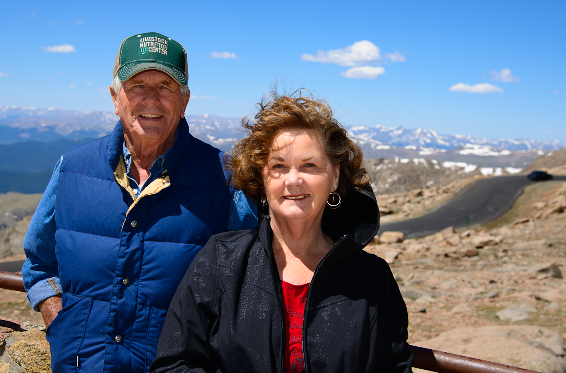
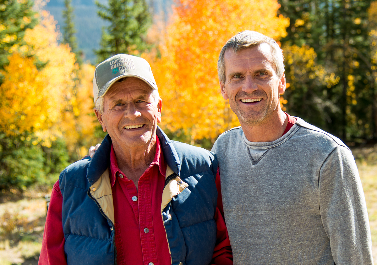
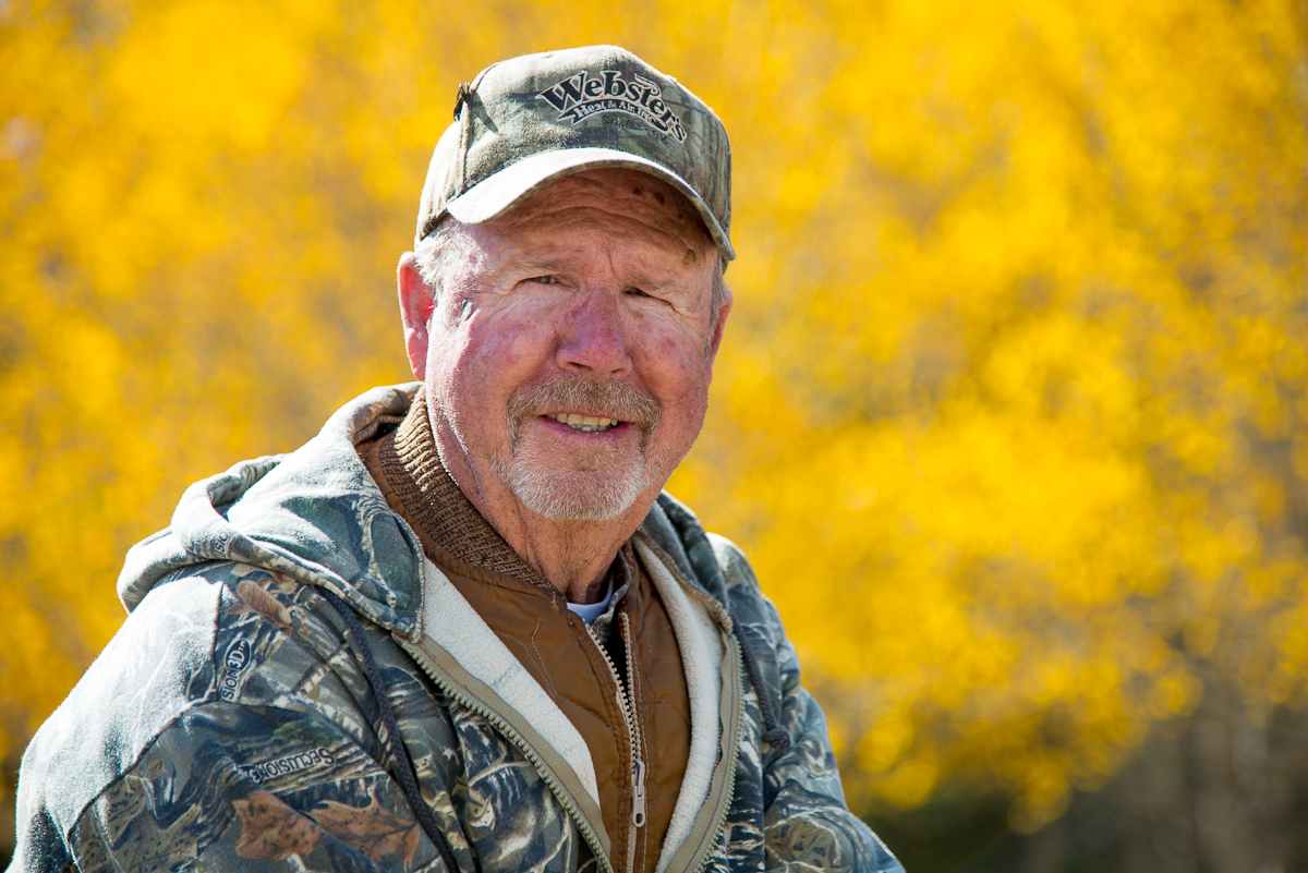
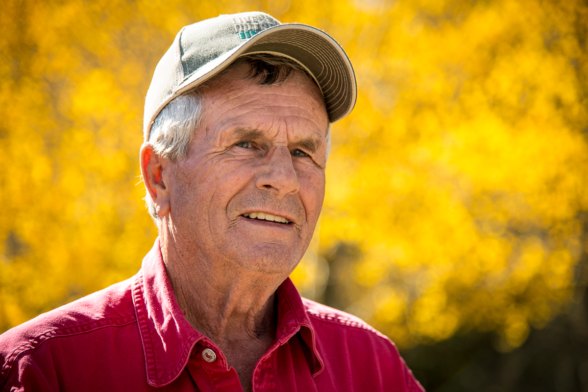
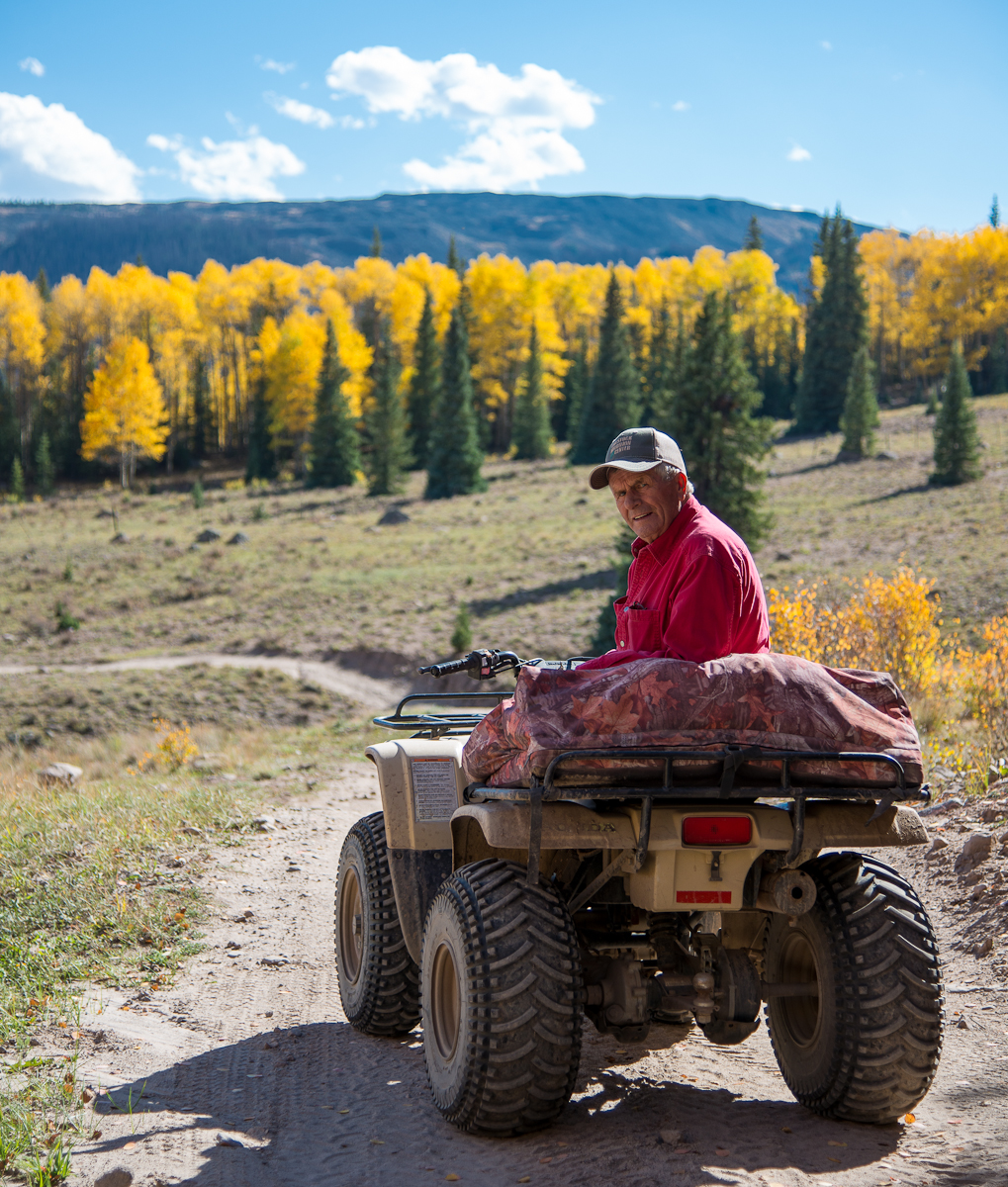
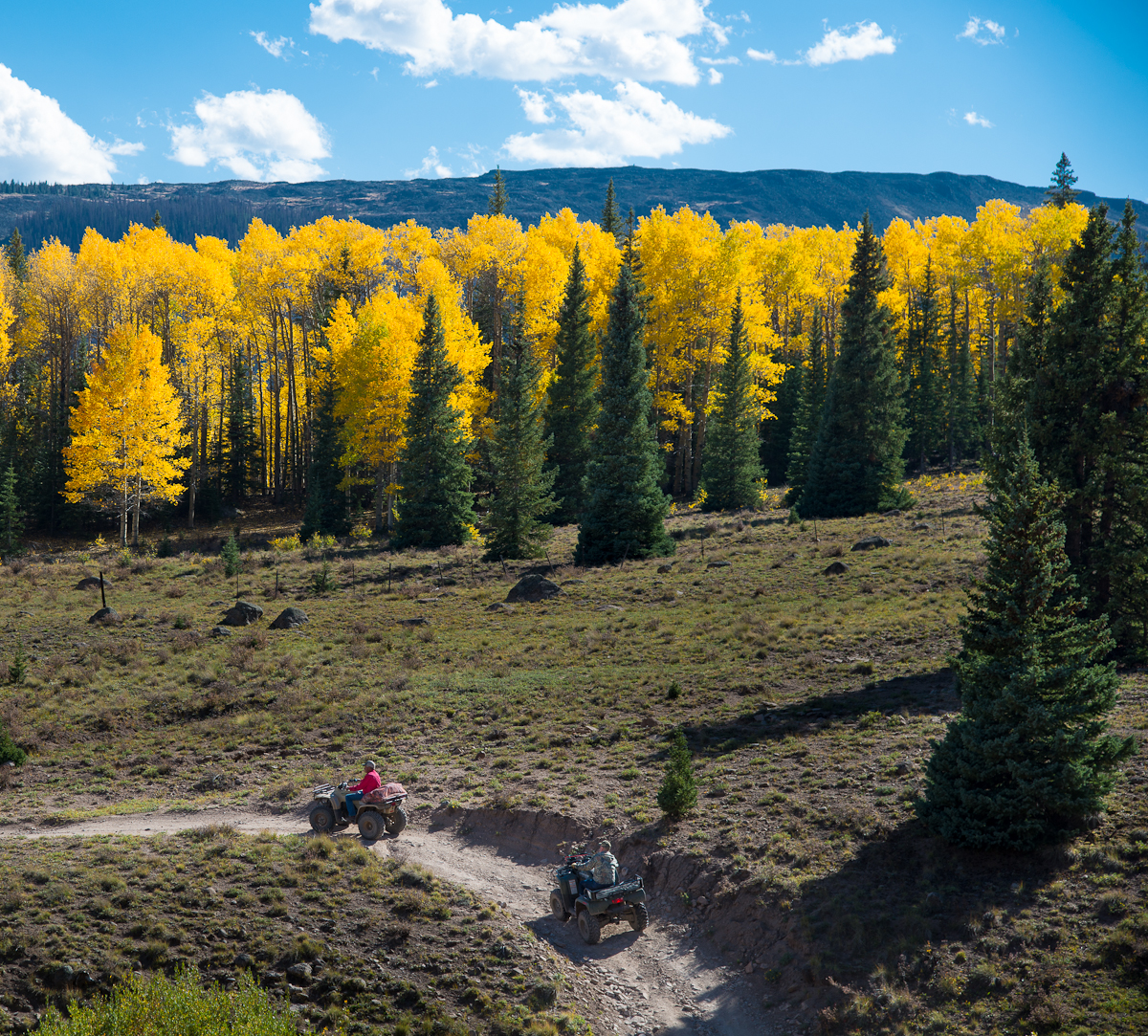
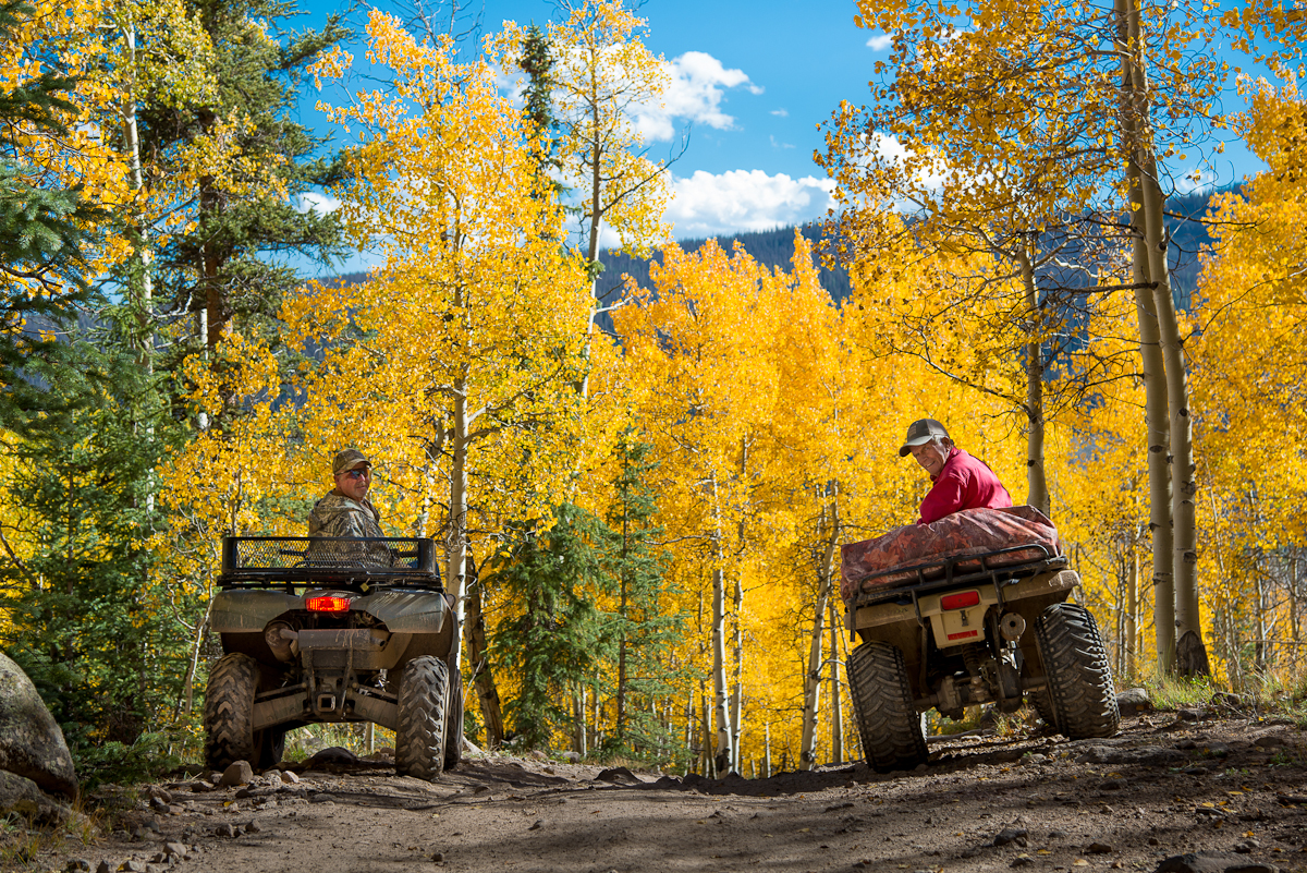
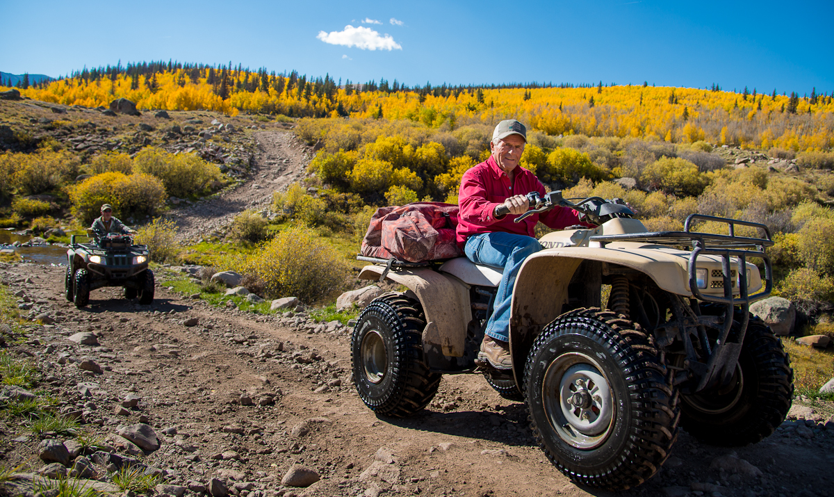
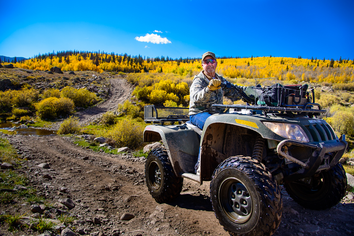
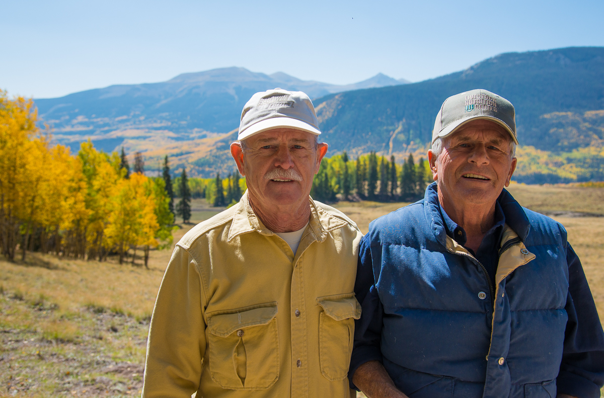
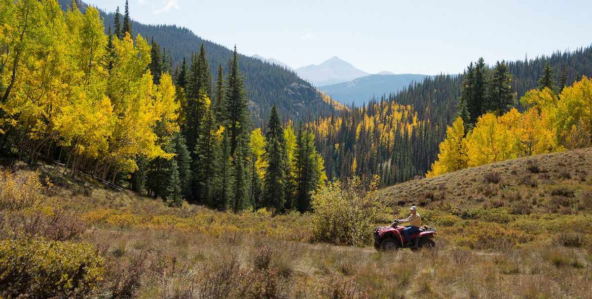
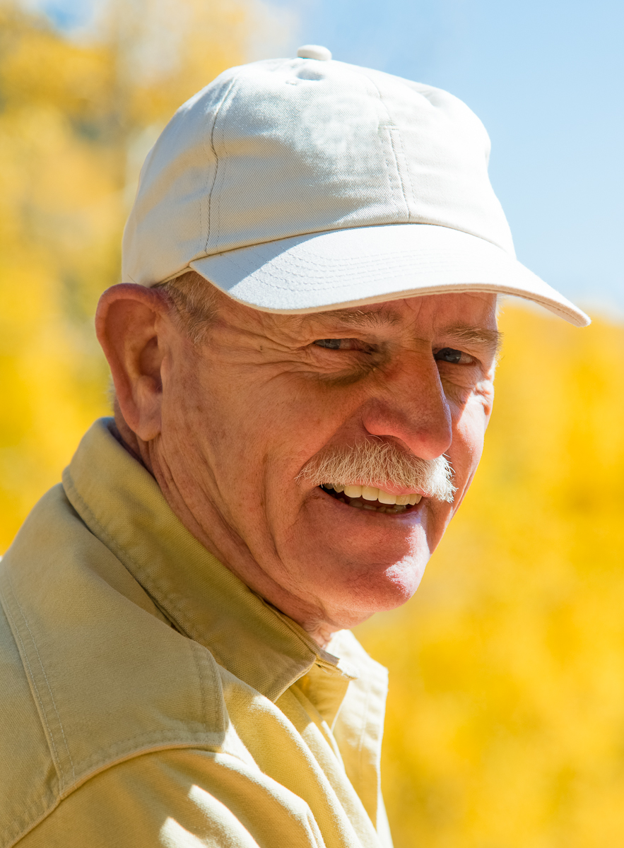
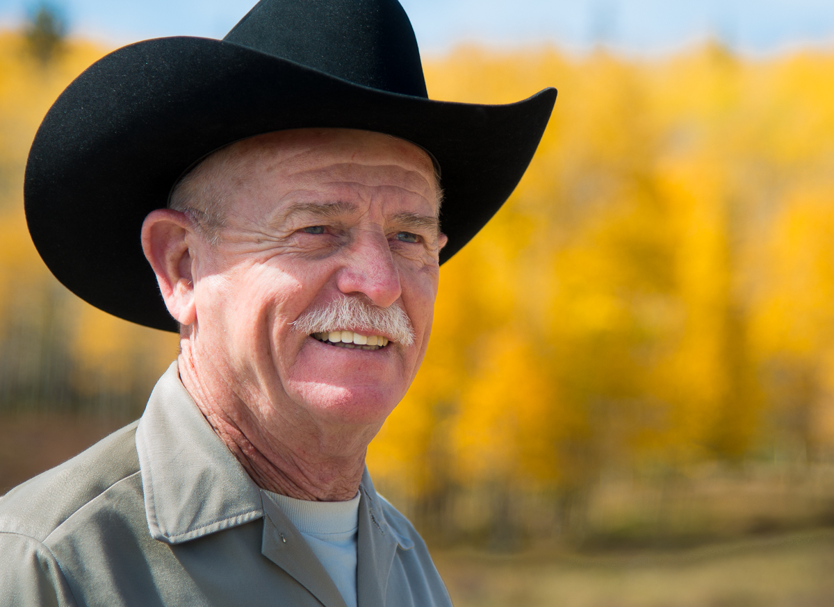
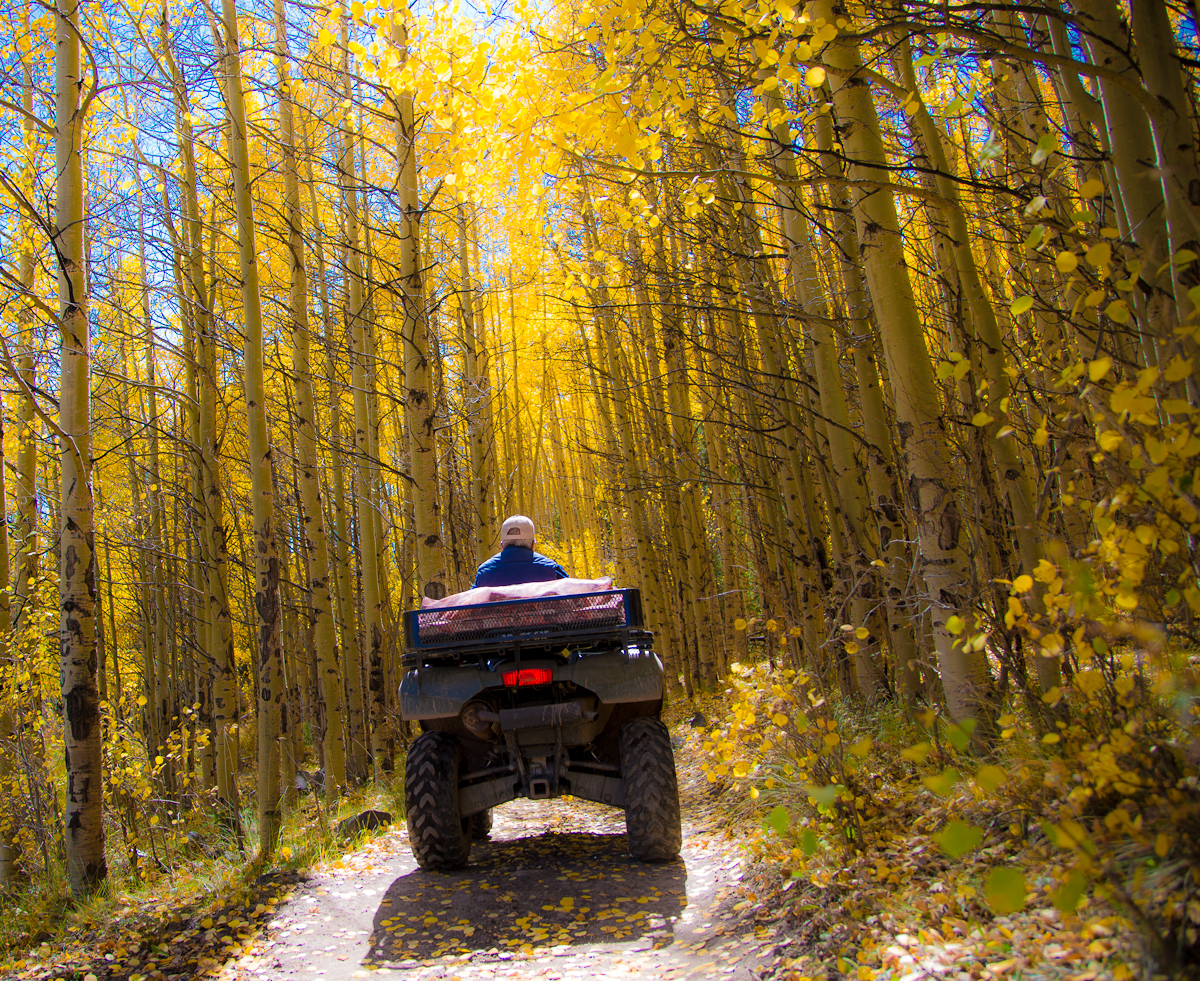
My trip to Creede wasn’t all (or even mostly) about leaves and cameras.  (You can click here to see the fall foliage pictures).  My Dad brought a trailer-full of 4-wheel ATVs.  So I spent a few days going down trails in the woods with my Dad (J.B. Cotner, in the red/blue shirts), my brother-in-law’s dad (Jim Parker, in camouflage), and a good friend of my Dad’s (John Frizzell of San Antonio, in the tan cap and black cowboy hat).

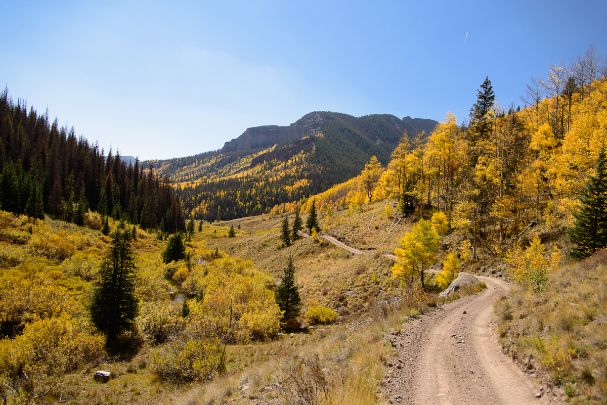
The mean age of my off-road 4-wheeling buddies was about 71, but we took on some long rides and rough terrain.  At one point, another ATV flagged me down at a trail intersection and encouraged me to turn back because the trail got “pretty hairy.”  He hadn’t seen that Dad and John had already gone right up it while I piddled in the back with a camera.  (The guy was right about the trail, though).

_JC87747.jpg_JC87727.jpg_JC87740.jpg_JC87758.jpg_JC87774.jpg_JC87787.jpg_JC87807.jpg_JC87825.jpg_JC87835.jpg_JC88171.jpg_JC88242.JPG_JC88255.JPG_JC88316.jpg_JC89166.jpg_JC88350.JPG_JC88297.JPG

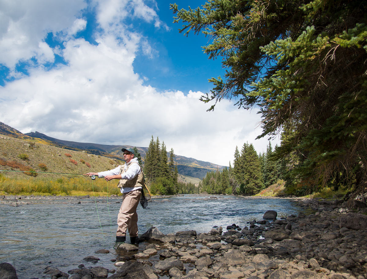
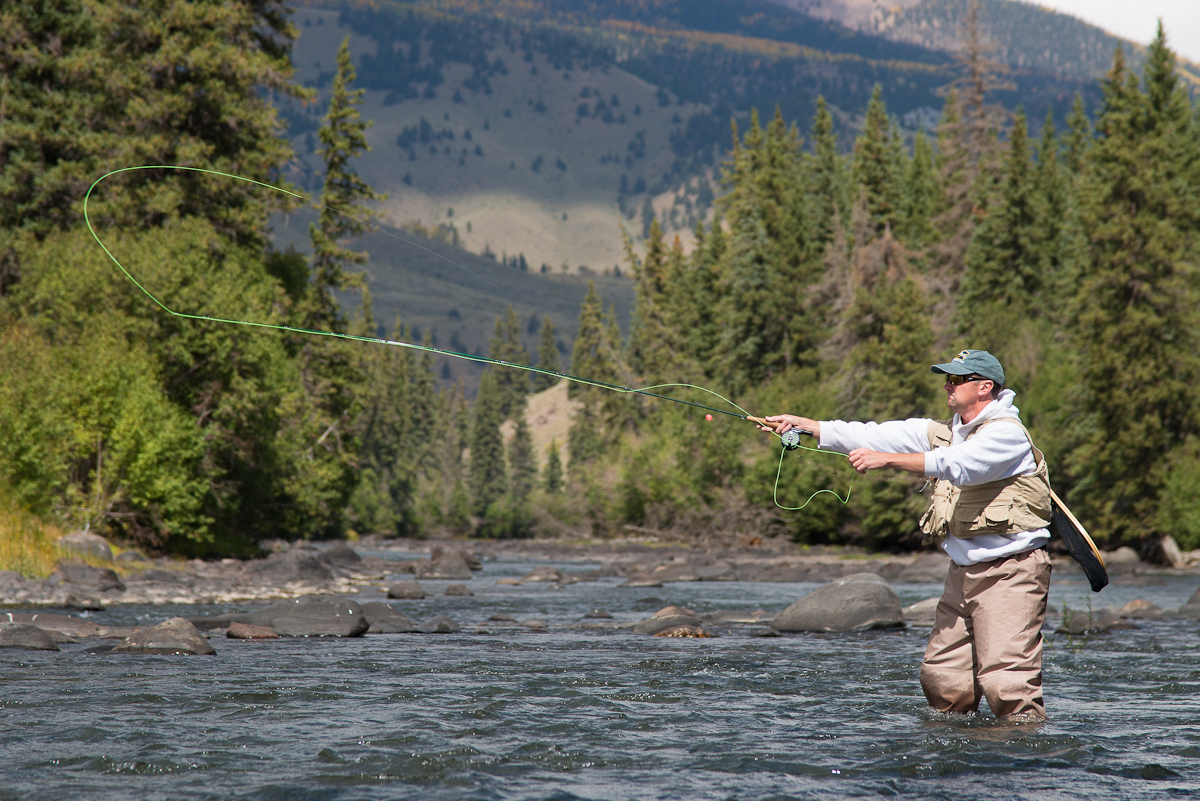
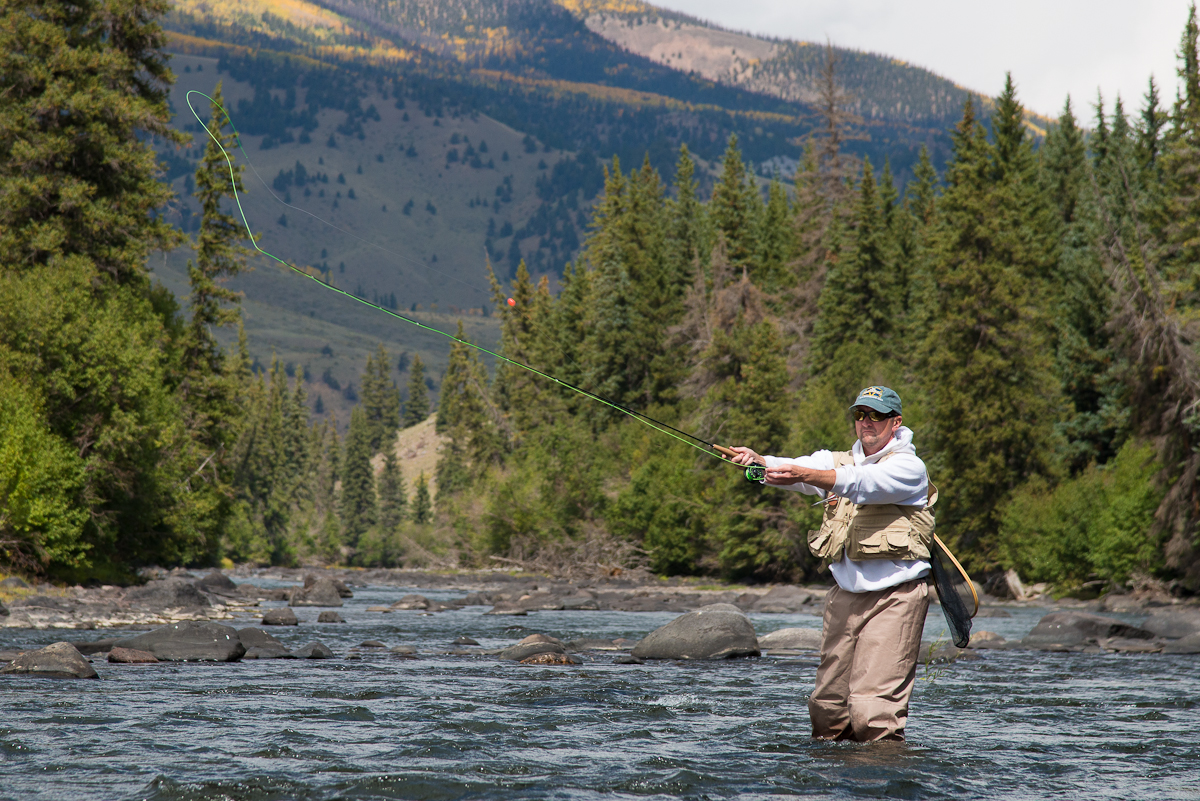
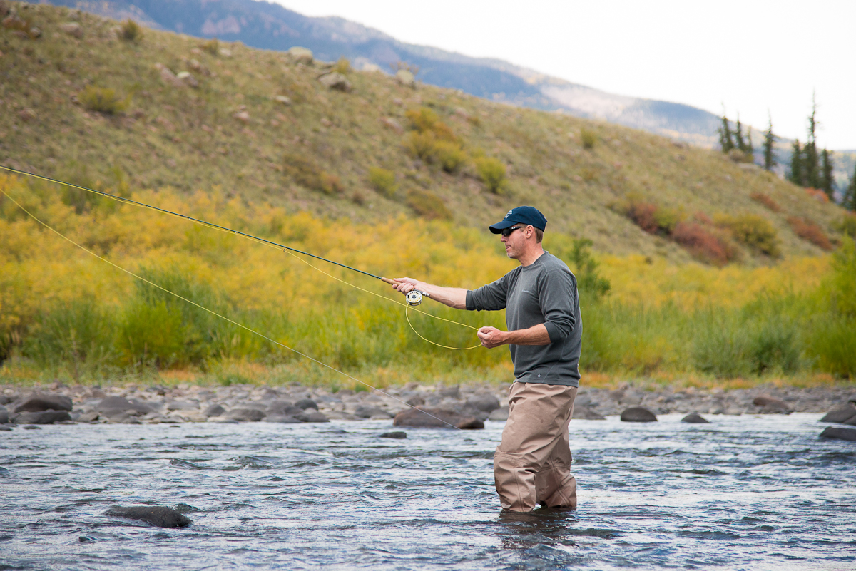
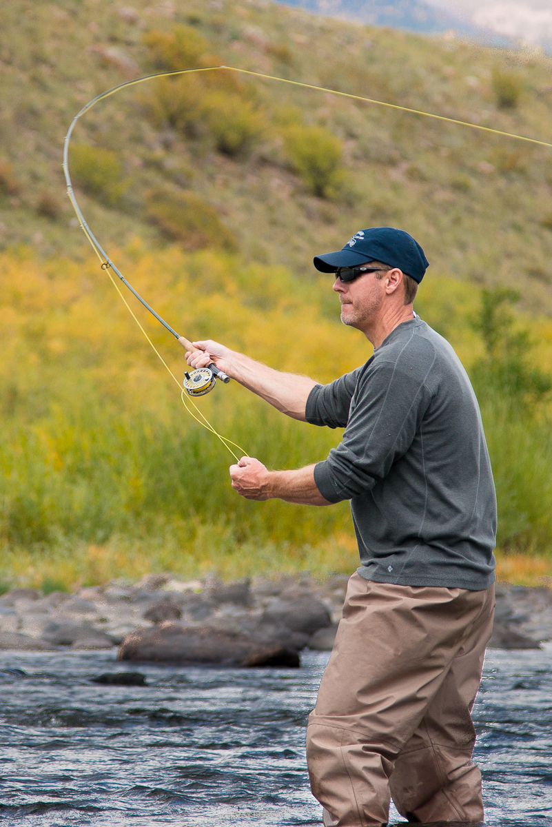
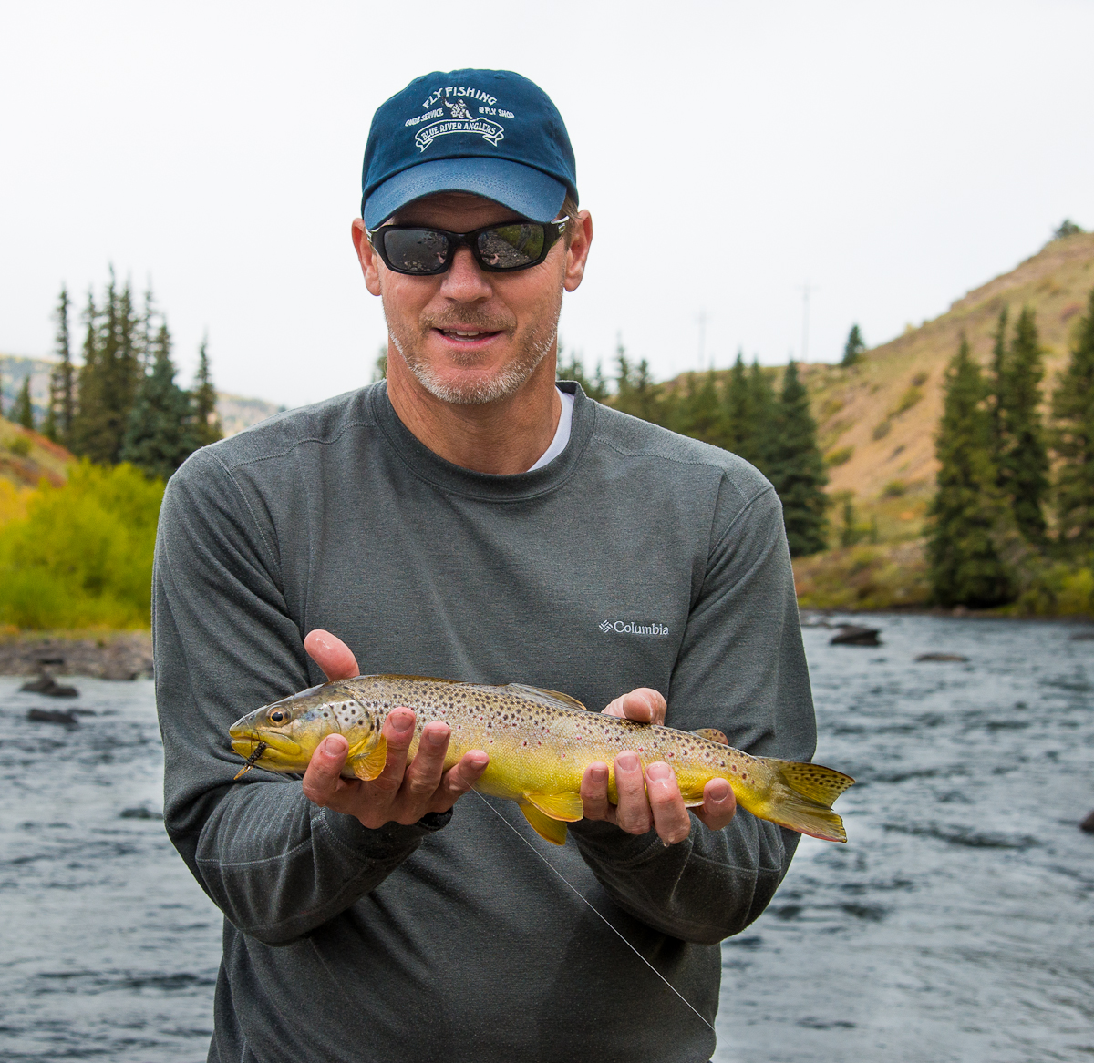
Meanwhile, my brother-in-law (Bill Parker) and his good friend Derald Glover spent most of their Colorado time knee-deep in mountain streams or in the Rio Grande itself.  Bill has become as much of a fly-fishing fanatic as someone from eastern Oklahoma can reasonably be.  By the last day they were in Creede, he and Derald finally got the right combination of location, lure and body English to land some trout he was proud to show off.

_JC87909.jpg_JC87929.jpg_JC87935.jpg_JC87942.jpg_JC87945.jpg_JC87960.jpg_JC87963-2.jpg

Fall Leaves in the Upper Rio Grande

Ever wonder where the Rio Grande got its start?

_JC89449

If you follow the Rio Grande upstream about as far as it goes — to where the Rio Grande is still a rio muy pequeño — you’ll wind up a little west of Creede, Colorado.   Fortunately, most Colorado tourists have overlooked this area because it’s a long way from major airports and ski resorts, but there’s a loyal Texas and Oklahoma crowd that usually arrive in RVs for riverside camping, or in 4-wheel-drive vehicles for exploring the mountains.

It’s a great place year-around, but — until last week — I’d never been there for the real “peak” color of the aspen leaves in the fall.  They’re beautiful, but they’re quick!  In the space of a week, lots of the a

spen leaves went from green to gone.  Fortunately, I got a few pictures before they all disappeared.

———–

If you want to see several more fall leaves shots, OR if that slideshow above doesn’t work on your browser or device, click here to see them on a different page.

————

Pine beetles are a constant scourge in Colorado, and a few years back a wave came through and killed a bunch of trees.  The locals call it “Beetle Kill.”  The bugs eat the mature evergreens but don’t touch the aspen.  Lots of the pictures have at least a few obvious dead trees.  The shots below are of areas where the evergreens are essentially wiped out.  It looks as though the aspen will quickly take over the open space.


OverCapitalized

It’s hard to take pictures in Washington D.C. that don’t look just like the zillion images you’ve seen all your life.  And you spend a disheartening amount of time waiting for a little gust of wind so the flags will look better flying in the breeze.  

It’s a tough time to get excited about Washington D.C.  Washington is nothing if it isn’t a big symbol – full of smaller big symbols – of the federal government.  A very big federal government.  I suspect D.C. tourism rises and falls a little with the approval ratings of the President and Congress – making this a fairly uninspiring time to visit the capital.

Even so, walking among the monuments and museums and memorials and government buildings, it’s hard not to be impressed.  I remember my first trip to D.C. many years ago:  what struck me was that it was full of American castles.  I’d grown up thinking that the U.S. – unlike England or France or Germany – didn’t have castles, but there they were in D.C., one huge, lavish government “castle” after the next.

_JC87039.jpg_JC87112.jpg_JC87271.jpg_JC87274.jpg_JC87329.jpg_JC87361.jpg_JC87370.jpg_JC87407.jpg_JC87448.jpg_JC87463.jpg


 I went to a seminar in Washington a few days back.  I got there a little early and stayed a little late so I could walk around the “mall” and take a few pictures.  Several of the pictures you see are of the Capitol just at sunrise (thus the pretty light).  There are a couple of shots – with the Washington Monument and reflecting pool – taken about 15 minutes apart, from the Lincoln Memorial.  One of those was taken as a nasty storm blew in, trapping me (and about 400 others) inside the Memorial watching the downpour.  A couple of shots (those from up high, and including the one of National Park Ranger Julia Clebsch) are from the clock tower of the Old Post Office.

That picture with the Capitol building in the distant, lower right and with the relief sculpture up close is at the Ulysses Grant Memorial, which is at a very prominent spot between the Capitol Building and the Washington Monument.  It was striking to realize that it’s a tribute to General Grant (as opposed to “President” Grant).  It’s a war momument:  He’s on a horse, dressed as a Union general, and flanked on all sides by dramatic sculptures of Union soldiers on the attack.  As a de facto Southerner, somehow that ongoing granite-and-bronze celebration is a little unsettling (To be clear, though:  I’d never suggest it be removed.  It’s real history.).  It reminded me of my lifelong observation that many Americans have been much quicker to embrace our former foes from international wars and conflicts than their fellow citizens from opposite sides of the Mason-Dixon.

.

Rocky Mountain Highest: Leadville, CO

I’ve been without a WIFI connection for a couple of weeks!  Forgive the delayed posts.  If you want a follow-up about the burro racing, go here


If you’re looking for America’s highest post office, head for Leadville, Colorado —  America’s highest town.  Depending on just what and where you measure, it’s around 10,200 feet in elevation.  The town also boasts (literally) the country’s highest airport.  Mt. Elbert, the highest peak in Colorado (14,440 ft), looms over the south side of town; Mt. Massive (the second highest at just 14,428) is just west of town.  Around here, thin air and isolation are selling points and badges of honor.

There’s plenty of evidence in Leadville of a past that was both grander and rougher.  The town started in the 1800s as a mining “boom” town.  It’s just got 3,000 or so people now, but it allegedly had 10 times that population (and 100 saloons!?!) in the 1880s.  Back then Oscar Wilde lectured in the city’s Tabor Opera House (probably with Leadville residents (unsinkable) Molly Brown and maybe Doc Holiday in the audience).  At the same time, thousands of men braved sub-zero temperatures, using mule and muscle to drag tons of silver-laden ore out of the mines that surround the city.


130 years later, there’s still a lot going on in now-tiny Leadville.  The first weekend in August was “Boom Days,” celebrating Leadville’s past with gritty mining competitions (see the jackhammer and sledgehammer pictures) on one end of downtown and a lacy Victorian costume contest on the other.  These are two very different crowds.  Meanwhile, a 22-mile pack burro race shut down Highway 24 through the middle of town.  This being Colorado — there’s always a laid-back “hippie” crowd around town, too, and on most summer days there are a dozen or so leather-shrouded Harley riders cruising the streets.  Talk about diversity.

Yet another crowd (this one with spandex shorts, carbon fiber bikes, and Gatorade) swarms the town in the summer, gearing up for  arguably the biggest mountain bike race in the country – the Leadville MTB 100 “Race Across the Sky”.  Like the Leadville Marathon I did a couple of months back, it starts at 10,200 feet and generally just goes higher and higher from there.  That’s why I was in town, along with a half dozen or so good friends.  More news on the bike race in a day or so when the pictures get compiled.

Topping it all off, camped out west of town were none other than Joyce and J.B. Cotner (my mom and dad!).  One day when we were doing a practice ride of the toughest climb on the bike race course (climbing up to Columbine Pass at 12,400 ft), there sat Mom and Dad at the summit on a red ATV, waiting for us.  To say that my Mom and Dad are troopers would be a terrible understatement.  I’d convinced my Dad to come to Leadville by telling him we needed to come up with a strategy to win next year’s burro race (me as runner, him a burro trainer).   Crazier things do happen — especially in Leadville.

In the photo grid above:  The big green rock is part of the mining competition.  Yes, that’s an attractive young woman operating the 120 lb. jackhammer.  Do not mess with her.  The two-man sledgehammer (“double jack”) competition requires more trust in one’s teammate than I have for any of my friends — no offense guys.  The two men in the sledgehammer pictures apparently set an unofficial state record — chiseling a 27-inch hole in 10 minutes.  You don’t ride the burros in the burro race — you lead/push/drive/drag them 22 miles.  The winner makes it back to town in about four hours.  Apparently Leadville is the second leg of Colorado’s “Triple Crown” of pack burro racing.  That’s my Mom and Dad above (in red and blue) downtown watching the burro race and parade.  And that’s also them with me (bottom) behind their ATV at the top of Columbine; they’re showing off their preferred means of high-mountain transport and I’m showing mine.  If you pay attention to such things: I do have a fabulous bike (Specialized Epic S-Works 26; full suspension and weighs less than many road bikes) — because I need all the help I can get. 

I threw in some shots of the mountains around Leadville.  I didn’t really dedicate the time it takes to get really good mountain photos (scouting locations then waiting on perfect weather and light), so these do not do Leadville justice in the “majestic views” category.  Hopefully you can still get a sense of the landscape. 

(Bottom photo by Peter Thomsen, using whatever little camera he’d stuffed into his bike jersey).


WTF! (Welcome To Frisco!)

Rocky Mountain Goats at 14,000 feet in central Colorado:

_JC82594.jpg_JC82628.jpg_JC82629.jpg_JC82668.jpg_JC82676.jpg_JC82736.jpg_JC82753.jpg_JC82807.jpg_JC82713.jpg

I’d like to claim that the mountain goat encounter was the culmination of a heroic, back-country mountain climb to capture shots of a rare and dangerous isolated species.  But these mountain goats were almost as docile as cows, and (as the last photo in the grid above shows) they’d pretty much taken over the un-manned park area at the top of Mount Evans.  So none of these pictures were taken more than 40 yards from the car (which was on a paved road).  Mt. Evans Road is the highest paved road in North America — 14,130 feet, which is eerily high up and desolate.

A few days back, I arrived in Frisco, Colorado hauling five bicycles, about six pair of running/hiking shoes, six cameras, ten or so non-fiction books, and a photo printer that weighs about fifty pounds.  I’ve already had five visitors from Oklahoma and Texas, already done about 30,000 feet of climbing (on bike and on foot), and already been nose to nose with a momma mountain goat.

The pretty sunset shots below were near Buena Vista, about an hour south of here.  You’ll recognize the happy couple pictured at the top of Mt. Evans as my Mom and Dad, who drove up from Oklahoma to hang out with me for a while.  Most of the other shots are of me or my biking crew (more on them as the summer progresses).  That’s Mike Short on the dirt bike path (east of Breckenridge) and Shane Merz on the paved path near the top of Vail Pass.  That’s me hiking at the top of Mt. Royal (overlooking Lake Dillon), me on a mountain bike in the woods near Frisco, and me at the top of Loveland Pass on my road bike.  It’s already been a great trip and there’s plenty more to come.

_JC82484.jpg_JC82841.jpg_JC82847.jpgIMG_0252.jpgIMG_0291.jpgIMG_0314-Edit.jpgIMG_0319.jpgMSHORT IMAG1077.jpg

(Photo credit for the picture of me mountain biking through the woods goes to Mike Short, who was far enough ahead of me to stop, dismount, dig his camera out of his backpack, and get into position for a fun picture before I finally rode by.  Photo credit for the Loveland Pass shot goes to some stranger who insisted I was crazy for biking to the top (for the second time that day) and offered to take my picture).