Category Archives: Photography

SCUBA School! San Pedro, Belize

IMG_1226

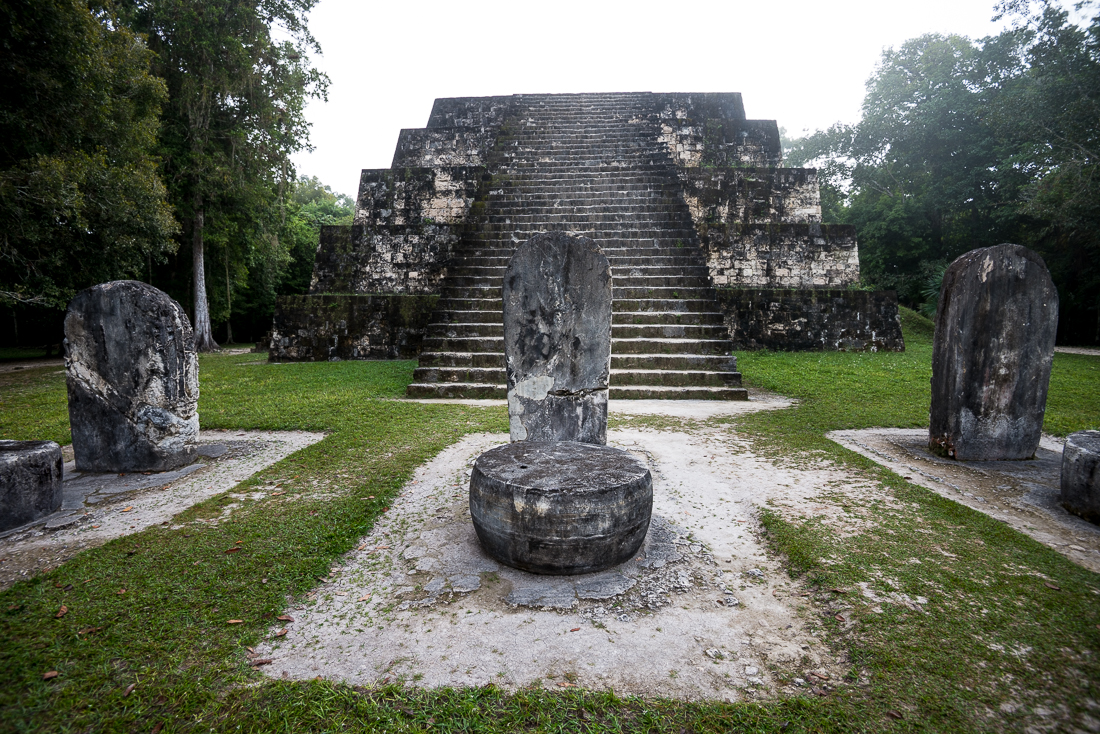
When I started planning this trip to Belize and mentioned that I’d try to get my SCUBA certification while I was here, pretty much every person I said this to responded, “What?  You don’t already have that?”  So I guess this was something I was supposed to do (or to have done already).

IMG_1446

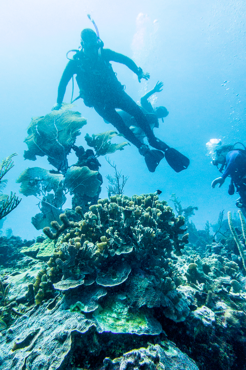
If you’ve ever been tempted to learn to SCUBA, let me endorse a plan.  I did the “written” part online (at home), then did the pool sessions in two afternoons in Houston.  Then I did my open water qualification dives in some of this hemisphere’s best SCUBA country — the reef just off Ambergris Cay, near San Pedro, Belize.  We covered the required skills, but 80% of the time, we were just swimming around enjoying the sights.  I got paired up with a group of fun Canadians who made their living building fancy vacation homes in zero degree weather.  They were happy to be in sunny Belize.

IMG_1361

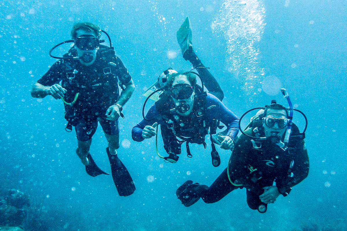
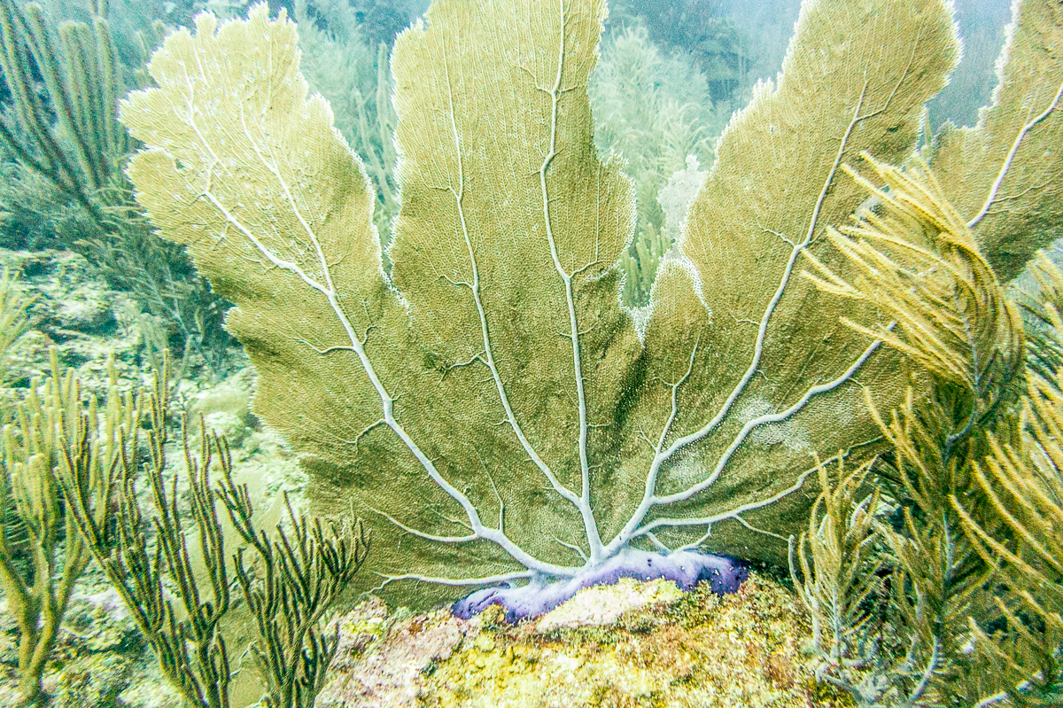
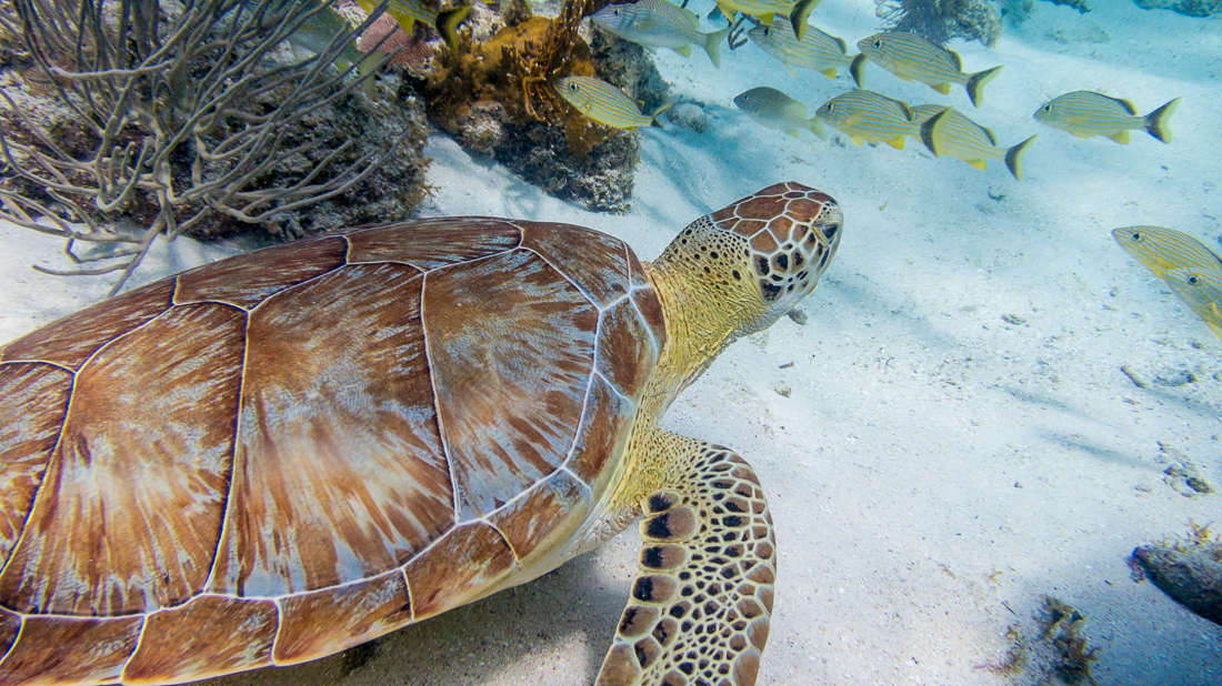
Yes, those are sharks.  We saw several — I’d been in the water about ten seconds when I saw my first one.  They’re harmless (to us) nurse sharks.  I liked the yellow turtle the most:  that thing was nearly three feet in diameter!  All in all some pretty amazing sights to be seen just 60 feet or so below the waves.  A big shout-out to my instructor, Gilbert, at Chuck & Robbie’s Dive Center in San Pedro.  (That’s me in the last picture in the grid — photo credit for that one goes to one or the other of my underwater Canadian buddies.)

Camera folks:  I used my “pocket” Canon S100, and bought Canon’s dedicated WP-DC43 underwater housing — which is not expensive at all relative to a DSLR housing.  It’s got at least a dozen buttons and knobs, so literally every menu and adjustment is available, down to 130 ft.  It worked great for my purposes.  As you can see, when you get deep, it gets very blue, so you MUST shoot in RAW and crank the white balance a ton (add lots of yellow and a ton of magenta!).  Get super-close.

IMG_1345

Tikal, Guatemala: A Glimpse of the Americas in 900 A.D.

Some big piles of rocks in a Guatemalan jungle may change your thinking about “American” history.

_JCE1101

Tikal, Guatemala — Temple II

In the year 800 or so, Tikal was a city of nearly 100,000 Mayan people, set in the northeast part of what is now Guatemala.  Huge temples and plazas were the centerpiece of the city; farmers tended the fields for miles in every direction.  The society collapsed around the year 900, for reasons no one fully knows for sure, and the huge structures were quickly swallowed up by the jungle until they were rediscovered and revealed by archaeologists 1,000 years later.

_JD85312

Tikal – Northern Acropolis

 If your image of our continent’s early history is mostly teepees and arrowheads, you’ll be pretty impressed by places like Tikal.  Most of us (including, I think, many Native Americans themselves) picture the American continents’ indigenous peoples as mostly hunters and gatherers in sparsely populated environments, living lightly on the land with modest agriculture and minimal construction.  If that’s the image in your head, a trip to a place like Tikal, Guatemala will change your assumptions.  Before the end of the first millennium A.D., there were tens of millions of people in the Americas, including huge cities and huge structures in what are now Mexico, central and South America.*

_JCE1072

Exactly what happened to all those ancient “Americans” is a bit of a mystery, but at least a part of the answer is smallpox.  The first European explorers – themselves largely immune due to generations of exposure – inadvertently brought the smallpox virus when they landed in the New World.  The virus spread faster than the European explorers did, so by the time (decades or even centuries later) most of the region was seen by Europeans, most of the “natives” were already dead from disease.  By some estimates, 95% of the continents’ population – perhaps a fifth of the world’s population — died in a wave of smallpox.  What European explorers “discovered” as they probed the continents were the minimal remnants of civilizations that had been as big (and in many ways as advanced) as those in Europe, Asia and the Middle East.  Tikal was already six feet under (literally) the jungle floor.

c8-_JD85254.jpgc41-_JD85290.jpgc34-_JD85384.jpgc24-_JD85312.jpgc32-_JCE1099.jpgc1-_JD85354.jpgc32-_JCE1101.jpgc15-_JCE1185.jpgc9-_JD85376.jpgc45-_JD85374.jpgc48-_JCE1303.jpgc57-_JD85460.jpgc62-_JCE1257.jpgc69-_JCE1086.jpgc84-_JCE1178.jpgc96-_JCE1072.jpgc72-_JCE1339.jpgc66-_JCE1135.jpg

Though Tikal had apparently seen its decline before the smallpox era, the site will certainly give a glimpse of the degree of “civilization” that existed on our own continent long before Columbus stumbled upon it.  Besides the sheer number of walls and buildings and monuments, the most striking features are the big temples – meso-American pyramids.  A similar temple at one of the Mayan sites in nearby Belize is, to this day, the tallest manmade structure in that country.

_JD85374

Tikal — Stone monument detail

Tikal – Grand Plaza (from Temple II)

This was my first trip to Guatemala, and I was surely impressed.  More to come from Central America…

= = = =

Update:  A few more daylight images from my return to Tikal a week later.  Night time images are here.

_JCE1988.jpg_JCE1993.jpg_JCE2015.jpg_JD86865.jpg

Houston Swoncert — Swon Brothers in Houston

I got to crash a private party in Houston this week where the Swon Brothers were performing a small just-two-guys-and-their-guitars concert.  I’ve talked about the Swon Brothers before here — they’re from eastern Oklahoma and have lots of connections to my home town.  I enjoyed the ‘small’ show even more than I’d enjoyed the big flashy version I saw a few weeks back.  Thanks to the brothers and my buddy Greg (their tour manager) for letting me join the fun.

New Zealand Roadtrip

Of course New Zealand has plenty of famously beautiful spots, but maybe the most striking thing about it is just how pretty the ‘ordinary’ roadsides and countrysides are.

I wound up with several images that hadn’t found a ‘home’ in the prior posts, so I had to add one more.  Most were just stops along the road as I logged 2,000 or so miles criss-crossing the South Island.  I’d also planned to see the North Island, but I somehow never made it that far and had to fly out of Christchurch instead of Auckland.  Plenty to see here.  In case it’s not already obvious, I like just driving around seeing the sights (and the sites).

I spent another night in Queenstown and made another trip through Wanaka after I did my first post.  Thus the nighttime shot from the gondola above Queenstown, and the shots of the sailboats and the somehow-famous semi-submerged tree at Lake Wanaka.  The glacier is Fox Glacier — on the West (Tasman) coast about halfway up the South Island.  My favorite image here is the one of the Waiau River, up near Hamner Springs.  Those wild yellow flower bushes were amazing.

Since a couple of the shots have sheep and deer in them, I’ll offer one last set of New Zealand factoids — about animals.  New Zealand has no indigenous land mammals (there are a few bats and several sea mammals).   Also no land snakes.  Whether you ascribe this to Noah or to Darwin, it’s a fascinating curiosity that New Zealand was (forgive me) mostly ‘for the birds!’  The absence of mammalian predators has lots of impact:  Many of the bird species (including the kiwi itself) are flightless, for example.  And when humans (starting with the Polynesian Maori) brought with them (purposefully or inadvertently) mammals like deer, rats, and possum, they multiplied like crazy to the point they all became major pests.

Today there are lots of mammals.  Plenty of cattle, and sheep that outnumber humans 10 to 1.  The deer ‘problem’ has been solved by domesticating them; there are huge high-fenced fields of hundreds of deer, grazing just like cattle and creating a significant venison industry.  Amusingly, I decided to be sure I got a nice New Zealand Merino Wool sweater while I was here.  When I tried on my favorite, they bragged that it was actually 40% possum.  I told them that wouldn’t seem very luxurious in the U.S., but they insisted that the south-seas Australian brushtail was a different animal altogether.  I was dubious on several levels.  But I bought the sweater.

_JCE3272.JPG_JCE3307.JPG_JCE5510.JPG_JCE5530.JPG_JCE5535.JPG_JCE5545.JPG_JCE5556.JPG_JCE5565.JPG_JCE5567.JPG_JCE5601.JPG_JD81468.JPG_JD81533.JPG_JCE5624.JPG_JD81566.JPG_JCE5637.JPG_JD81383.JPG_JD81419.JPG_JD81433.JPG_JD81445.JPG_JD81956.JPG_JD82108.JPG_JD82129.JPG


By the time you’re reading this, I’m already home in Houston — mostly likely planning another trip. 


New Zealand: Abel Tasman National Park

Abel Tasman is a big name in New Zealand.  You may think you’ve never heard of him, but you’ve heard of the Tasmanian Devil (from Bugs Bunny if not from the local zoo).  That little devil was named after the Australian island of Tasmania, which in turn was named after Abel Tasman.  He was the Dutch explorer who first sailed to New Zealand back in the 1640s.  Today, New Zealand’s longest glacier, its second-highest mountain, a river, a lake, a rock band, a national park, and the entire Tasman Sea between New Zealand and Australia are named for him.

Tasman stopped for water in New Zealand, wrongly thinking it was part of Argentina.  The friendly Maori locals attacked him and killed some of his sailors.  He bravely sailed away, never to return.

A lot of the European explorers of that era were “discovering” lands that had been inhabited by humans for thousands or even tens of thousands of years.  But the arrival in New Zealand of the Europeans and the ‘aboriginal’ Polynesian Maori was a virtual dead heat by those standards — the various tribes of Maori arrived starting around the year 1300 and apparently spent much of the next 500 years warring among themselves for control of lands (occasionally eating the conquered, and maybe a few 18th-century European missionaries).  It was the Brits who ultimately took control in the 1800s, so British customs, language, culture (and left-sided driving) prevail today.

The Abel Tasman National Park is New Zealand’s smallest national park — and perhaps that’s fitting, given his short and inauspicious time here.  (I’ve spent more time here than he did, after all, and my interactions with the locals have been much more amicable).  The main activity at the Park is hiking — mostly along the coast, from beach to beach through rain-foresty jungle.  I spent a couple of days here.  There are ‘huts’ where you can sleep inside the isolated parts of the park, but I’ll admit I caught the water taxi out and slept in a snug bed at a little ‘lodge’ back in the town of Motueka.


_JD81701.JPG_JD81724.JPG_JD81762.JPG_JD81765.JPG_JD81781.JPG_JD81891.JPG