Category Archives: Landscapes

Scotland: Skye and the Outer Hebrides

 OKAY!  Finally — the last of my pictures from Scotland.  Yes, I’ve been home for quite a while, but these were some cool places and I still wanted to share what they looked like.

_JD87553

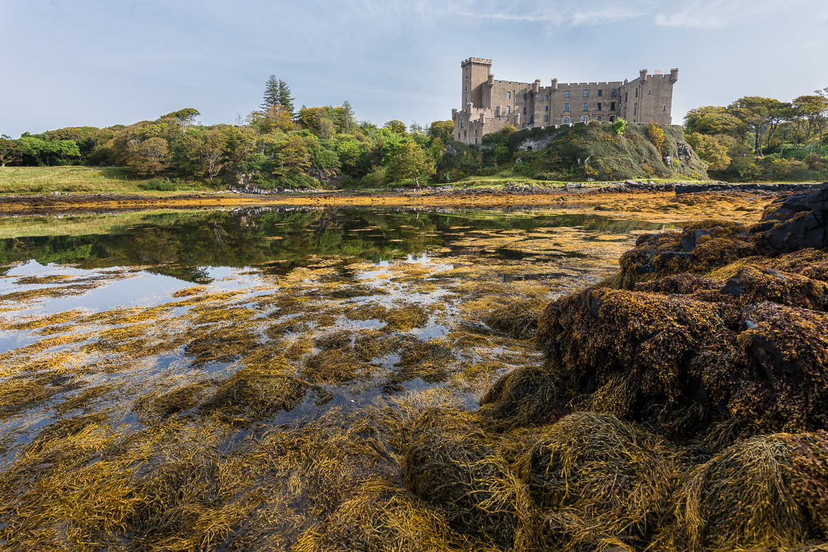
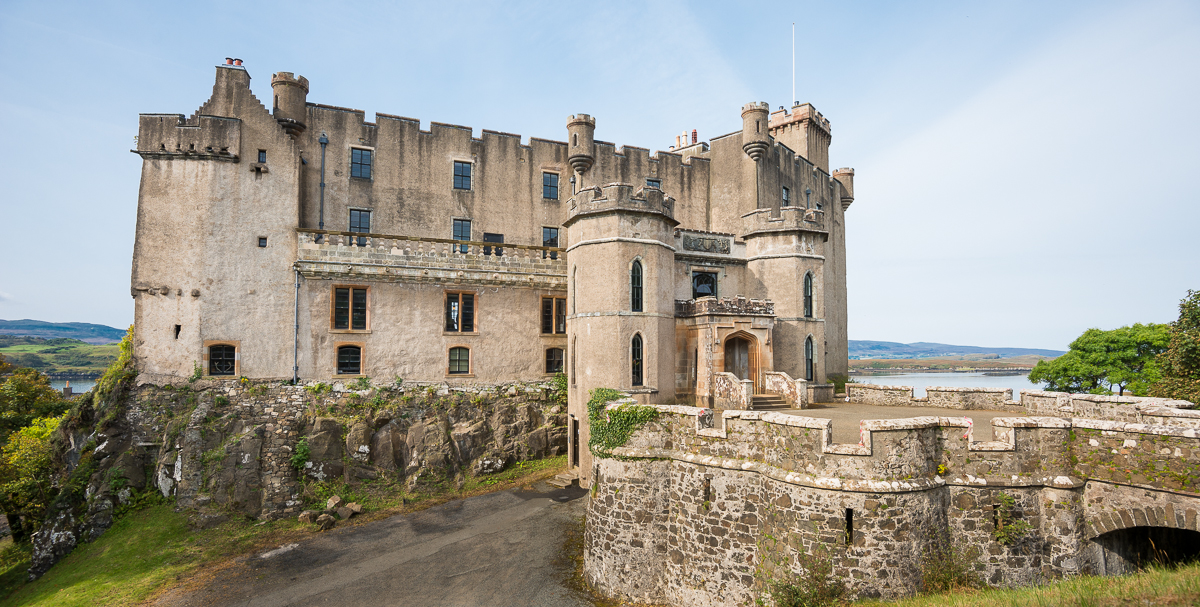
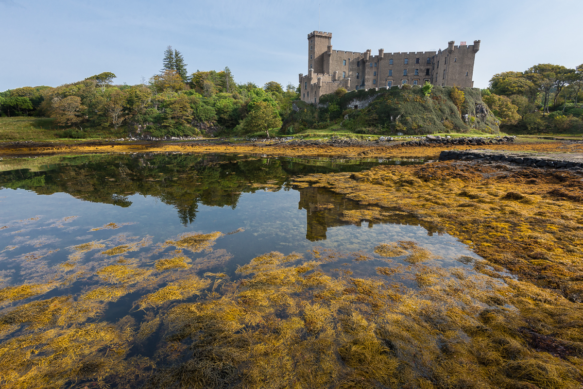
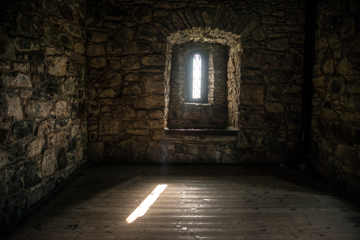
Dunvegan Castle has been the headquarters of the MacLeod Clan for over 700 years.

Not surprisingly, Dunvegan Castle, the home of the MacLeod clan chiefs for the last 800 years or so, was chock full of old paintings of men named MacLeod wearing kilts and high socks.  After my visit there, I headed for the ferry from the Isle of Skye out to the Isle of Lewis & Harris, and the big semi next to my car said, “D.R. MacLeod Transport.”  Two of the workers who were getting me checked in on the ferry had name tags with the last name MacLeod.  Apparently the MacLeod clan is alive and well on Skye and Lewis & Harris, just like they have been since before Columbus sailed west.

_JD87495.jpg_JD87476.jpg_JD87529.jpg_JCE5934.jpg_JCE6099.jpg_JCE5907.jpg_JCE6070.jpg
_JCE5907

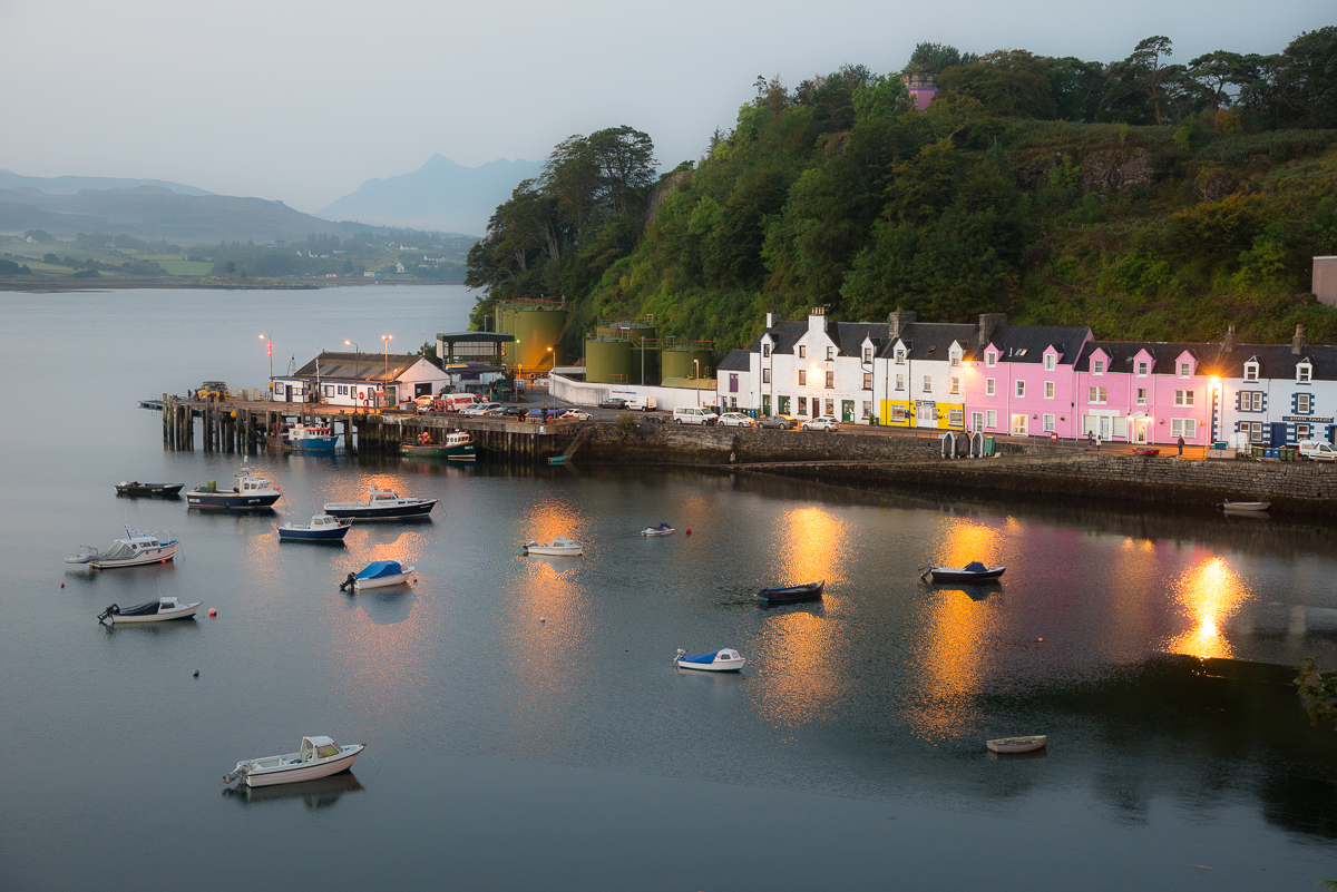
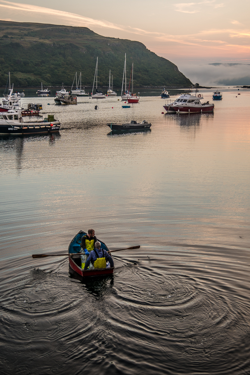
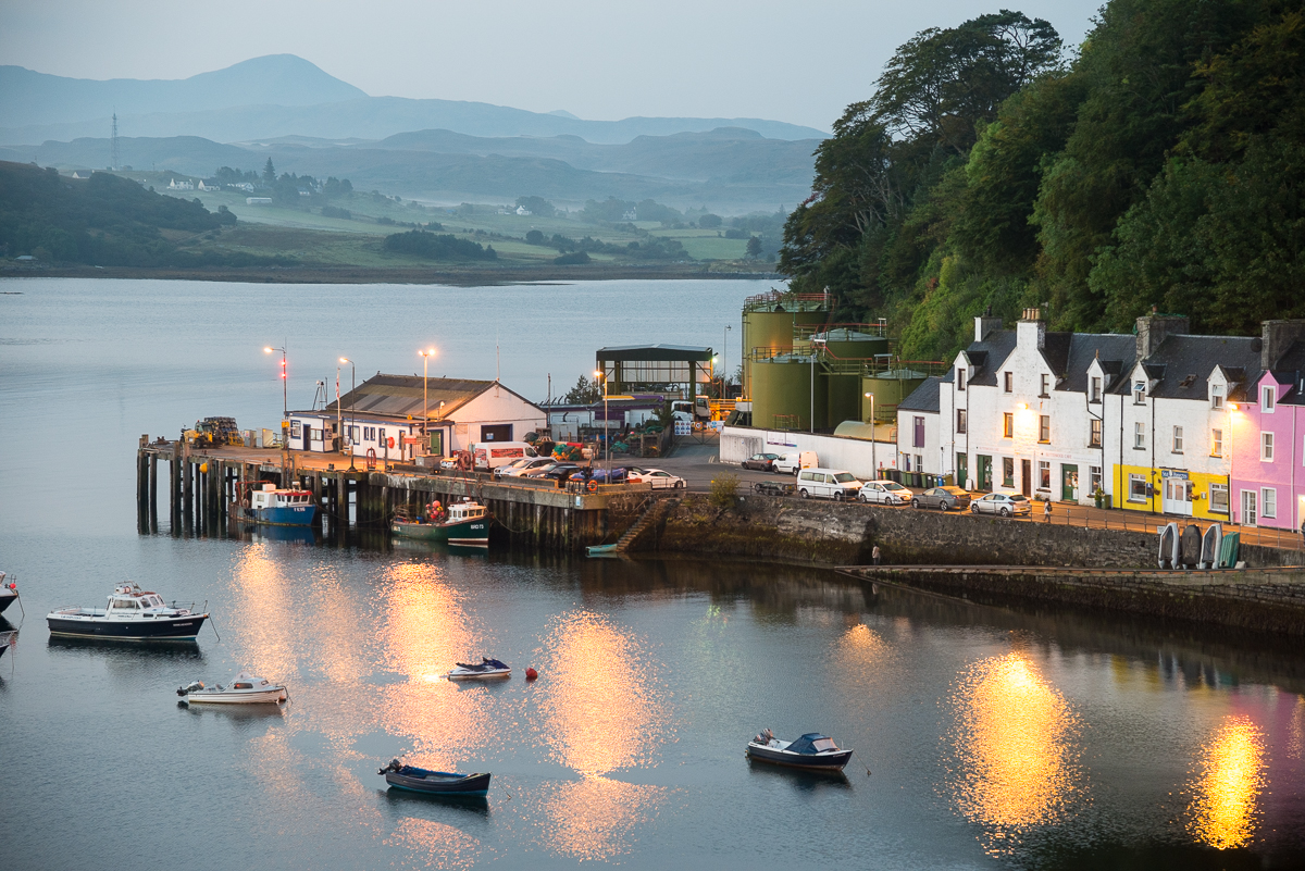
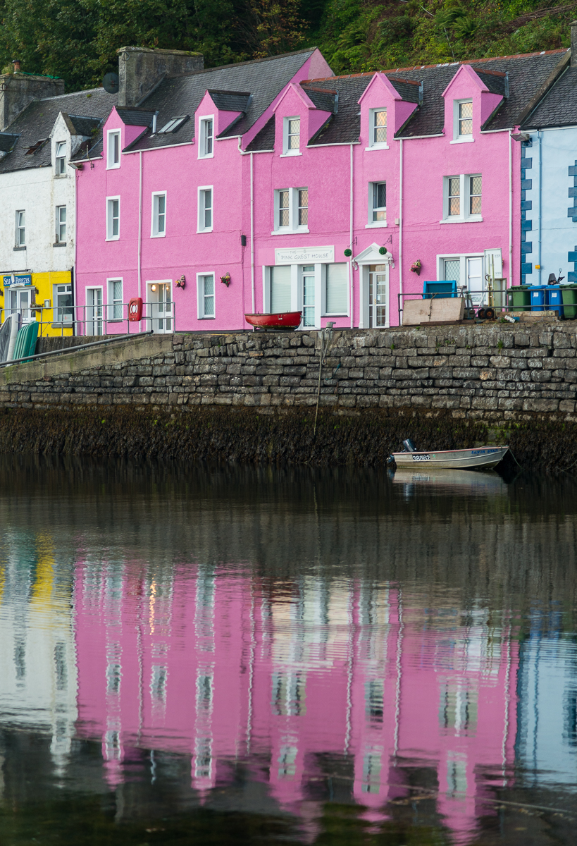
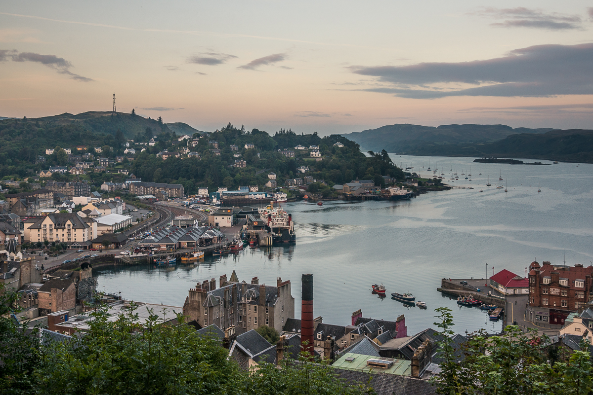
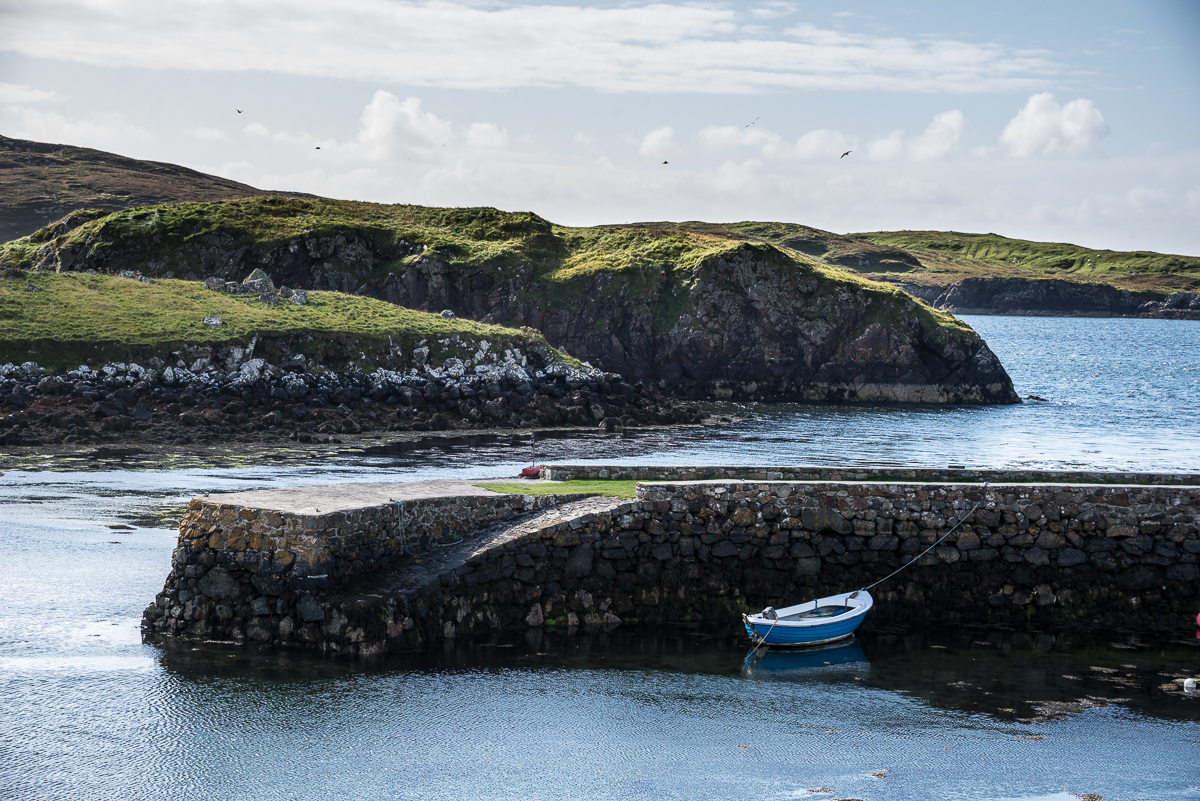
The harbor town of Portree — the biggest ‘city’ on the Isle of Skye — was my home base for a few days on and around the Isle.

The Outer Islands have their own culture.  The area is known for its strong religious heritage – mostly the Presbyterian-ish Church of Scotland, as I understand it.  On Sunday, there was almost nothing open: I finally found one café and one gas station that were (apparently) heathen-operated.

The highway and other signs in the area are written in both English and Gaelic, but a long-time local I quizzed thought that was mostly symbolic.  He didn’t believe there were many people who spoke only Gaelic. I was surprised that I had no trouble understanding the Scottish accents in the Highlands and islands, even though I could barely understand the folks down in Glasgow.  (I was briefly concerned that I was going to be detained at the Glasgow airport because I was unable to understand and answer the several security-screening questions asked in Glasgow-accented “English”).

_JCE6221

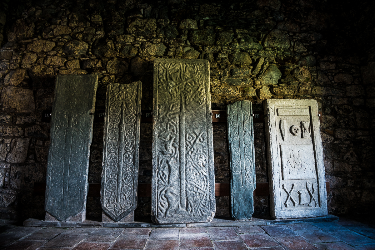
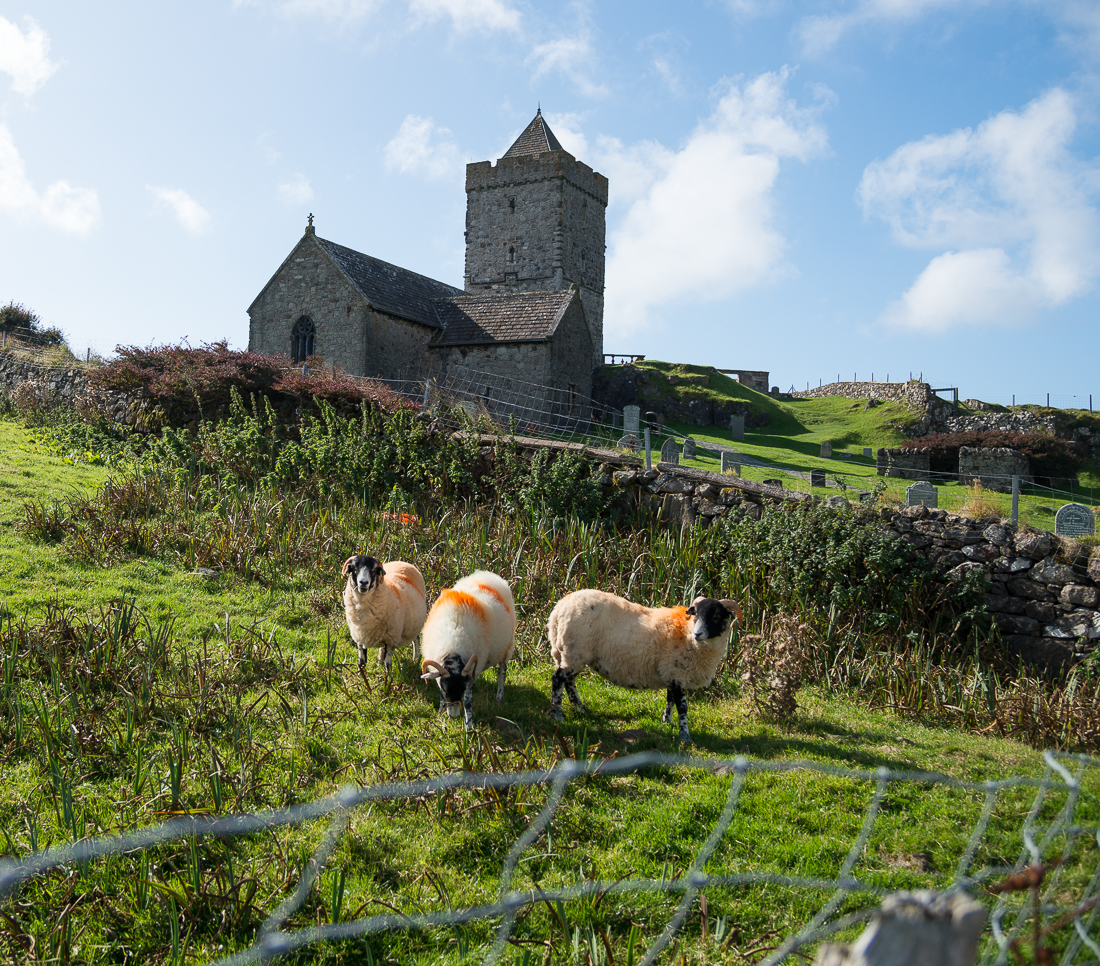
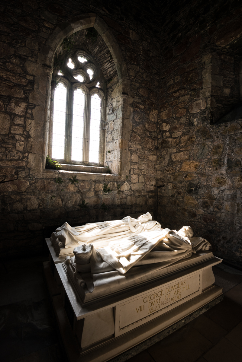
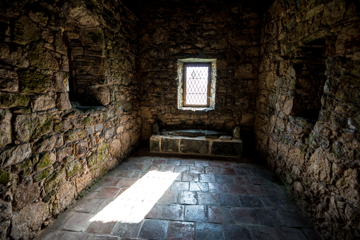
These 600-year-old carvings of swords, displayed inside St. Clements Church on the southeast tip of the Isle of Harris, probably once marked the graves of prominent members of the MacLeod clan.

_JD88502.jpg_JD88598.jpg_JCE6221.jpg_JCE6242.jpg_JD88180.jpg_JD88316.jpg_JD88436.jpg_JD88610.jpg_JD88618.jpg_JD88715.jpg_JD88744.jpg_JD88803.jpg_JD88857.jpg
_JD88316

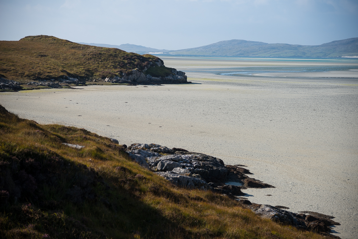
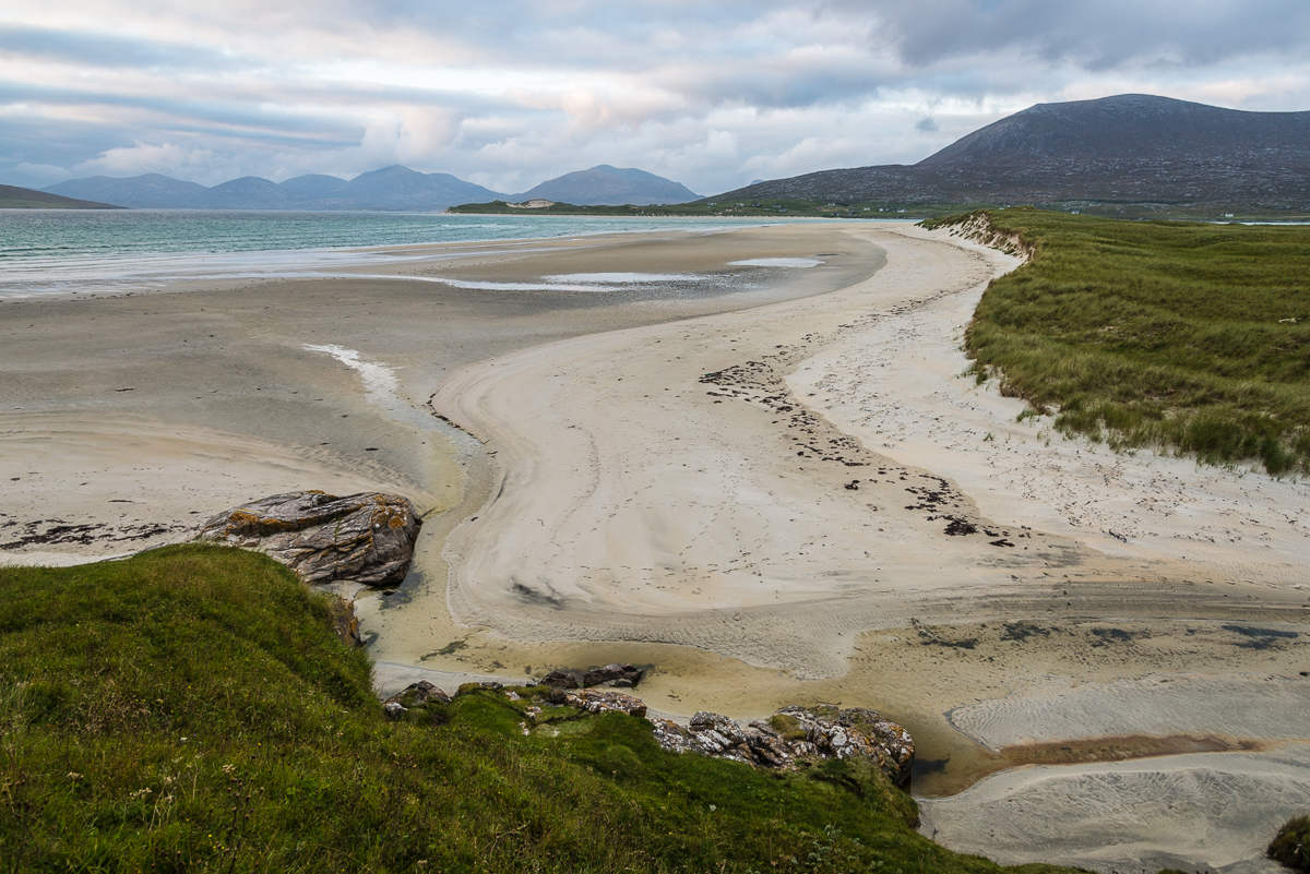
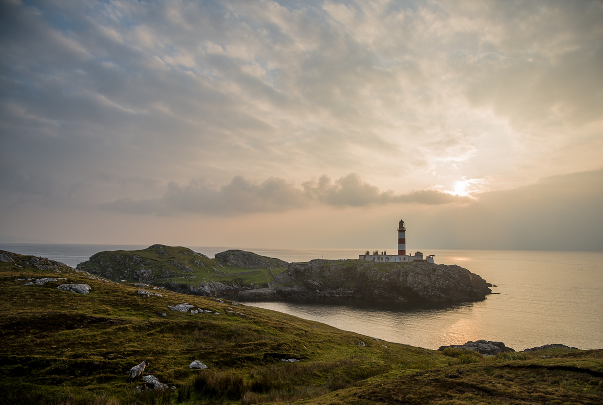
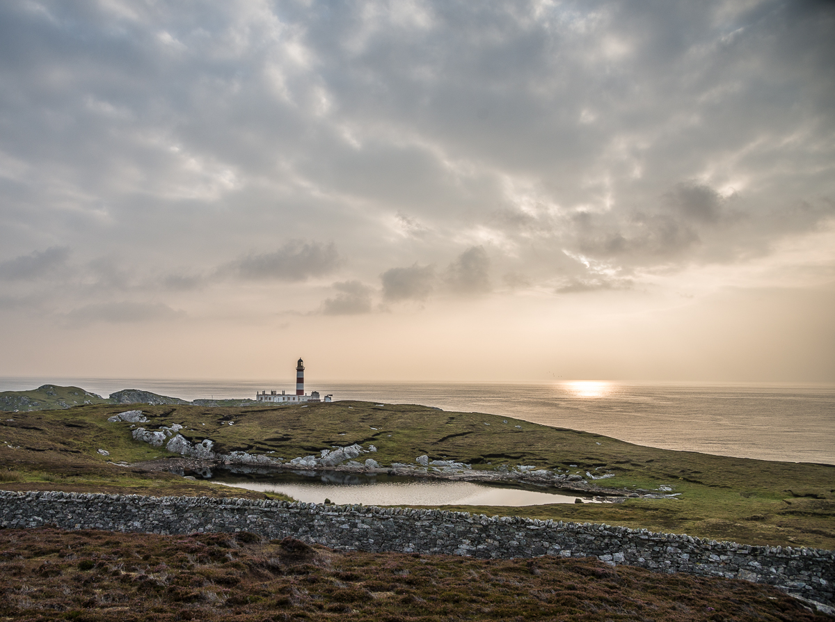
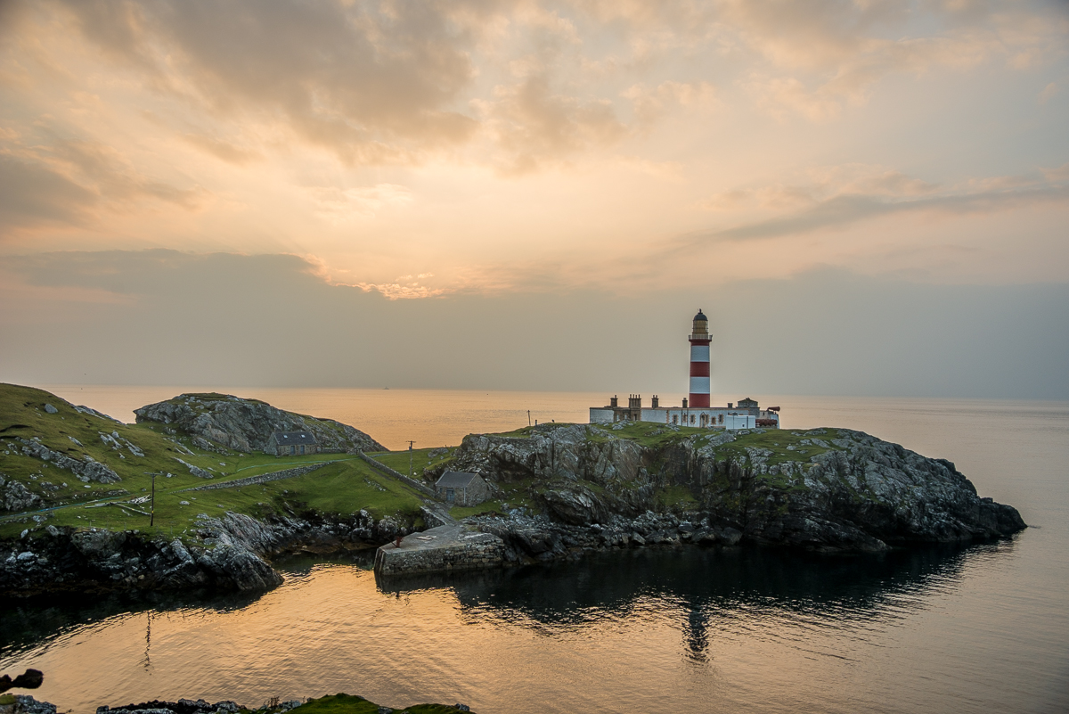
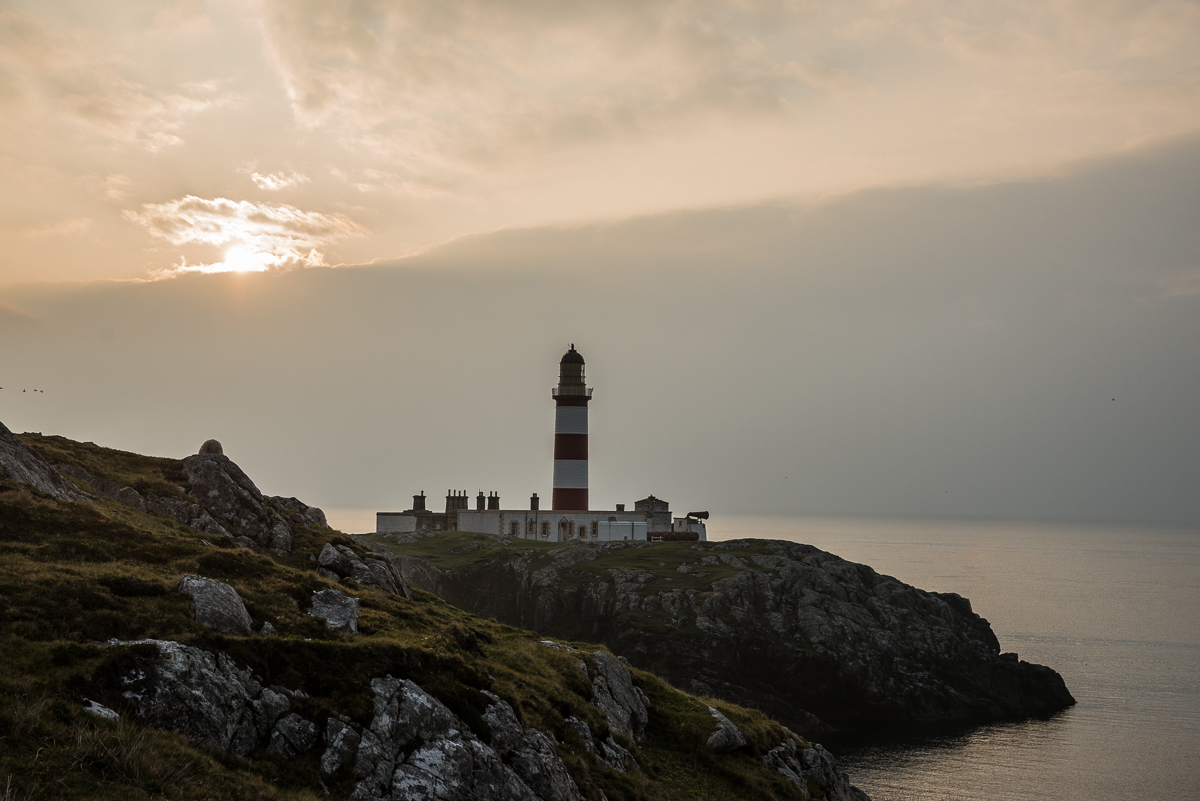
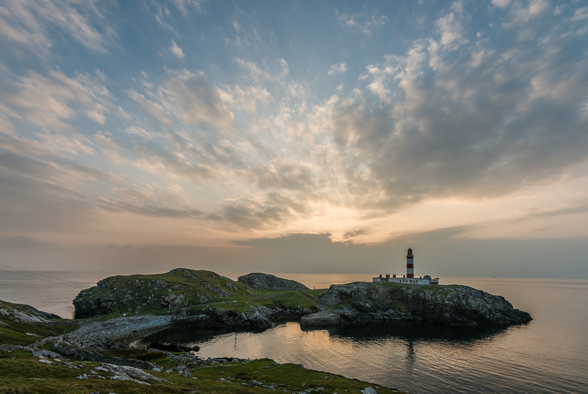
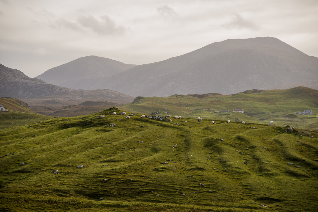
Looking east from the southeast coast of the Isle of Harris, with the Isle of Skye on the horizon.

_JD89195

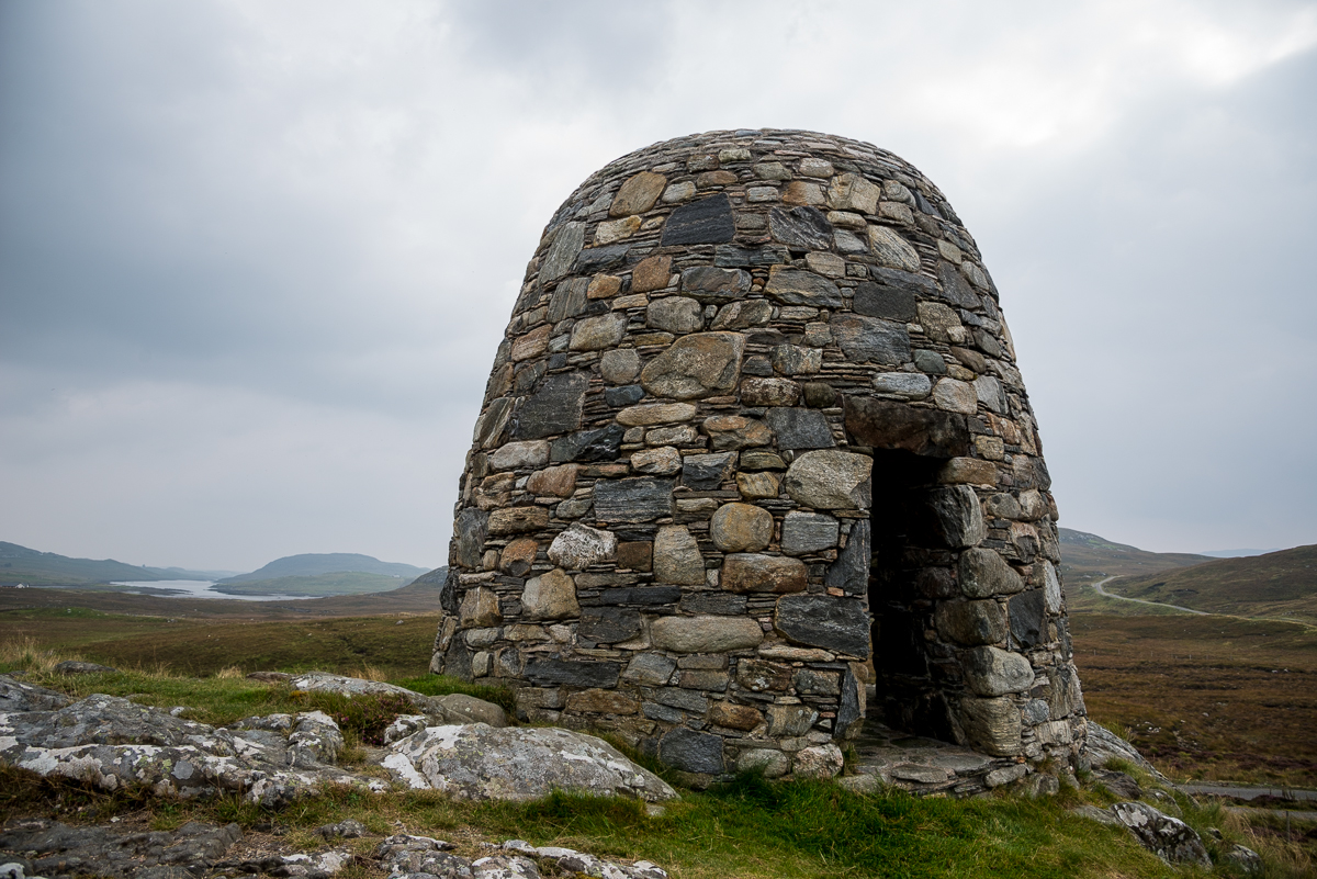
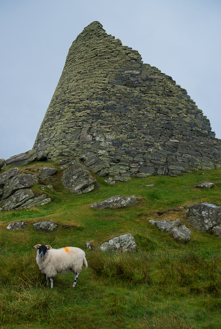
This igloo-looking monument on the Isle of Harris is a modern memorial to a group of protesting local farmers from the late 1800s. A part of it marks the spot where the local sheriff (literally) “read the Riot Act” to the protesters. The Riot Act was English law; if an unruly group gathered (creating a threat of a riot) the sheriff could read a section of the Act ordering them to disperse or else be arrested. I knew the modern idiom of “reading someone the Riot Act” — giving them a strong scolding or warning — but never knew its history!

Before I made the trip, I learned the words and music to “Scotland the Brave”.  It’s the anthem (sometimes regal and sometimes eery) you always hear Scottish bagpipers playing as an iconic musical symbol of the country.  At a minimum, I knew it would be running through my head while I was there, and I wanted to be prepared in case I was caught up in any pre- or post-Independence vote revelry and felt compelled to amuse, or to show some local musical allegiance.  I was ready play it on either guitar or ukulele.  Among the resulting disappointments:  no occasions arose where my would-be barroom antics would have been appropriate; no real patriotic revelry erupted anyway; and — worst of all — I learned that the song was a 20th Century creation (written perhaps in the 1950s).  Somehow I’d imagined it being played for those kilted soldiers who fought alongside Braveheart in the 1200s — not something written for a potential gig on the Ed Sullivan Show.

_JCE6762

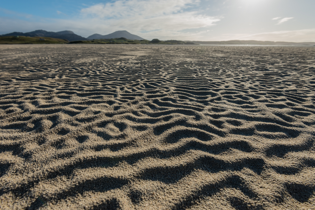
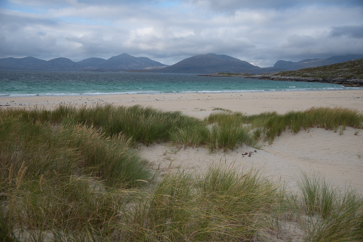
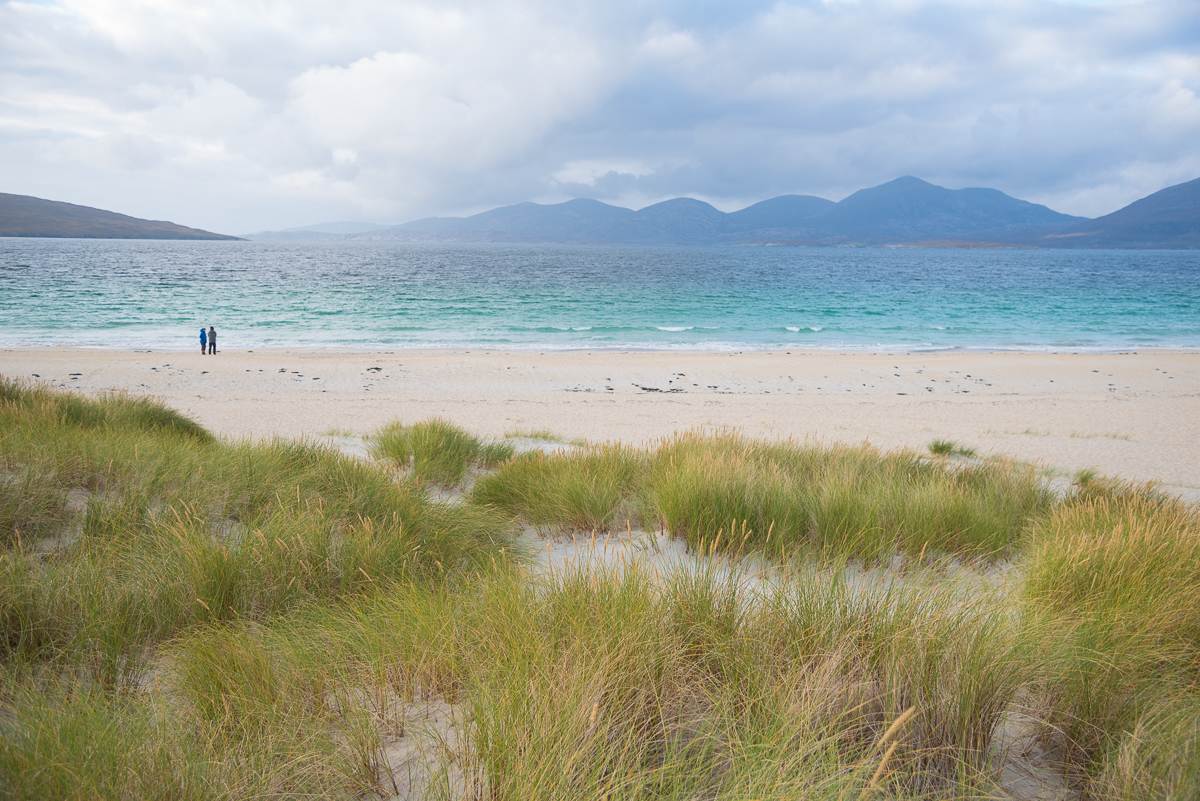
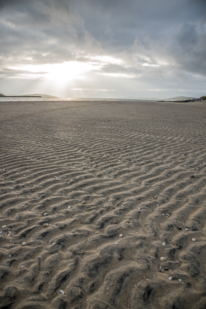
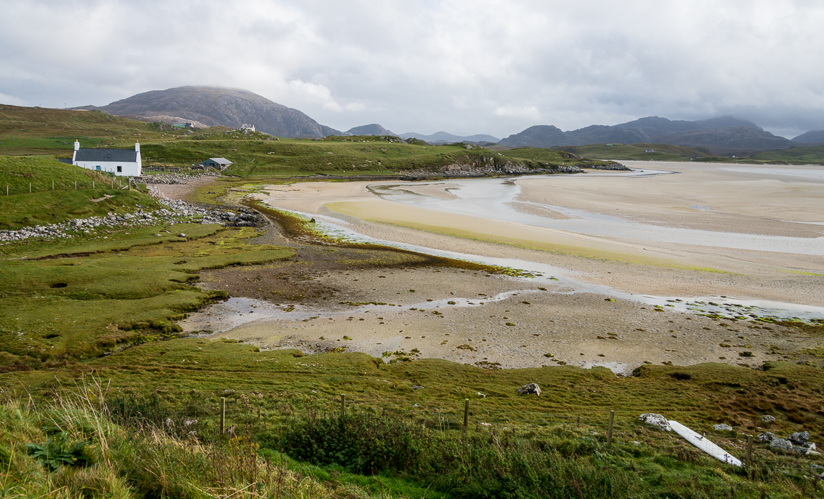
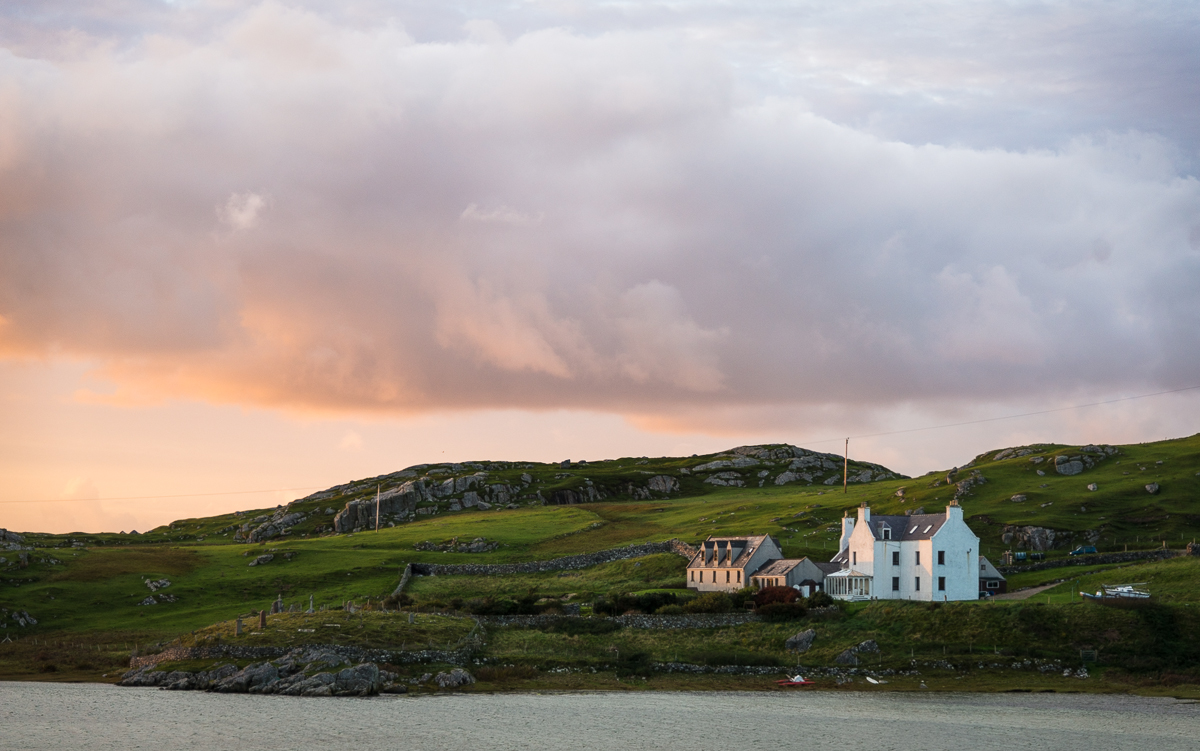
My most-remote destination was the Uig Sands area, on the west side of Lewis & Harris. At low tide, there was a mile or so of flat sand between my 400-year-old guest house and the water. At high tide, the Sands were flooded and the water was only a few yards away.

_JD89537.jpg_JD89577.jpg_JD89657.jpg_JD89812.jpg_JD89901.jpg_JD80024.jpg_JD80060.jpg

In one sense, the Outer Islands were a lot further from home than the mileage might make it seem.   I started toward home at about noon on a Tuesday.  A drive to the port where the ferry would leave the next morning; hotel overnight; ferry to an Inner island; drive to the town where I’d rented my car; taxi across the bridge to the mainland; train to Inverness; another train to Glasgow; taxi to Glasgow airport hotel; morning flight to Newark; airport tram; flight to Houston; parking shuttle; then my trusty Chevy Tahoe back to the house on Thursday night.  I spent almost my entire two weeks in Scotland on the out-of-the-way islands rather than seeing the major cities and sites.  I didn’t even make it to Loch Ness to see the monster.  I had a great trip, but I don’t think I’m ready to cross Scotland off my list.

_JD88857

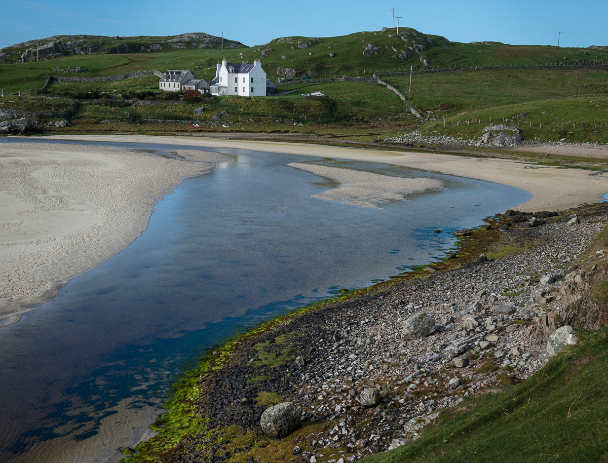
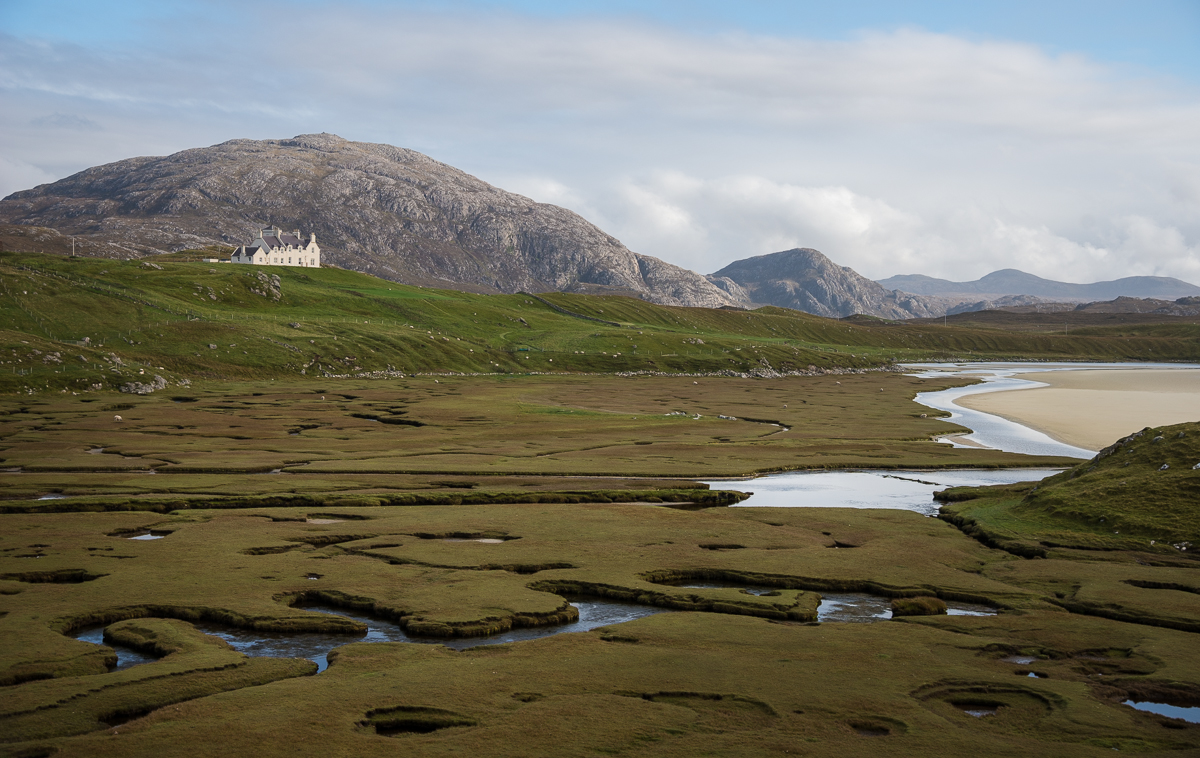
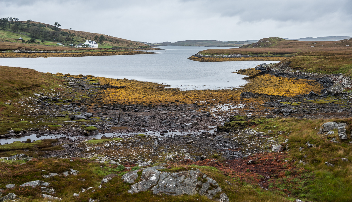
Coastal sands on the Isle of Harris


Scotland 2014: Lighthouses, Sheep, and Dead Economists


Yes, I’ve been home from Scotland for a while, but I’ve got a few more batches of pictures to share.

_JD89127

For 190 years, the Eilan Glas lighthouse has sat on the small peninsula off the Isle of Scalpay (a prior lighthouse was on the same spot in the 18th century).  Scalpay is a tiny island recently connected by bridge to the Scottish Isle(s) of Lewis & Harris.  The peninsula it sits on sticks well out into the Minch – the branch of the Atlantic Ocean that goes between the Inner and Outer Hebrides – which is presumably the reason someone thought a lighthouse was needed there in the first place.  In better light, you can see back to the Isle of Skye.

Honestly, it’s probably hard to be more photographically trite than a bunch of cliched pictures of a lighthouse with a sunrise in the background.  But my pre-dawn hike through the sheepfields of Scalpay was a pretty special experience, and – if I may say so myself – these pictures turned out pretty well.  I only got lost (and wet) a little on my two-hour hike — taking the long way — through coastal sheep fields back to my car.

_JD89156

_JD89014.jpg_JD89112.jpg

_JCE6337


_JD88905

Much of the land in Scotland’s outer islands is part of a Common Grazing system. Local committees generally supervise the land and decide how much livestock each farmer is allowed to graze.

This area of Scotland has lots of sheep, and lots of land dedicated to “common grazing.” In a common grazing system, grazing lands are controlled by the town or by some sort of semi-governmental cooperative, and the individual citizens have some ability to put their livestock on the land for grazing. But nobody owns the grazing land (or maybe everybody sort of does). This is especially interesting (to me) because there is a famous principle of Economics called the “Tragedy of the Commons,” which analyzes the ups and downs of common ownership of resources like this (mostly the downs – thus the term “tragedy”).   The grazing tragedy occurs because every farmer with access to the common grazing land has the incentive to graze as many animals as possible on the seemingly free public land, so the land becomes overgrazed and barren and thus no good for anyone. This rarely happens on privately owned grazing land, because a property owner tends not to spoil his own land. The moral of the story is that when nobody owns the land (or other resource), nobody has a great incentive to care for it.

Solving the “tragedy” can take two seemingly opposite courses: heavy governmental regulation (like the Grazing Committee); or private ownership of the lands. Environmentalists analogize to the concept to argue that something must be done (i.e. regulation) to prevent a similar tragedy from occurring in the “common” air we breathe and water supplies from which we drink.  Because nobody owns the skies or rivers, people are unfortunately inclined to abuse them absent some government control.  On the other hand, conservatives (more precisely: capitalists) point to the “tragedy” concept to teach that private ownership of resources (where possible) is the best way to ensure that they will be well cared for and preserved. Both these arguments are mostly correct, and that’s why the Tragedy of the Common idea is such an important, interesting concept.

Somehow it’s also interesting that Scotland was also the home of Adam Smith, the 18th Century economist and author of Wealth of Nations. Smith is the one who taught the modern world that a capitalist system – where people act in their own financial interest – generally creates better outcomes for a society because private ownership and profit interests usually lead people to direct resources to their most productive and valuable uses. It’s a little ironic that the odd pocket of common grazing systems persists in the country that is Smith’s homeland. He may be rolling over in his Edinburgh grave.

So if you ever wonder what I think about on a two-hour solo hike through quiet Scottish sheep fields on the way to and from an isolated lighthouse, now you know.

_JD80024.jpg_JD88502.jpg_JD88914.jpg_JD89416.jpg_JD89480.jpg_JD89630.jpg
_JD89630

Sheep graze near Uig Sands on the Isle of Lewis

Scotland 2014: Oban, Staffa and Iona

_JD87291

Dunollie Castle, at the north end of Oban Bay

Scotland’s odd little Inner Hebrides island of Staffa is famous for more than sightseeing.  The 19th Century composer Felix Mendelssohn wrote a now-famous overture about it:  the Hebrides Overture (a.k.a. “Fingal’s Cave”).  Too bad there was no orchestra around to play it when I went to visit.  (You can listen to it here if it’s not playing automatically:  http://www.vicenzapuericantores.it/mp3/mendelssohn_hebrides.mp3 ).  The Isle of Staffa is just a few hundred yards across, and is a geological fluke.  It’s a volcanic island with a huge layer of crystalized basalt columns.  Its most famous feature is that sea cave Mendelssohn focused on, now called Fingal’s Cave. It’s about 200 feet deep.

_JD86541

Staffa


_JD86541.jpg_JD86562.jpg_JD86589.jpg_JD86818.jpg_JD86852.jpg_JD86863.jpg_JD86977.jpg

The trip back from Staffa consists of an ferry ride to the Isle of Iona, another ferry to the Isle of Mull, a car ride to catch the ferry back to Oban on the mainland.  The church in the pictures is the Iona Abbey, established in 563 A.D. by now-Saint Columba and now a busy pilgrimage destination for folks who (for some reason) want to visit Columba’s grave.  That prominent stone cross, St. Martin’s Cross, is over 1200 years old.  The pretty pictures of the bay and from the ferry are Oban Bay.

_JD85676.jpg_JD87086.jpg_JD87134.jpg_JD87191.jpg_JD87246.jpg_JD87291.jpg

_JD85676

_JD86977

2014-09-26 19.28.14_resized-2

I was lucky to be able to travel Scotland with Jim Richardson and a couple of Scotch natives as guides. Jim is a long-time National Geographic photographer and is their go-to guy for Scotland; he’s been there dozens of times. In fact, the August 2014 edition of NatGeo has one of Jim’s photo essays from Scotland as its cover story. Great to have Jim to show about a dozen of us around  Scotland. That’s Jim in the red jacket waiting on the dock in the picture above (apparently someone from the group was late getting back to the boat . . .)

Scotland 2014: Gylen Castle

_JD86154

The Scottish Isle of Kerrera is just a few hundred yards off the mainland west coast, near the town of Oban in the southern part of the Inner Hebrides.  A few dozen people (one of whom tends to 100 or so pet parrots) live there.  The sightseeing highlight is Gylen Castle, built on the south end of the island in about 1582.

To get to Gylen, you take a short ferry from Oban, then walk about three miles.  The ferry is a small one-car ferry, so you just stand where the one car would normally be.   When you get out near the castle, there’s no visitor center, no admission charge, no security guards or park rangers.  It’s just out there by itself like it has been for the last 500 years.

The castle was built by the MacDougall Clan and used in support of James I – then the king of a united England, Ireland and Scotland.   In the mid 1600s, he was at war with the “Covenanters” (crazy Presbyterians, apparently).  They laid siege to the MacDougall Clan soldiers at Gylen.  Apparently the castle’s defense systems had one big flaw – access to fresh water.  The very thirsty soldiers holed up inside were eventually coaxed into coming out voluntarily, only to be promptly killed by their surrounding attackers.

_JD86317

Gylen wasn’t a true “castle,” but was more of a small watchtower or fort.  Its perch above the waters  was a perfect vantage point to watch for threatening ships entering the Firth of Lorn near Oban.  Now that same perch makes modest Gylen one of Scotland’s most picturesque spots.

_JD86023.jpg_JD86196.jpg_JD86347.jpg_JD85845.jpg_JD86381.jpg_JD86436.jpg

 _JD86053

A Hawaiian Connection: Mahalo, United Airlines

IMG_1712

The view of Honolulu and Waikiki from atop Diamond Head Crater.

On my way home from Australia, my connecting flight was cancelled, leaving me stranded in the middle of the Pacific and halfway home.  Happily, that was Honolulu.  My 2-hour layover became a 26-hour layover, leaving me time for dinner on the beach, a morning run to and up Diamond Head Crater, and an afternoon on Waikiki before heading back to the airport and resuming the trip.  I got just a handful of pictures.  It worked out well, so I’ve decided to wholly forgive (and maybe even THANK?) United Airlines for the screw-up.

At least the botched connection had a huge silver lining.   The airline debacle on the front end of that trip was all downside.  I arrived in Cairns, Australia on a Sunday, and my bicycle (needed for the triathlon I was there to do) arrived four days late, after an unintended (and unattended) tour of Tokyo and Sydney (neither of which were on my travel itinerary).  At least it got there in plenty of time for the race.

_JD83039.jpg_JD83052.jpg_JD83071.jpg20140613_120044.jpgIMG_1690.jpgIMG_1712.jpgIMG_1713.jpgIMG_1723.jpgIMG_1736.jpg
_JD83071

Waikiki Beach, at the Moana Surfrider Hotel