Category Archives: Travel

Scotland 2014: Lighthouses, Sheep, and Dead Economists


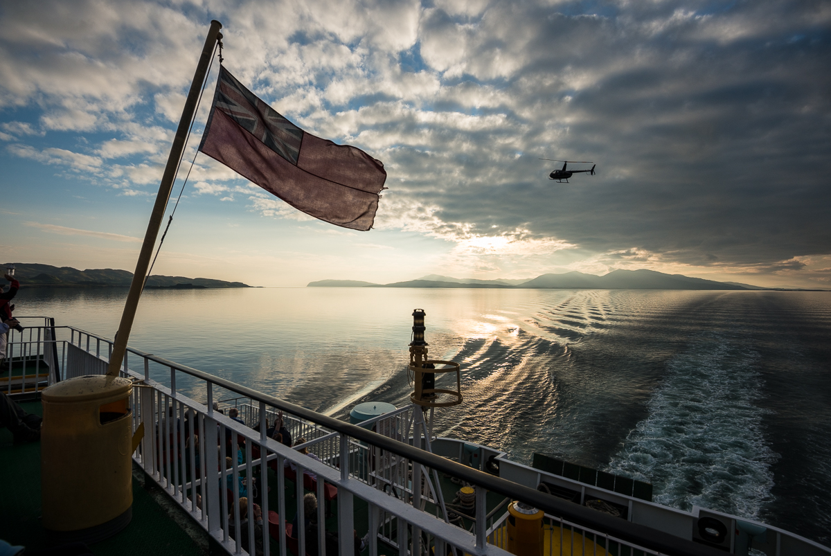
Yes, I’ve been home from Scotland for a while, but I’ve got a few more batches of pictures to share.

_JD89127

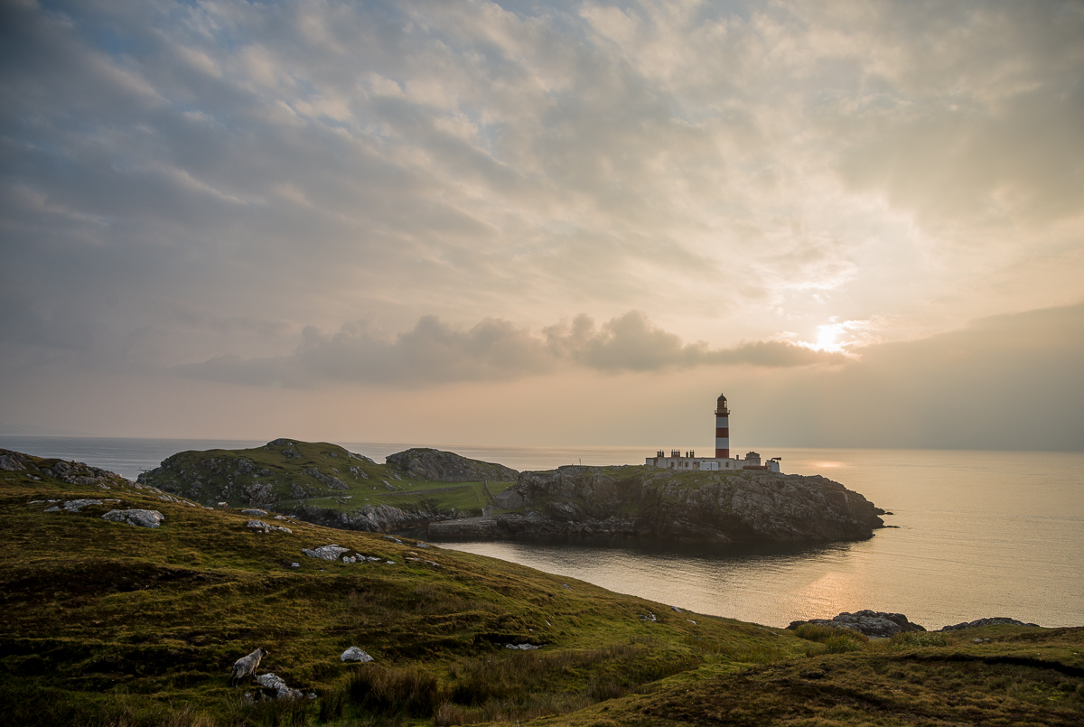
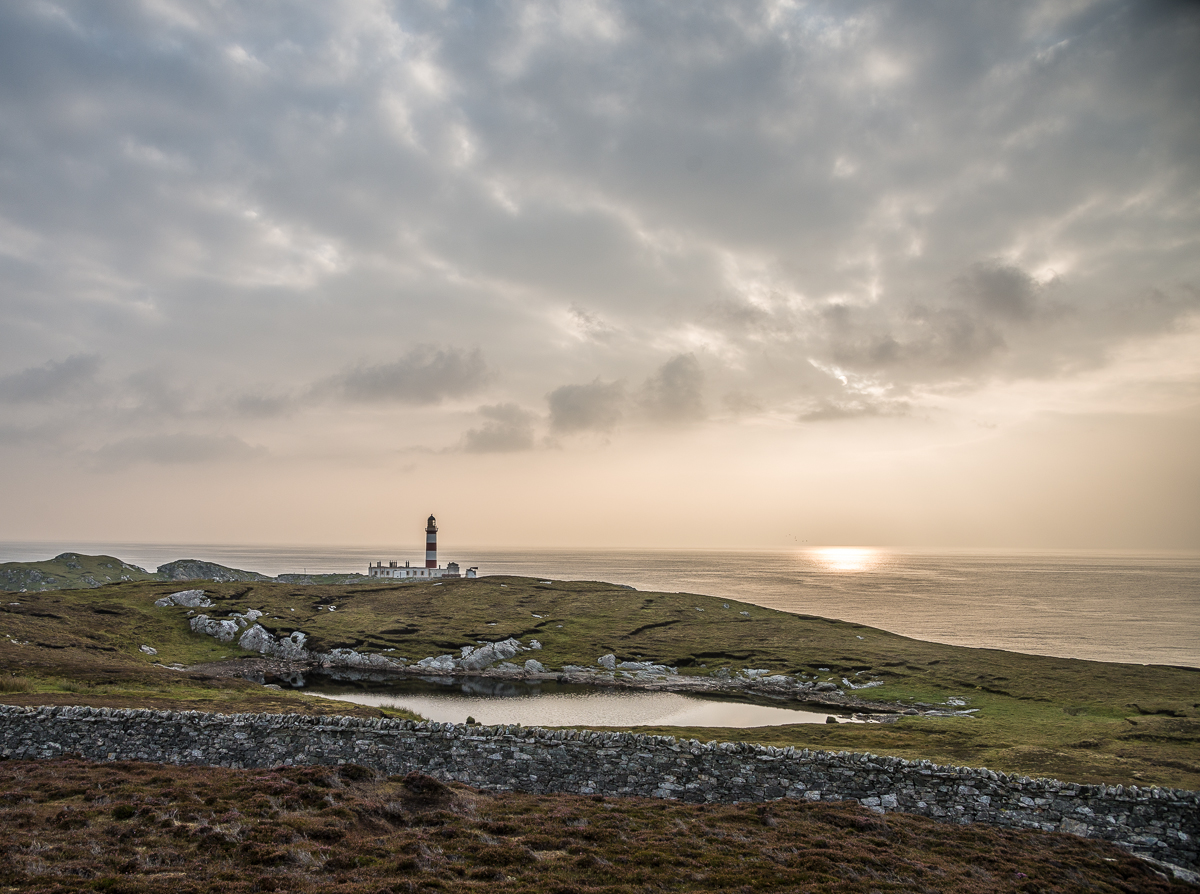
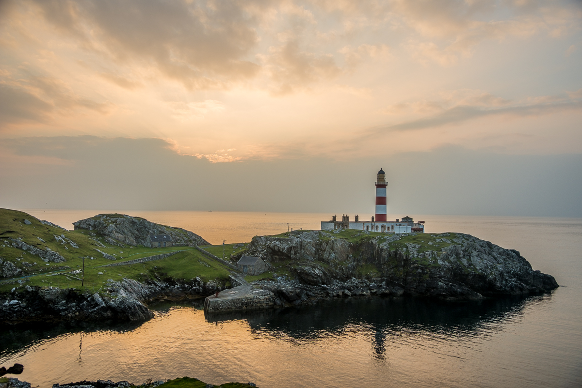
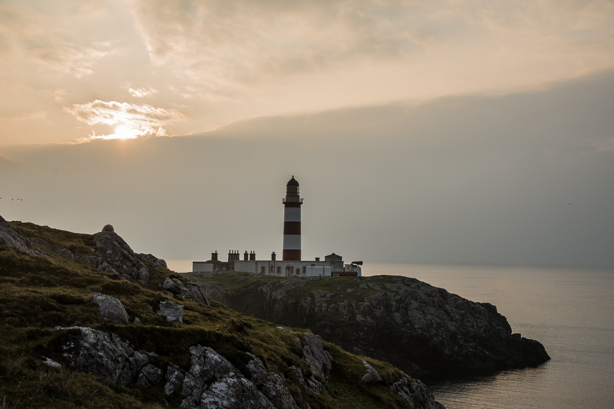
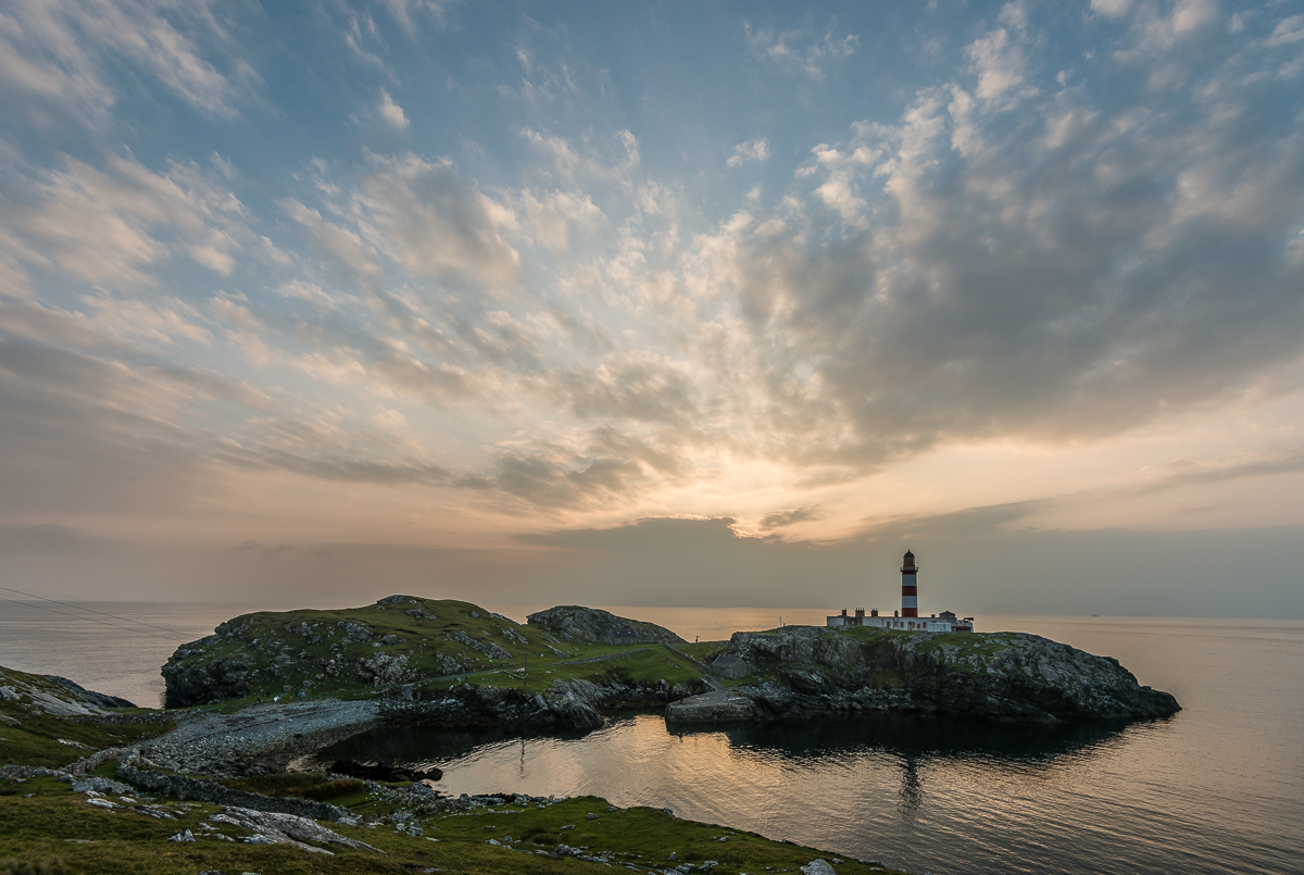
For 190 years, the Eilan Glas lighthouse has sat on the small peninsula off the Isle of Scalpay (a prior lighthouse was on the same spot in the 18th century).  Scalpay is a tiny island recently connected by bridge to the Scottish Isle(s) of Lewis & Harris.  The peninsula it sits on sticks well out into the Minch – the branch of the Atlantic Ocean that goes between the Inner and Outer Hebrides – which is presumably the reason someone thought a lighthouse was needed there in the first place.  In better light, you can see back to the Isle of Skye.

Honestly, it’s probably hard to be more photographically trite than a bunch of cliched pictures of a lighthouse with a sunrise in the background.  But my pre-dawn hike through the sheepfields of Scalpay was a pretty special experience, and – if I may say so myself – these pictures turned out pretty well.  I only got lost (and wet) a little on my two-hour hike — taking the long way — through coastal sheep fields back to my car.

_JD89156

_JD89014.jpg_JD89112.jpg

_JCE6337


_JD88905

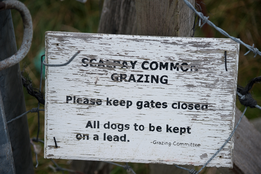
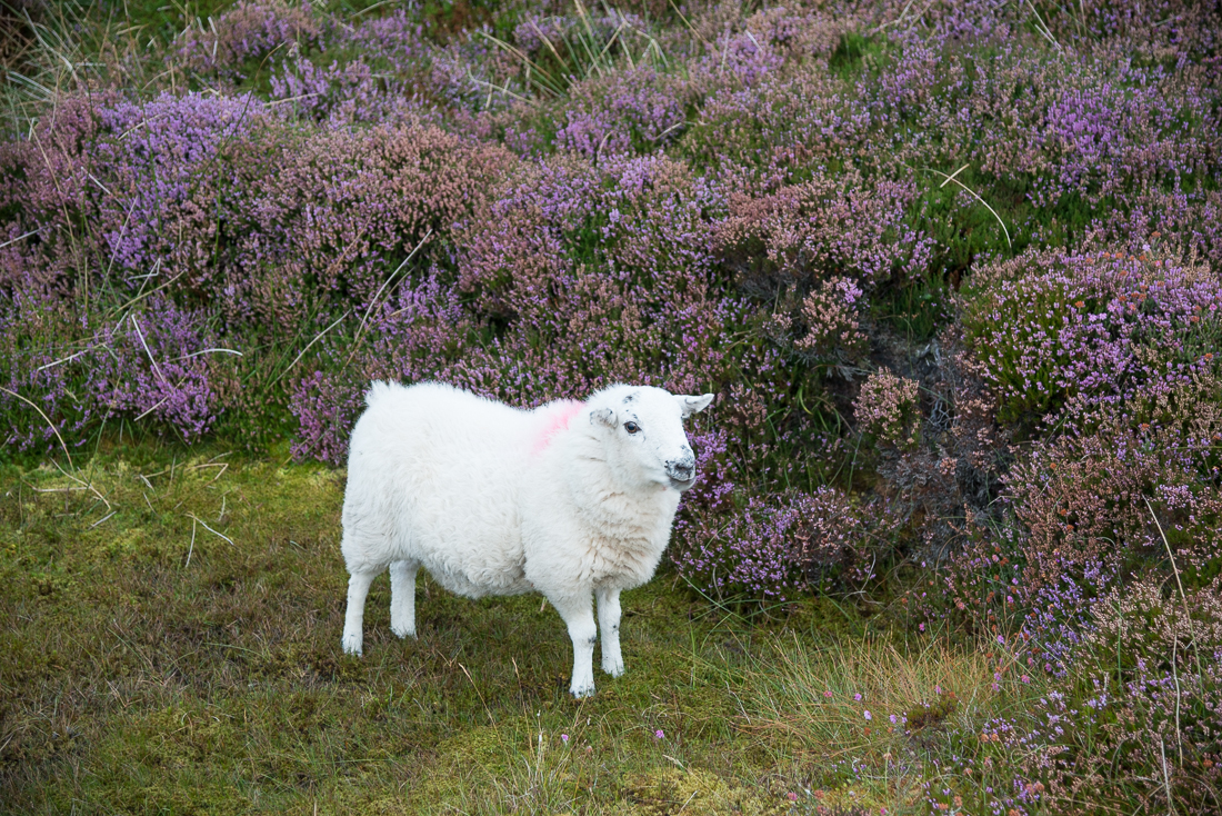
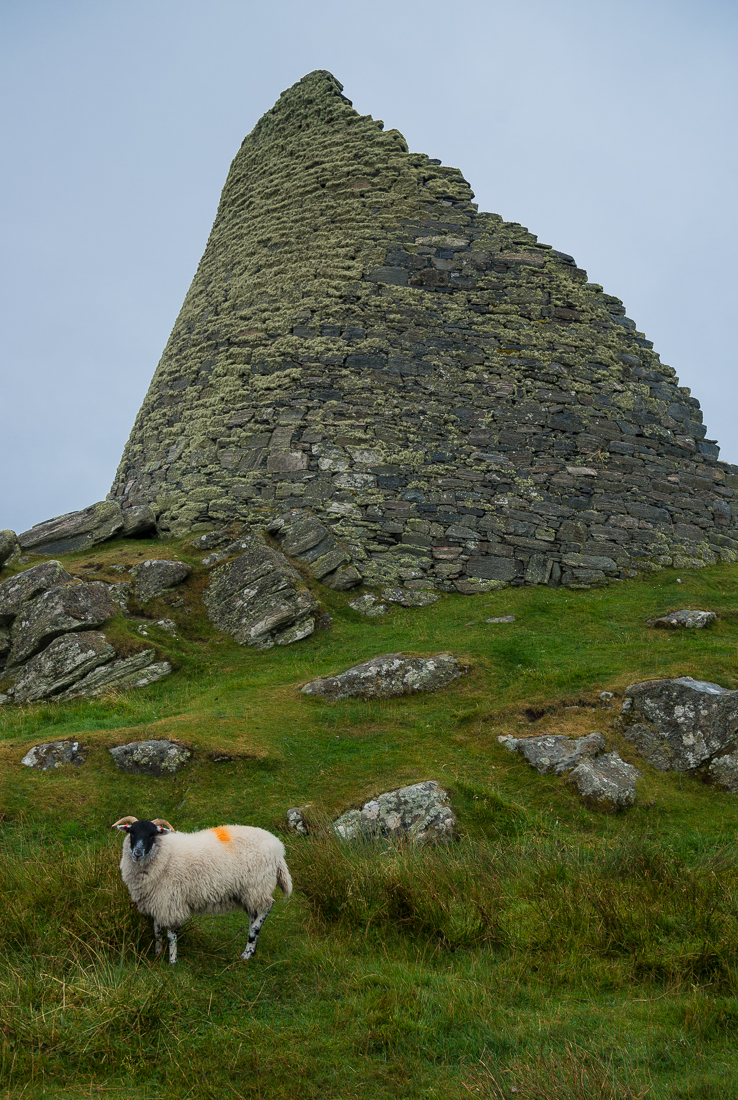
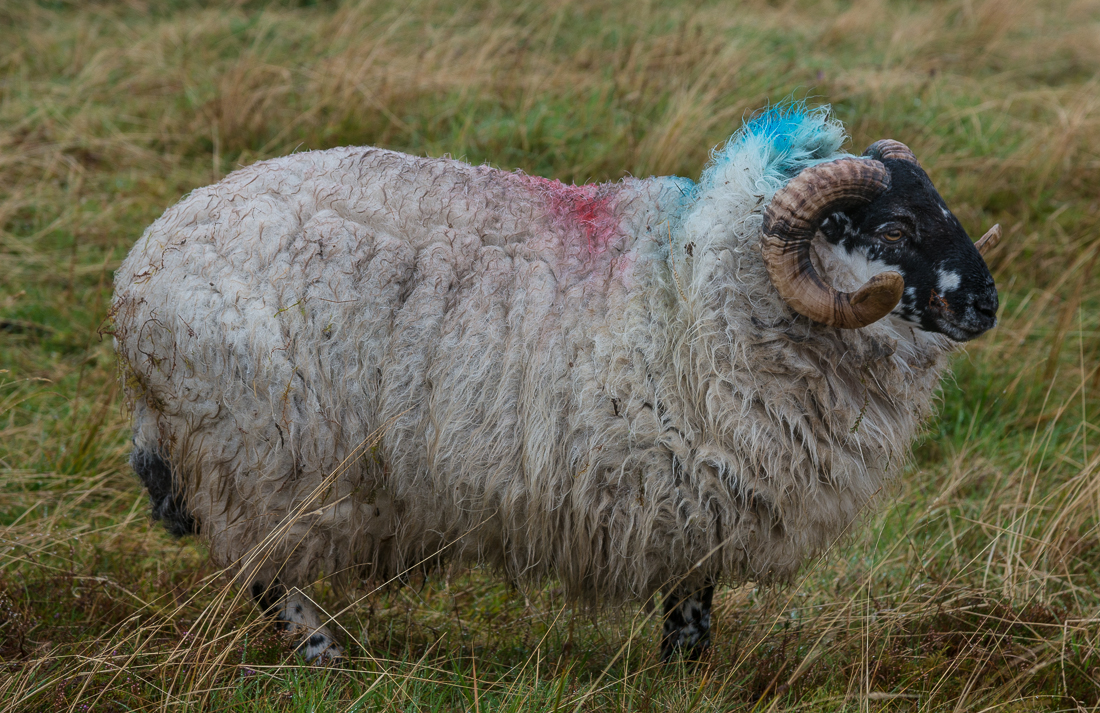
Much of the land in Scotland’s outer islands is part of a Common Grazing system. Local committees generally supervise the land and decide how much livestock each farmer is allowed to graze.

This area of Scotland has lots of sheep, and lots of land dedicated to “common grazing.” In a common grazing system, grazing lands are controlled by the town or by some sort of semi-governmental cooperative, and the individual citizens have some ability to put their livestock on the land for grazing. But nobody owns the grazing land (or maybe everybody sort of does). This is especially interesting (to me) because there is a famous principle of Economics called the “Tragedy of the Commons,” which analyzes the ups and downs of common ownership of resources like this (mostly the downs – thus the term “tragedy”).   The grazing tragedy occurs because every farmer with access to the common grazing land has the incentive to graze as many animals as possible on the seemingly free public land, so the land becomes overgrazed and barren and thus no good for anyone. This rarely happens on privately owned grazing land, because a property owner tends not to spoil his own land. The moral of the story is that when nobody owns the land (or other resource), nobody has a great incentive to care for it.

Solving the “tragedy” can take two seemingly opposite courses: heavy governmental regulation (like the Grazing Committee); or private ownership of the lands. Environmentalists analogize to the concept to argue that something must be done (i.e. regulation) to prevent a similar tragedy from occurring in the “common” air we breathe and water supplies from which we drink.  Because nobody owns the skies or rivers, people are unfortunately inclined to abuse them absent some government control.  On the other hand, conservatives (more precisely: capitalists) point to the “tragedy” concept to teach that private ownership of resources (where possible) is the best way to ensure that they will be well cared for and preserved. Both these arguments are mostly correct, and that’s why the Tragedy of the Common idea is such an important, interesting concept.

Somehow it’s also interesting that Scotland was also the home of Adam Smith, the 18th Century economist and author of Wealth of Nations. Smith is the one who taught the modern world that a capitalist system – where people act in their own financial interest – generally creates better outcomes for a society because private ownership and profit interests usually lead people to direct resources to their most productive and valuable uses. It’s a little ironic that the odd pocket of common grazing systems persists in the country that is Smith’s homeland. He may be rolling over in his Edinburgh grave.

So if you ever wonder what I think about on a two-hour solo hike through quiet Scottish sheep fields on the way to and from an isolated lighthouse, now you know.

_JD80024.jpg_JD88502.jpg_JD88914.jpg_JD89416.jpg_JD89480.jpg_JD89630.jpg
_JD89630

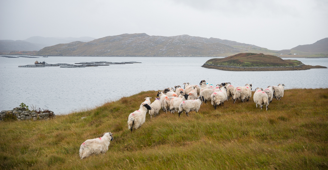
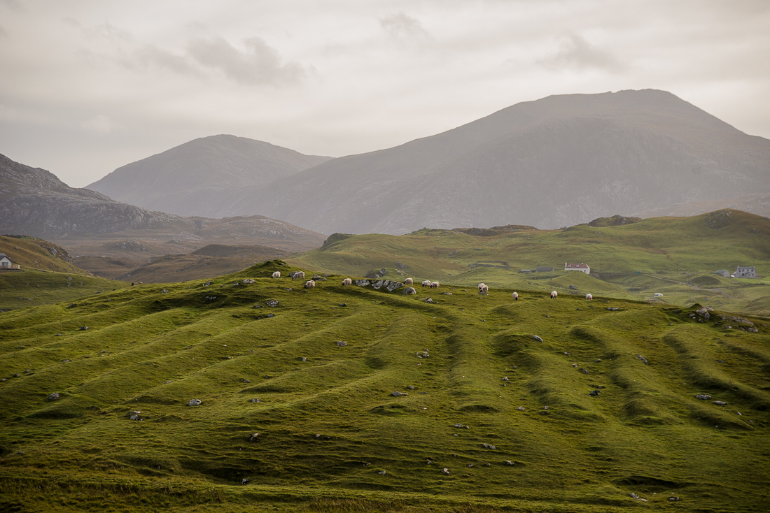
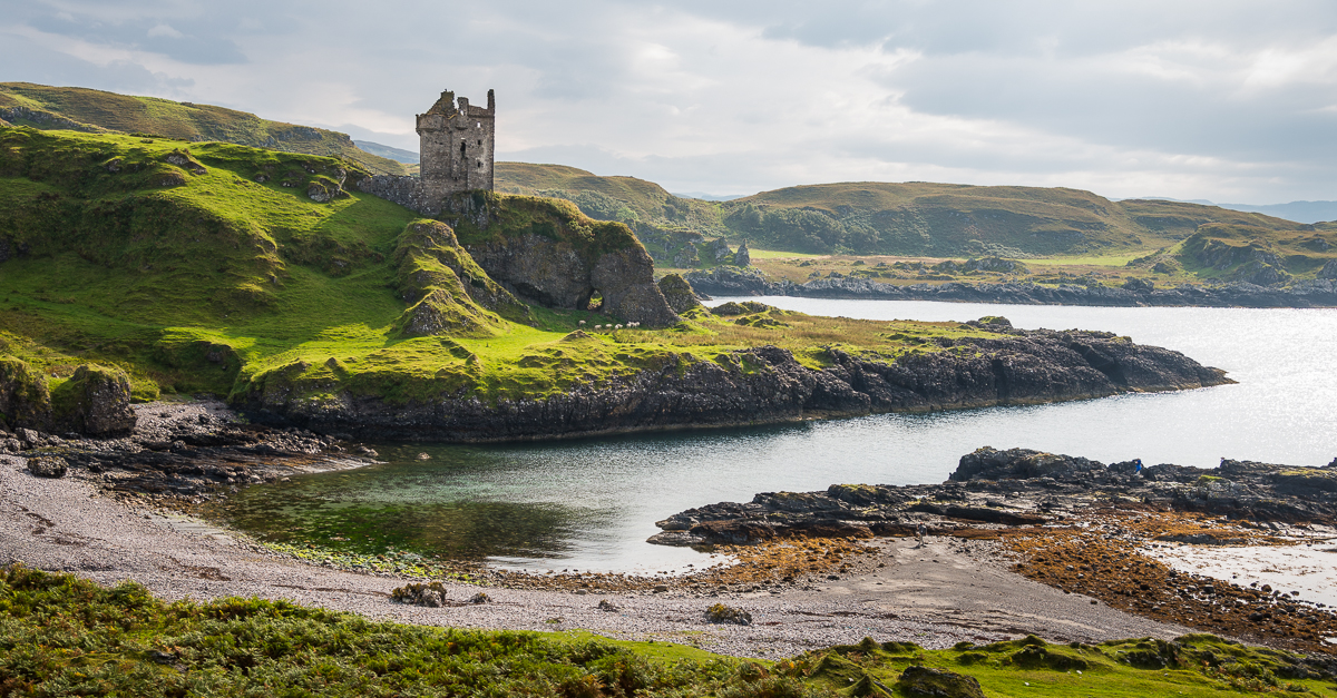
Sheep graze near Uig Sands on the Isle of Lewis

Scotland Stone Circles

Can you say “Scottish Stone Circles” three times, fast?  I can’t._JCE6557

_JCE6458

I included the picture with the dog in it mostly to give some perspective on the size of the big rocks that make up the Callanish (or Calanais) Stone Circles.  The biggest ones are probably ten feet tall.  The main circle sits on a hilltop on the west side of the island called Lewis & Harris in far west Scotland.  There’s actually a person in one of the other pictures — can you spot her?  There are lots of those stone circles all around Scotland — in fact there were two other (smaller ones) within sight of the big one at Callanish (the last three photos in the grid below).

I just missed the better image of the dog that had happened a few seconds prior — of course he had hiked his leg on those 5,000-year-old Stone Age relics.  I know they’re just giant rocks, but there’s something odd about the fact that these stone circles sit unguarded and unprotected on a barren hillsides, where a regular stream of visitors shows up to touch them, climb on them, and let their dogs pee on them.  Sheep graze among them.  One family was playing hide-and-seek behind them.  The neolithic megaliths are unphased.

Nobody knows for sure, but it’s generally assumed they might have something to do with a ceremony or ritual of some sort.  Recent archaeology digs have revealed structures near some of the circles that are surprisingly sophisticated.  The late Stone Age builders of these circles weren’t the cave men you may imagine (Neanderthals lived at least 30,000 years ago; these ruins are “only” 5,000 years old).  Very recent work at a similar, nearby site in far north Scotland shows that the neolithic farmers who built these circles had art, masonry homes, and extensive agriculture.  (Like Fred Flintstone without the dinosaurs?)  At 5,000 years old, the Scottish stone circles are from about the same era (or maybe a little older) as Stonehenge, which is a few hundred miles to the south, in England.  These folks would have looked pretty much like modern Europeans do.  In fact, based on a scientific reconstruction, I may look more ‘neanderthal’ than they did — at least when I haven’t shaved.

_JCE6360.jpg_JCE6499.jpg_JCE6518.jpg_JD89307.jpg_JD89312.jpg_JD89469.jpg

 (Photographers:  I had no tripod, no assistant, no lightstands and just one small flash unit, so I didn’t get very creative with the stone circle pictures, and I didn’t bother staying past dark.  Some of these shots do have that single flash unit (triggered remotely) propped up on a rock or camera bag and pointed toward some of the stones.  I just exposed for the ambient light (minus a stop or two), then experimented with the flash on manual settings.)

==================

CARLOWAY:  Not far from the Callanish stones is another stone relic, but one from a much more recent era — “only” 2,000 years ago.  It’s the Carloway Broch.  A brooch is a round double-walled building made of stacked (no grout or cement) stones.  It’s unclear if it was a fort, a castle-like home, or perhaps a factory, of sorts, for pottery.  Like the Callanish Stones nearby, you’re likely to have the place to yourself if you visit — except for the sheep.

_JD89354.jpg_JD89359.jpg_JD89368.jpg_JD89380.jpg_JD89405.jpg_JD89416.jpg_JD89433.jpg

Scotland 2014: Oban, Staffa and Iona

_JD87291

Dunollie Castle, at the north end of Oban Bay

Scotland’s odd little Inner Hebrides island of Staffa is famous for more than sightseeing.  The 19th Century composer Felix Mendelssohn wrote a now-famous overture about it:  the Hebrides Overture (a.k.a. “Fingal’s Cave”).  Too bad there was no orchestra around to play it when I went to visit.  (You can listen to it here if it’s not playing automatically:  http://www.vicenzapuericantores.it/mp3/mendelssohn_hebrides.mp3 ).  The Isle of Staffa is just a few hundred yards across, and is a geological fluke.  It’s a volcanic island with a huge layer of crystalized basalt columns.  Its most famous feature is that sea cave Mendelssohn focused on, now called Fingal’s Cave. It’s about 200 feet deep.

_JD86541

Staffa


_JD86541.jpg_JD86562.jpg_JD86589.jpg_JD86818.jpg_JD86852.jpg_JD86863.jpg_JD86977.jpg

The trip back from Staffa consists of an ferry ride to the Isle of Iona, another ferry to the Isle of Mull, a car ride to catch the ferry back to Oban on the mainland.  The church in the pictures is the Iona Abbey, established in 563 A.D. by now-Saint Columba and now a busy pilgrimage destination for folks who (for some reason) want to visit Columba’s grave.  That prominent stone cross, St. Martin’s Cross, is over 1200 years old.  The pretty pictures of the bay and from the ferry are Oban Bay.

_JD85676.jpg_JD87086.jpg_JD87134.jpg_JD87191.jpg_JD87246.jpg_JD87291.jpg

_JD85676

_JD86977

2014-09-26 19.28.14_resized-2

I was lucky to be able to travel Scotland with Jim Richardson and a couple of Scotch natives as guides. Jim is a long-time National Geographic photographer and is their go-to guy for Scotland; he’s been there dozens of times. In fact, the August 2014 edition of NatGeo has one of Jim’s photo essays from Scotland as its cover story. Great to have Jim to show about a dozen of us around  Scotland. That’s Jim in the red jacket waiting on the dock in the picture above (apparently someone from the group was late getting back to the boat . . .)

Scotland 2014: Gylen Castle

_JD86154

The Scottish Isle of Kerrera is just a few hundred yards off the mainland west coast, near the town of Oban in the southern part of the Inner Hebrides.  A few dozen people (one of whom tends to 100 or so pet parrots) live there.  The sightseeing highlight is Gylen Castle, built on the south end of the island in about 1582.

To get to Gylen, you take a short ferry from Oban, then walk about three miles.  The ferry is a small one-car ferry, so you just stand where the one car would normally be.   When you get out near the castle, there’s no visitor center, no admission charge, no security guards or park rangers.  It’s just out there by itself like it has been for the last 500 years.

The castle was built by the MacDougall Clan and used in support of James I – then the king of a united England, Ireland and Scotland.   In the mid 1600s, he was at war with the “Covenanters” (crazy Presbyterians, apparently).  They laid siege to the MacDougall Clan soldiers at Gylen.  Apparently the castle’s defense systems had one big flaw – access to fresh water.  The very thirsty soldiers holed up inside were eventually coaxed into coming out voluntarily, only to be promptly killed by their surrounding attackers.

_JD86317

Gylen wasn’t a true “castle,” but was more of a small watchtower or fort.  Its perch above the waters  was a perfect vantage point to watch for threatening ships entering the Firth of Lorn near Oban.  Now that same perch makes modest Gylen one of Scotland’s most picturesque spots.

_JD86023.jpg_JD86196.jpg_JD86347.jpg_JD85845.jpg_JD86381.jpg_JD86436.jpg

 _JD86053

Scotland 2014 Independence Referendum: God Save the King(dom)?

One thing at stake in the Scottish Independence referendum is the iconic flag of Great Britain – the Union Jack.  They call it the Union Jack because it was the combination — “union” – of the old English and Irish red crosses, and the old Scottish blue flag with a white diagonal cross.  No more union could mean no more Union Jack!

I ran across these three Scottish Independence supporters on the hike up to Ben A'an in Scotland's Loch Lomond and Trossachs National Park, just days before the Indpendence Referendum

I ran across these three Scottish Independence supporters on a weekend hike up to the tiny peak of Ben A’an in Scotland’s Loch Lomond and Trossachs National Park, just days before the Independence Referendum.   That’s Loch Katrine in the background.

Since at least the 13th Century times of the real Braveheart, William Wallace, the Scots have variously, vigorously, and repeatedly fought for, gained, and relinquished their independence from England.  In 1707, the Scottish parliament ended (mostly) the centuries of bloody battles, and voluntarily entered an economic union with England, making Scotland officially part of Great Britain, and giving up its separate currency, parliament, and military.

In recent decades, a new movement for Scottish independence has taken root.  The Scots re-formed their own parliament in 1999.  This week, the Scots take to the polls for a referendum on independence from England.

The “Yes” Independence movement has lots of momentum and its rallying cries sound sympathetic – perhaps especially to Americans (and Australians and Canadians and half the planet) who now love the Brits as dear allies, but appreciate having gained our own independence from them all the same.  Beyond the need for new flags, a “Yes” vote (for independence) would surely raise lots of complications.  Would Scotland join NATO (and how would its army be formed)?  The E.U.?  Would it have to start its own currency?  Who can tax the oil revenues from the North Sea?  Who’ll get custody of Queen Elizabeth?  There are lots of predictions of economic and political chaos.

The independence movement makes lots of semi-socialist-sounding promises of government care-taking.  The Economist magazine mocks it gently as offering a “dreamier” vision of Scotland’s future, “promising Scandinavian-style public services supported by taxation closer to American levels,” and concludes that the plan being pitched by the “Yes” men is “fantasy.”   Still, I guess the Economist would have scoffed at Washington and Jefferson if that magazine had been invented 250 years back.

_JD85667

Either way, it’s an interesting time to be visiting Scotland.  While hiking up Ben A’an (Gaelic for “small pointed peak”) just four days before the independence referendum election, I ran across the three ladies you see in the picture above.  They carried their blue “Yes” For Independence balloon all the way to the top, and were intent on somehow planting that yellow Scottish flag (actually a bath towel, but whatever) at the top.  They were glad to pose and share a few thoughts about their plans for the future in an old, old country that might be born anew in the days or years to come.

_JD85661.jpg_JD85662.jpg_JD85663.jpg_JD85665.jpg_JD85672.jpg_JD85757.jpg_JD85759.jpg

A “Yes” vote is a vote for independence; “No” is a vote to keep the Union together.  At least in Edinburgh and the Highlands, there are a lot more “Yes” signs visible on the streets.  It may be telling that the biggest anti-independence sign I saw was the one one strapped to the iron fence of a very nice, aristocratic-looking home.  The word “bairns” (on the “Yes” sticker) means baby in Scottish and Northern English. 

_JD85758-2